April 24, 2015
A day off work and leaving early in the morning put us out in Overland Park, Kansas just in time to pick up Brian Stertz after he worked a half day. My son, Ryan Thies, his friend Ryan Hensley, Brian and I then headed out west. The original goal continued to move slightly west as the afternoon moved on. After a quick lunch at the Wendy's in Hayes, Kansas, we look up to see a storm developing just to the northwest of town. We quickly stopped to top off the tank as the storm developed. It was extremely quick to form and began dropping small hail as we filled the tank.
As the storm continued to develop and moved northeast, we jumped back on the highway and shot back east getting out in front of the storm and in a position so we could continue to watch the storm develop. We positioned ourselves and watched as the storm went through many changes under the base.
Storm Beginning to Develop
Pea to Dime Size Hail Falls
We moved a bit further north as the storm approached and began seeing some interesting changes happening under the base.
Storm Continues to Build
Lowering Continues to Form
CConstantly Changing Shapes AAnother Look
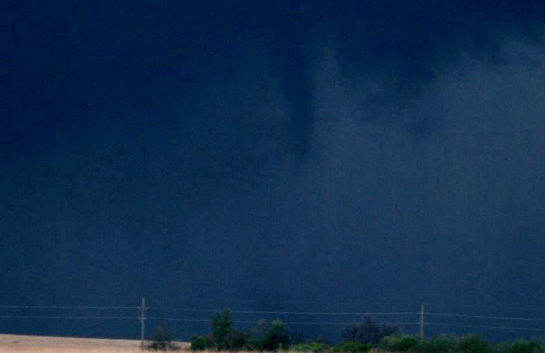
Then out pops a funnel cloud. Although we did not see the debris, this was a confirmed tornado as chasers that were closer to it confirmed.
Wall Cloud
Continues to Change Shapes
ZoomZoomed Out LookZ
Large Wall Cloud
Continues to Change
Continues to Look Ominus
Tornado Touches Down
Another Look At The Tornado
Another Look At The Tornado
Then a few minutes later in another part of the storm....................

Another Funnel Cloud
Zoomed In Funnel Cloud
As the storm caught up to us, we needed to flee as the storm had large, damaging hail reported. Road options were not so good and did not give us many options for escape. As the small hail belted the car, we found a dirt road and made our escape east.
As we managed to stay ahead of the storm, we continued to take pictures of the storm at various locations.

Hail Belting the Car
Summary and Location
Total Trip - 1114 miles
Return to the
Summary 2015 Page
Return to the
Storm Index Page