This
was one of those setups that I would not even consider
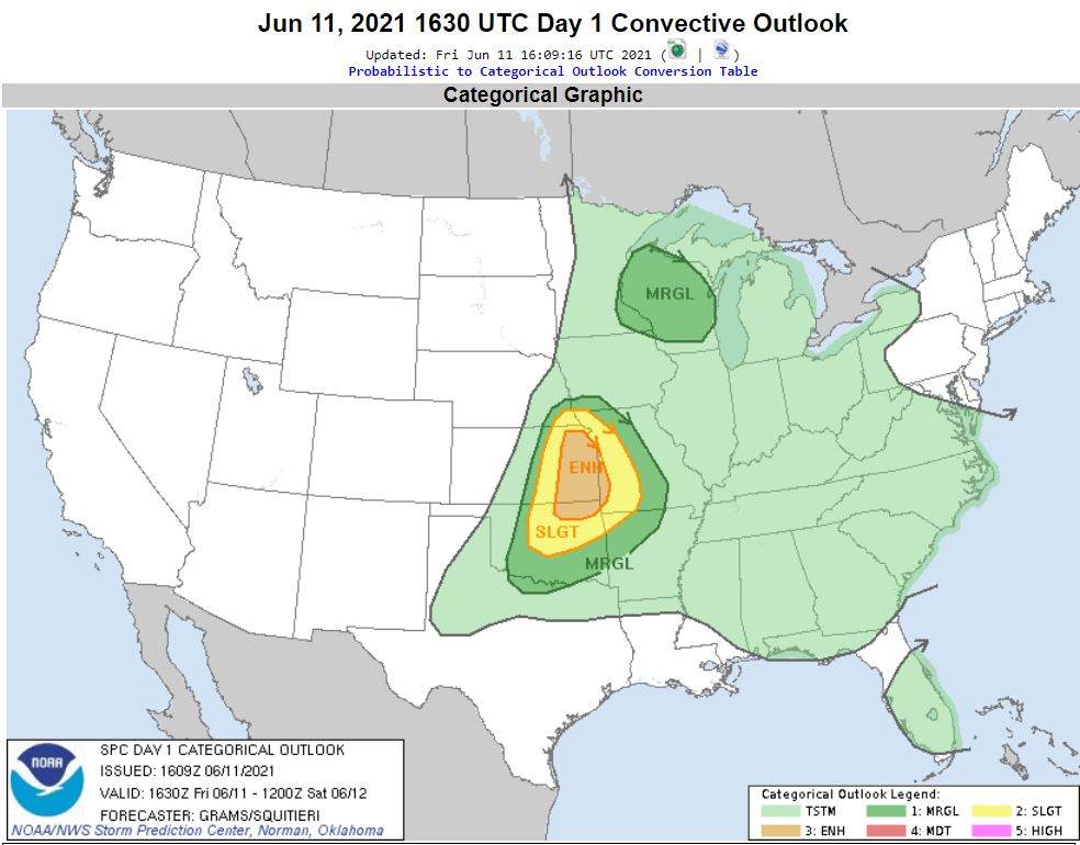
other than possibly a local chase. The forecast
was for Strong Wind and Hail, but with little to
no Tornado potential.
When our chase
partner Brian Stertz said he was chasing it in his
own Eastern Kansas "backyard" and asked if we
would like to join him, my original thought was
"No, Thanks" based on the lack of tornado
potential. That "No-Go" decision was
confirmed after speaking with my son Ryan.
But.....
Before I hung up the phone with Ryan, he throws
out another option. He says, why don't we
hook this potential storm day up with a wildlife
photo trip the following day to one of our
favorite Wildlife Refuges near Brian's place,
Loess Bluffs. That was enough to tilt the
scale for us to take the trip out to Kansas for a Storm
opportunity plus a Wildlife photo trip.
Ryan and I waited until Friday
morning, the day of, to leave. Brian was going
to put some work in before he could head out in the
afternoon, so Ryan and I agree to meet him at his
place at 2:00 and then we'd head out to our target of
Emporia, Kansas. A line of storms was already underway
moving out of Nebraska into Northeast Kansas and
Northwest Missouri as we made our way down I-35.
These storms were severe warned for
wind and hail as they entered Kansas and Missouri, but
then the line broke up as they moved southeastward.
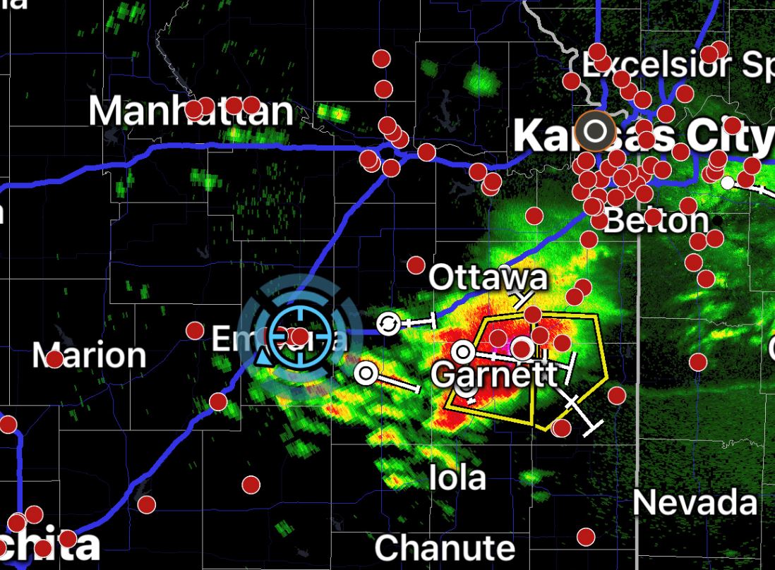
We grabbed some late afternoon dinner at Freddy's
Frozen Custard & Steakburgers in Emporia as we
watched for any sign of new development. As the
remnants of the line of storms went by us to the east,
a couple cells in the line regained intensity again
and became severe warned with strong wind and large
hail, especially the cell on the western edge of the
now broken line in east central Kansas.
|
We
drifted a bit east as new cells attempted to develop
just to the west of the passing line, but the storms
to the west of the severe cell struggled in the strong
cap and would go up and die.
With
no new cell development, we finally decided to move
toward the on-going severe warned storm to our
east. Although this storm was moving quite slow,
as we made our approach, a closed road forcing a
detour put an end to the possibility of circling
around the storm in the daylight. Nothing was
lost as the severe warning was dropped and the storm
transitioned into a big rain blob.
As the sun set, we
saw no high wind, hail, or tornadoes on the day.
However, we were treated to a very bright orange
underbelly of the storm with the sun making a late
appearance to give us the dazzling sunset.
 June
11, 2021
June
11, 2021