There
was a lot of talk about severe weather, but not much
talk about tornadic storms, so I wasn't anticipating
going on a storm chase today. That said, our chase
partner Brian gave us a heads up that he thought Central
Illinois could produce some tornadoes in the
evening. I took a look at the HRRR and adding that
to Brian's reasoning behind his thoughts, decided that a
chase was in order.
I gave a call to Max Slover to see if
he wanted to join us. He accepted and my son Ryan
did some rescheduling to leave work a few hours
early. The three of us were on the road by
3:30pm.
Our target area was just to the north
of the I-72 corridor. As we left, there was
already a Severe Thunderstorm Warning in the Quincy,
Illinois area. We weren't expecting the storms
would become severe so early in the day, but figured
the storms would gain strength as they got into
Central Illinois into the better parameters in the
zone we were targeting.
With the storms on-going, we chose to head up I-55
and approach these storms from the east. When
we hit Springfield, we worked our way around to the
west side of town and hit Highway 97. That
highway went in a west-northwest direction with the
tail end, severe warned storm coming right at us.
We worked our way up to the storm.
Lucky for us, the wall cloud and rotation were very
separated from the rain at this point giving us a
clear view of the business part of the storm. We
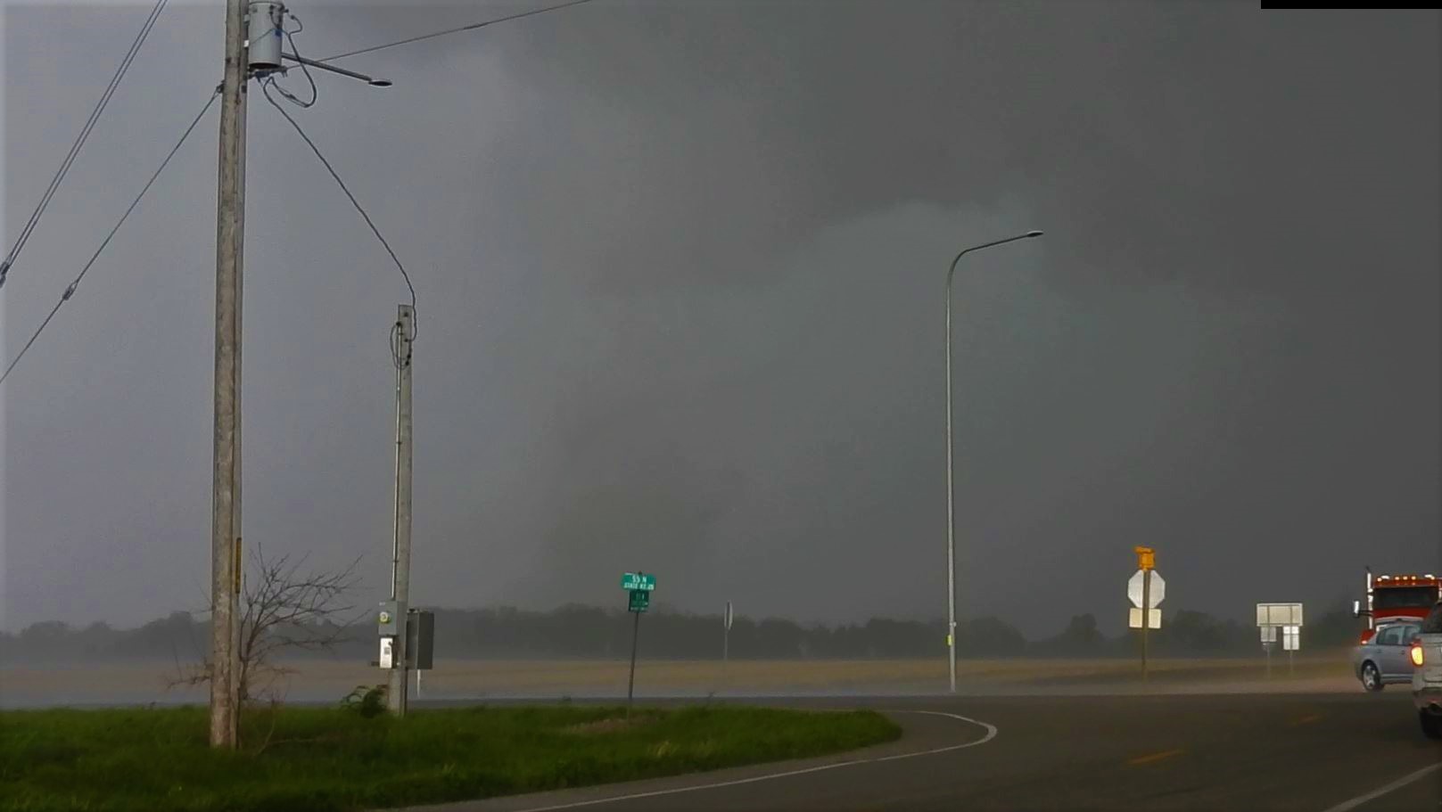
reached the wall cloud near Ashland, Illinois and
followed along with it back east stopping
occasionally to watch it. Just to the west of
Pleasant Plains,
Illinois, a new tornado
warning is issued on the storm with a confirmed
tornado. Ryan shot video out of the back
window as the dust in the open field behind us was
being kicked up from the circulation.
We found a spot to pull off and continued
to record. It had weakened considerably by
this time, but you could still see the shadow as it
continued to spin.
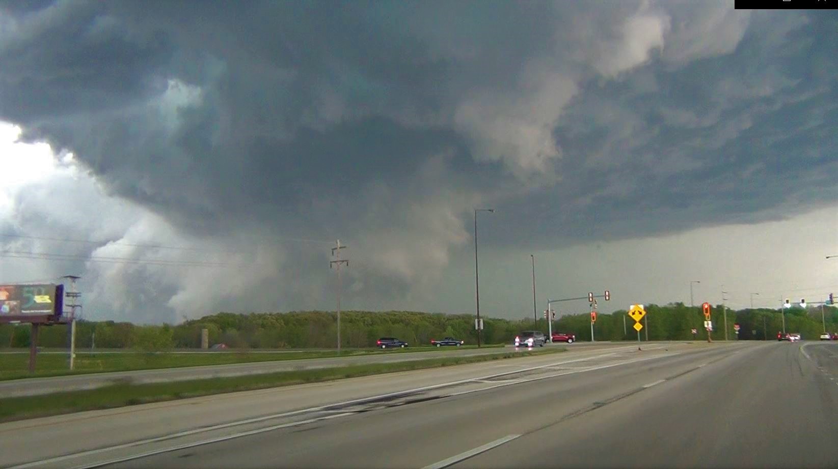
We continued following
the storm north of Springfield, Illinois and once we
got east of the city, we adjusted eastward and
southward as the storm dictated. The
storm continued rotating hard creating the corkscrew
look with a load of cloud to ground lightning bolts.
Around Mechanicsville,
Illinois, the circulation made contact with the
ground creating a big dust swirl again prompting
another confirmed tornado warning. We got a
glimpse of it while were driving, but by the time we
broke free of the hills blocking the view, we no
longer could find it as the rotation was now getting
wrapped up in rain.
We broke off of this
storm as rain now made it impossible to see.
We worked our way south taking a look at several
other cells in the broken line. Unfortunately,
none of these cells were intensifying and once we
reached I-70, the last cell went by us as we headed
home.
National Weather Service Survey
 May 03, 2021