In
a season of very few opportunities, our team eyed the
chance for a potential two day chase. My son Ryan
and I left for our chase partner, Brian Stertz's place
the night before and got our night sleep there.
Got up early the next
morning as our preliminary target was Colby out in far
western Kansas. Strong, Tornadic storms were
forecasted from southwest Nebraska southward along a
dryline as well as as along the warm front.
The most intense supercells were forecasted to erupt in
western Kansas in the late afternoon. The Storm
Prediction Center had a Moderate Risk for the area.
We arrived in Hays,
Kansas around lunch time and grabbed some to-go lunch
from Freddie's Frozen Custard and Steakburgers, then
continued westward toward our target. When we
arrived in Oakley, Kansas, we decided to stop and
watch things unwind from there. Several strong,
Tornadic Supercells were projected to initiate in the
late afternoon / early evening between Colby southward
to Garden City, so it was now a waiting game as we
watched radar and browsed the lastest data.
We found a parking
spot near the Highway exit and now waited. We were
soon joined by our fellow Metro St. Louis Chaser
Association Friends, Lucas Munzlinger, Michael Onesty,
with their friend, Caleb Kime and then a little later,
Tom Stolze (in his Tesla)
pulled in as well. Still amazes me how we can all
find ourselves in the same spot on a chase day many
miles from home.
First storm to fire
was ironically a storm near the city where we had
grabbed lunch 90 miles back east. We watched it on
radar intensify and considered heading back east for the
storm, but the forecast of those stronger, tornadic
storms initiating just to our west and moving at us
later, held us in this spot. Patience was still
present as we watched on radar as the Hays storm went
tornado warned, then put down a confirmed tornado along
with reports of large hail. The storm movement was
10mph. But would that storm persist or die
out? It could
be catch-able at that speed. We
chose to hold our ground. (Side
note: Those storms remained tornadic for multiple
hours although most of its life were high
precipitation supercells with few views of the
tornado)
A bit later in the
afternoon, storms fired up to our north along the Kansas
/ Nebraska border a little over an hour to our
north. They soon went tornado warned with
confirmed tornadoes. Seemed every storm up in that
area became tornado warned and there were many confirmed
tornado reports. Thoughts again were will they
persist or die? Again we held our ground. (Side note: These storms also
remained tornadic for several hours and were classic
supercells with tornadoes being viewable for miles)
Wasn't long before we
finally had two cells fire to our
southwest. We plotted out their track and left
Oakley to intercept them just to our west in Winona,
Kansas.
We arrived and found
an open spot just to the south of town and watched them
approach. We had a clear view into the base with
the wall cloud. It went by us with little fanfare.

|

|
As
we kept our eyes on the cells as we followed them, it
was becoming painfully obvious that the cells were
struggling in a strongly capped atmosphere, so our
patience finally ran out and we headed for the still
tornadic storms to the north on the border of Kansas
and Nebraska, an hour or so to our north.
We worked
our way north on Highway 25 and crossed
over I-70. Then we worked our way east over to
Highway 83 to continue traveling north toward the
closest Tornadic storm. Passed through Seldon, Kansas as we made
our way closer to the storm and saw some of the
damage from the tornado that tore through that
town two days earlier on May 24.
As we continued, we
passed several cells along the way staying mostly out
of the path of the hail shafts. Saw several
rainbows along the way along with one hailbow.
As we got north of
Oberlin, Kansas and crossed over into Nebraska as we
neared the storm.
The still Tornado
Warned Storm came into view. We
drove up right next to the back end and it seemed a
tornado was imminent as it was rotating hard, but as
we watched, it never could wrap up all the way and
eventually, rain curtains wrapped around cutting off
our view.
The road network was
not friendly to follow the storm, so we worked our way
east to get us to a road that would take us south to
some intensifying cells that were now showing some
rotation. We passed through Norton, Kansas as we
traveled south on Highway 283 moving toward one of the
cells, but we were cut of by the storm's hail
core. This is where we encountered our biggest
hail of the day, 1 inch in size as the edge of the
core grazed us. We backtracked into town and
took cover under an overhang at the town Medical
Center. We watched the back end of the storm go
by and watched as a funnel cloud descended. The
rotation started to wrap up tight and condense, but
after a minute or so, the rotation fell apart.
We followed the
storm briefly, but no sign of stronger rotation
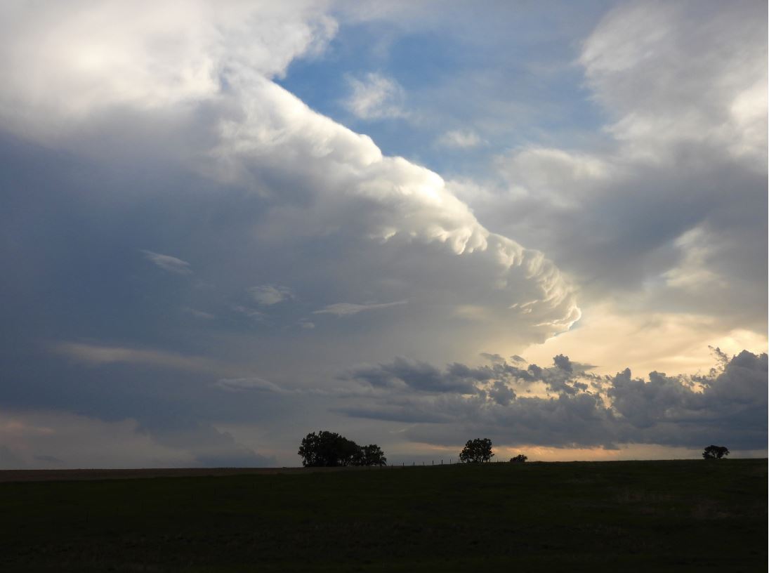
reappeared. We continued to move southward as
the sun began to set. The storm structures and
the sunset lighting created very colorful photographic
opportunities.
This day proved
to be very frustrating as the area that was
forecasted to have strong, tornadic supercells
remained void of big storms yet storms on the
fringes of that area produced some longer lived,
tornadic supercells with some photogenic
tornadoes. Many times, being patient in a
targeted area will pay off when you don't get lured
away by early convection, but today was the
opposite. Those few people that left for the
early storms were rewarded. Those that waited
missed out.
Although we anticipated a second day chase, the
weather gods didn't cooperate.
 May 26, 2021