It
figures that the weekend I make plans to go out of town
to Indiana, a decent severe weather opportunity
unfolds. I cut the out-of-town weekend short so I
could get back for the Sunday event.
I
arrived back home around 10:00am after a very early
start from Indiana. Around 11:00am, my son Ryan
and I met up. We sat and discussed for a few
minutes to finalize our target before leaving as there
was multiple targets to choose from. Should we
play the cold front coming into western Missouri, play
the triple point up in Northwest Missouri, or play the
warm front that was projected to be draped across
Northern Missouri into Illinois? Tough decisions
today. We settled on the target out to the west as
tornadic storms were expected to fire in western
Missouri and work their way east. We chose
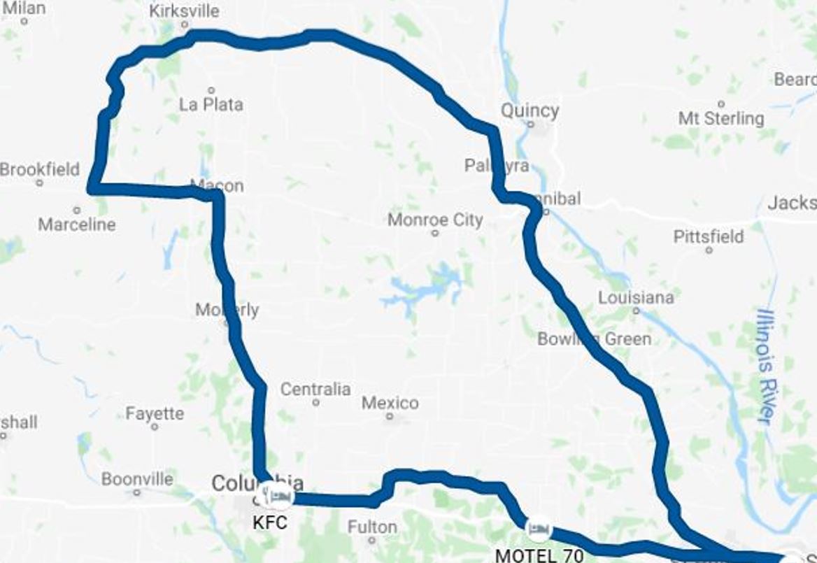
Columbia, Missouri as our hold spot.
We
pulled in next to Tom Stolze on the way out to the
target and discussed the upcoming possibilities, then
Ryan and I grabbed some lunch at the KFC drive-through
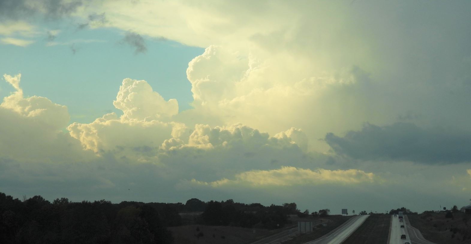
in Columbia. As we enjoyed our lunch, a line of
storms was forming just to our west. It continued
to intensify as it came overhead. We followed it
back east to give the line a bit more time to
mature. Plenty of lightning, but no sign of
velocity. As the rain became the main feature, we
let it go. Meanwhile, tornado warned storms broke
out over northwestern Missouri. Storms also fired on the cold front
to the west, but those storms were slow to
develop. A couple storms to the northwest on the
triple point continued to maintain tornado warnings as
they moved east-northeast, especially the southern most
cell that seemed to be riding the warm front.
We
finally settled on moving northward to play any
developing storms on the warm front to the north while
also staying in range of any developing storms on the
northern portion of the cold front to the west.
Further south on the cold front, storms were
intensifying, but there was a notable gap in the line of
storms between that southern most tornado warned storm
to the north and those storms along the front to the
south. Seemed we were in the middle of the
storm-less bubble. Our target city of Moberly,
Missouri changed to Macon, Missouri as no new
development seem imminent. The continuing tornado
warned storm remained the only viable option, so our
attention now turned to intercepting that storm.
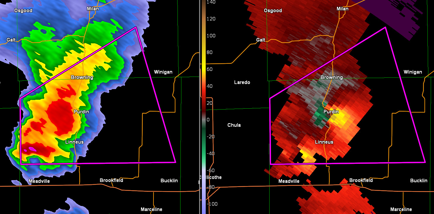
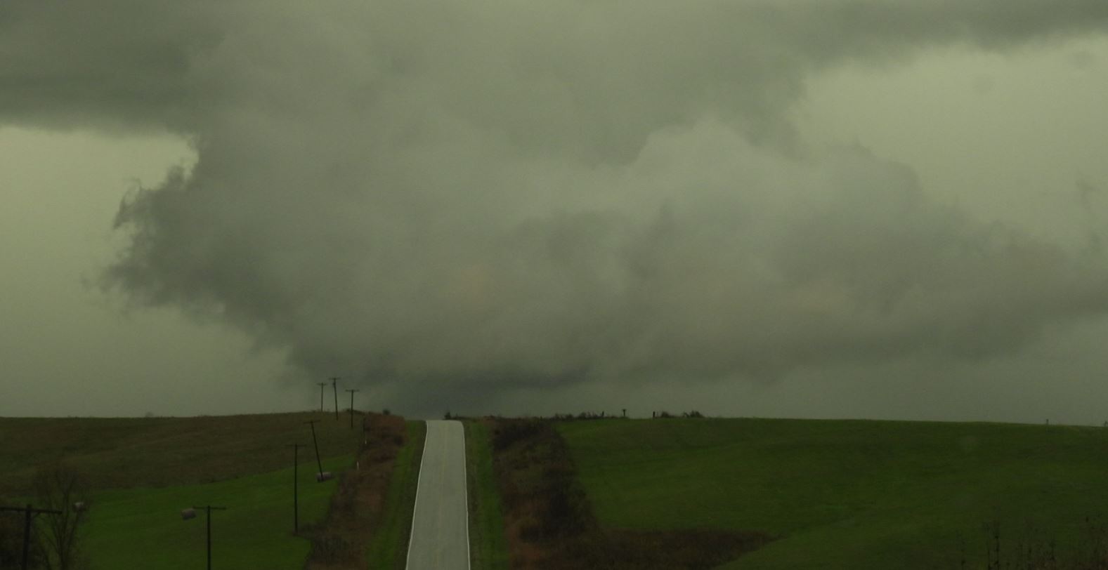
We moved west on Highway
36 and reached Highway 129 with the storm still to the
northwest. We traveled north to New Boston,
Missouri and now the storm was coming within
range. The storm now had a confirmed tornado near
Purdin, Missouri.
A quick decision was to be
made as we had to decide to either continue on 129 which
jogged west for a bit before going north again or
continue north on Route 'J'. We were concerned
taking the western road 129 would not get us to the
storm in time. We chose to take "J", then needed
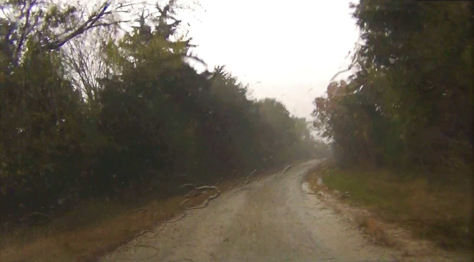
to continue on Route "JJ" going north. We cringed
as the roads turned to rock, and then in a heavy rain,
rock and mud. These were the most treacherous,
slick, hilly roads I've traveled on in a long
time. There were no houses on this road.
This was a farm road with only barns and out
buildings.
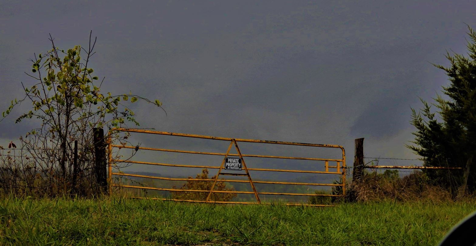
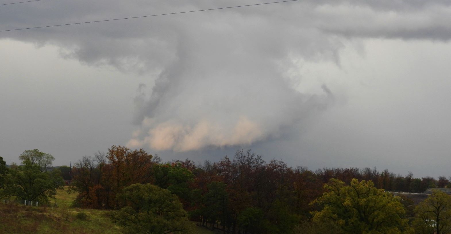
As we reached the storm crossing in front of us, we were
up on top of a ridge with a view of the valley where the
wall cloud was crossing. Unfortunately for us, we
were in a forested area at the edge of the Montgomery
Woods Conservation Area with little to no view in the
rain. The limited view that we had a very low wall
cloud with rain wrapping around the circulation.
As we continued to work
our way through the back roads on a trek back out to a
paved road after the storm passed, we came across the
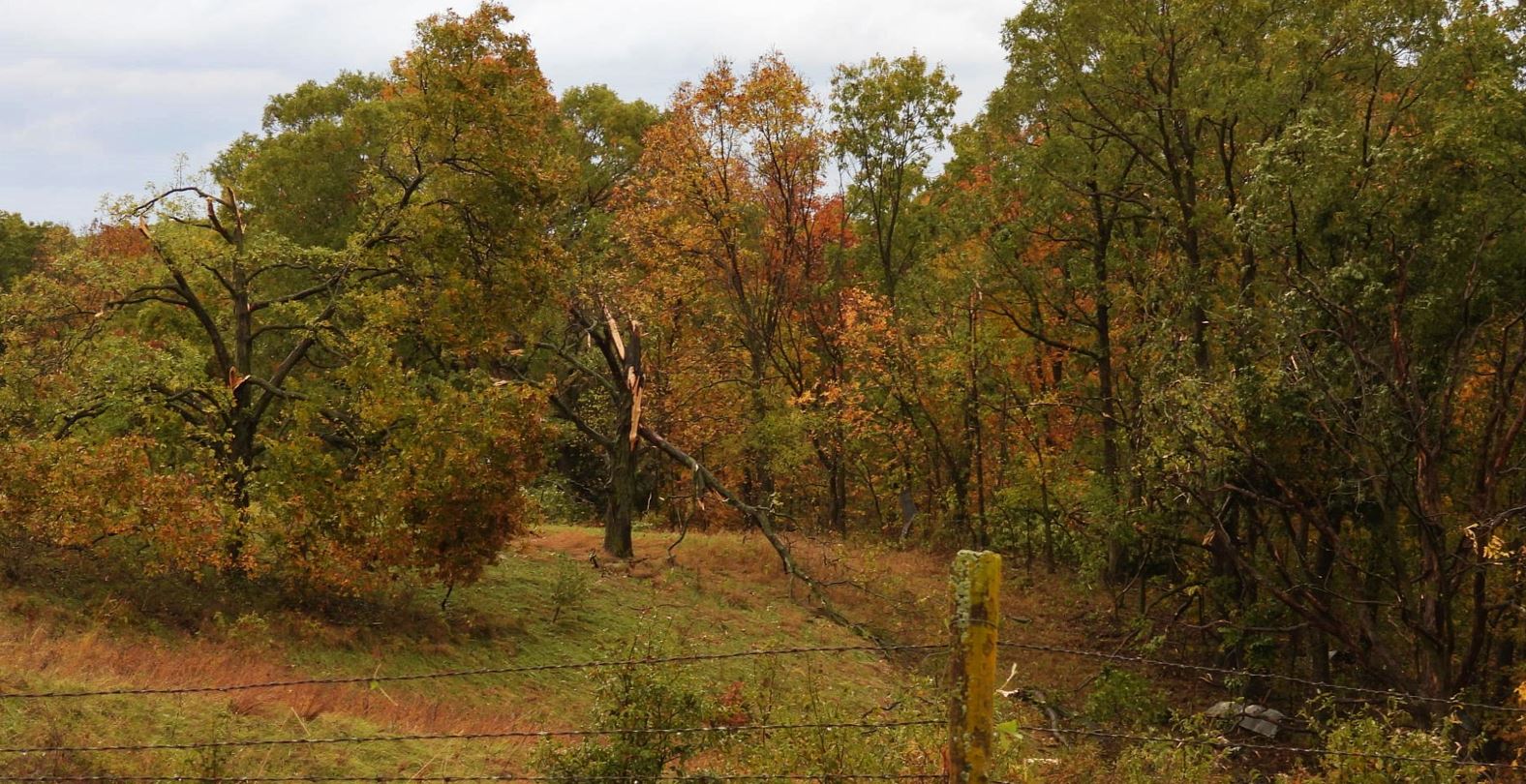
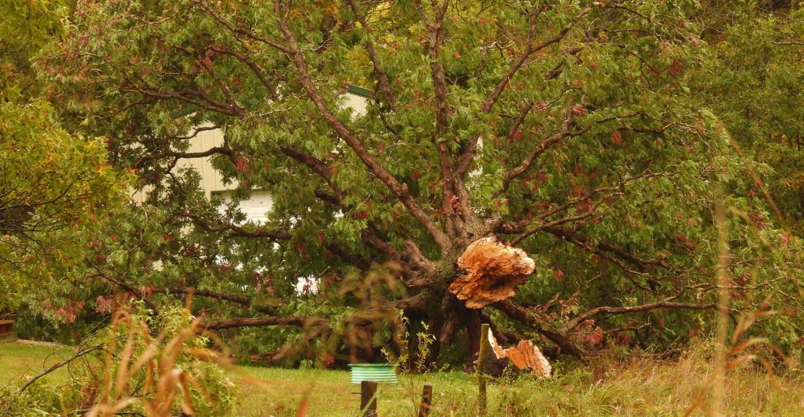
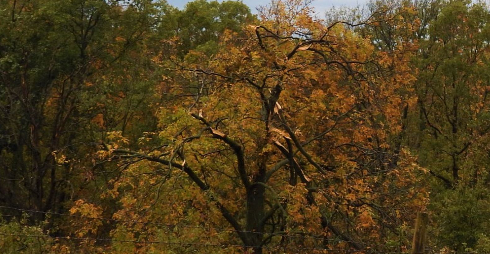
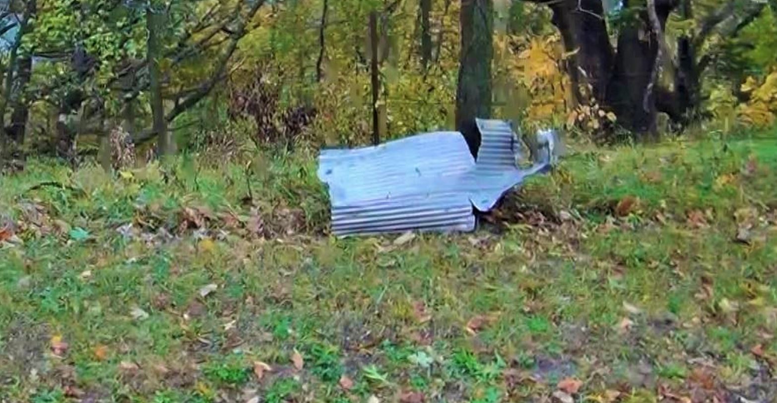
damage path to the storm that just went by us. I
was an obvious tornado damage path as several large
trees were snapped at the base and every tree in the
narrow path had limbs snapped and twisted and thrown
various directions.
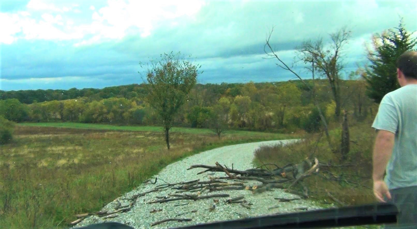
At one point, Ryan had to
get out of the car to move a dead tree that had fallen
across the road.
We
found our way back to the paved road, Highway
11. The road moved northeast. We
eventually caught the storm again, but it would not
wrap up again to produce another tornado.
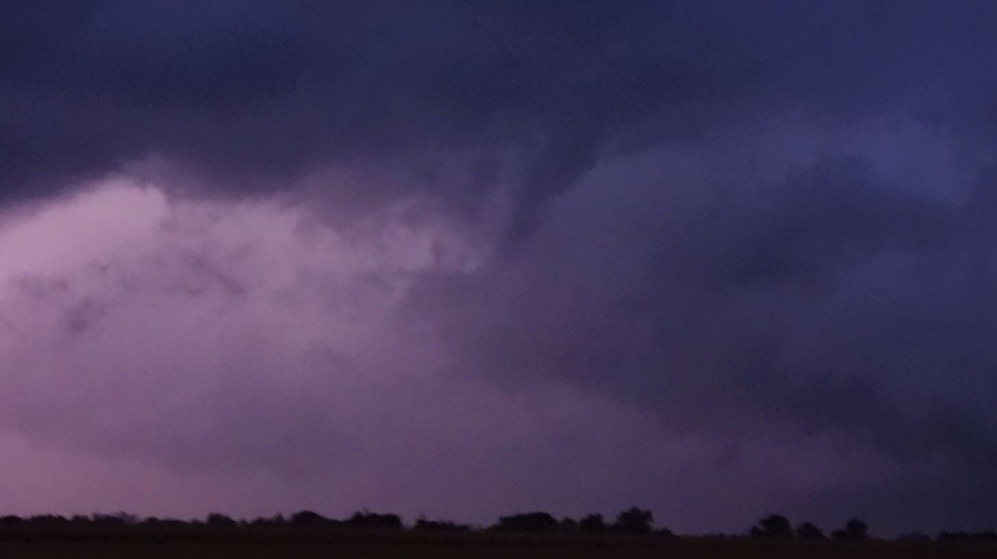
After dark, we stopped as
we saw another interesting lowering. As we
watched, a funnel began snaking down. A check on
radar showed a small velocity couplet. The funnel
lasted a minute or so and then disappeared.
|
Our Trip
|
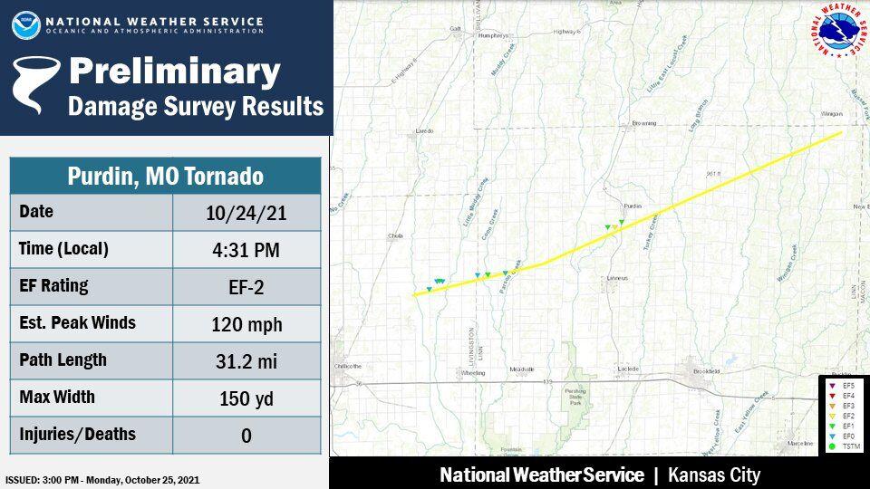
UPDATE:
The National Weather Service out of Pleasant Hill did
a survey on the Purdin Missouri tornado. It was
rated EF2. There findings stated the tornado end
location was roughly 1.5 miles southwest of our
location at 5:18pm and did not include the damage path
we came across .
When
I got home Sunday night, I had even attempted to send
them an email showing the damage path we came across
so they could check the spot in their survey, but my
effort to send them an email from their email address
I found on their webpage came back as undeliverable.
 October 24, 2021