 May 21, 2022
 15 Hours - 590 MilesHad the Saturday available and a Slight Risk of severe storms was forecasted. The tornado risk was very low, so the thought of a storm chase wasn't really on my mind for this day. A call from our friend Tom Stolze suggesting a wildlife trip into the slight risk area along with checking out any storms that could potentially develop in the same area convinced my son Ryan and I to make a trip.
I picked up Ryan and Tom mid-morning and headed out to the target area around the Missouri / Arkansas border near the boot heal which is where we thought the best shot at a rogue tornado could be later in the afternoon. We had some lunch on the way down and decided to make a visit to the Otter Slough Conservation Area to check out the wildlife. This Conservation Area was very close to Poplar Bluff, Missouri and very near the Arkansas border.
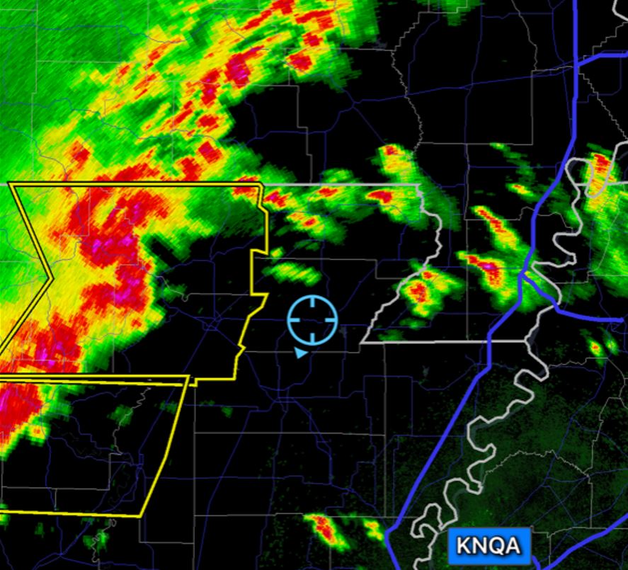
As we searched and photographed the wildlife, we kept an eye on the radar. There was a severe line of storms out to our west about 150 miles in Northwestern Arkansas, but our hope was there would be isolated storms forming out in front of this eastern moving line with storm development aided by a boundary that was stalled just south of the border in Arkansas.
As a few meager cells began showing up in the preferred area, we moved south into Arkansas and positioned ourselves where we had options to pursue anything that developed and became promising.
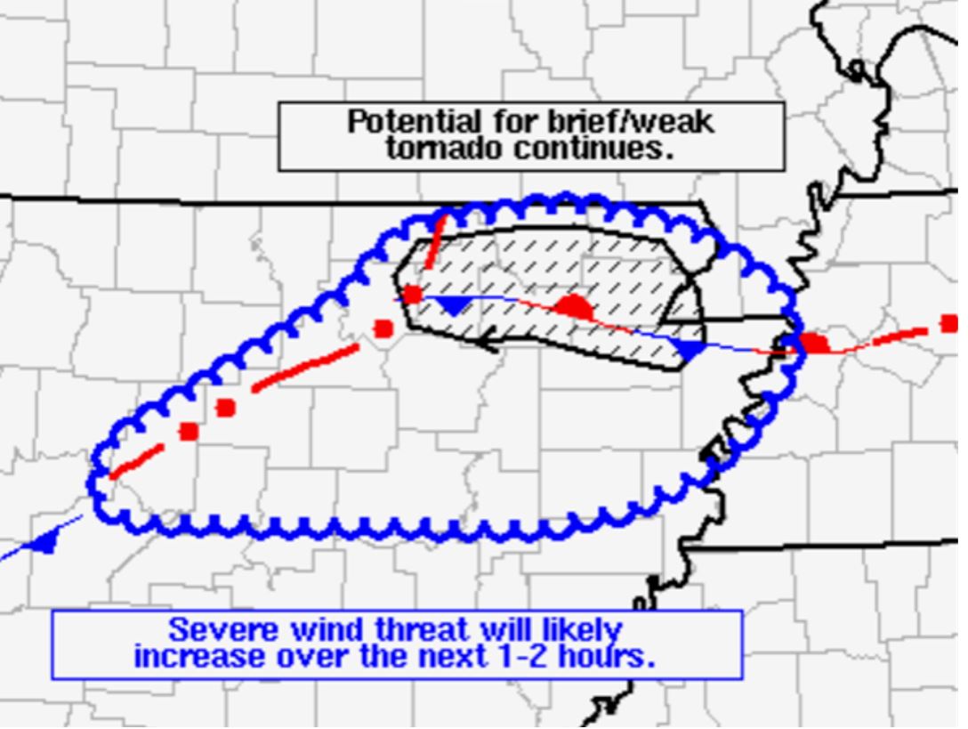
We also had a ray of hope when the Storm Prediction Center issued a mesoscale discussion and mentioned there could be some tornadic risk in the area we were in.
As the severe line of storms continued coming toward us from the west, we continued moving east back into the boot heal of Missouri. A storm out in front of the line finally became severe warned to the south of us, but showed no signs of developing any notable velocity or couplet.
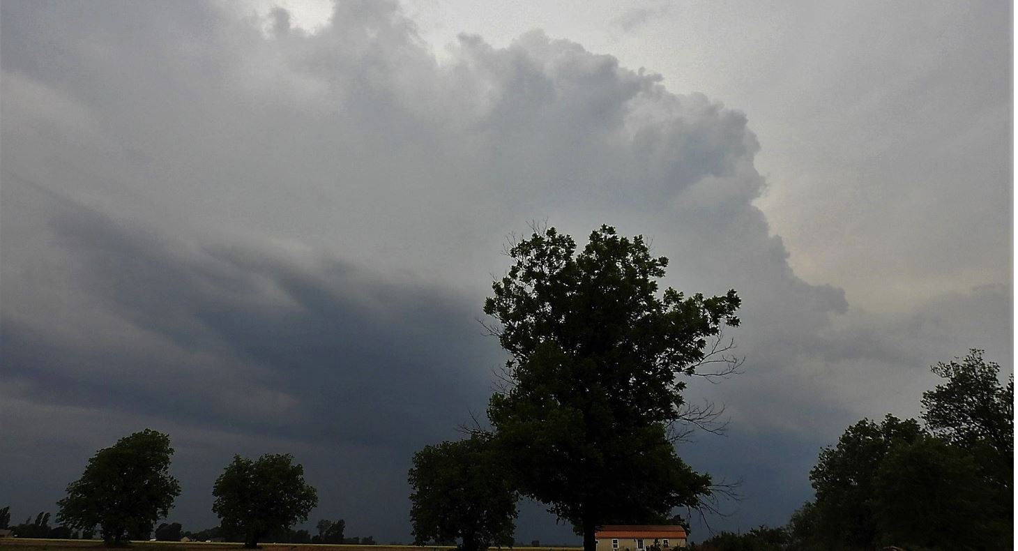
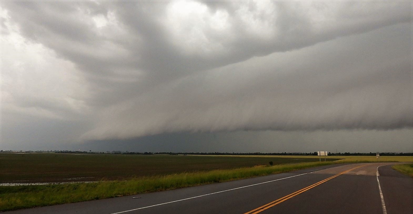
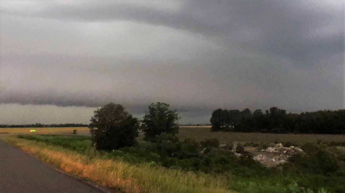
The whole line continued advancing toward us as we continued east. Eventually, the line pulled in the cell coming at us from the south. When we reached Interstate 55, we had no other options east as we were blocked by the Mississippi River, so we pulled off and watched the gust front over take us.
The line had a massive amount of rain as it came through along with plenty of cloud to ground lightning, and our estimate of 50mph wind. Made for a white-knuckle, very low visibility drive until the heaviest part of the line cleared the highway to the east. Stopped for dinner on the way home to let the last of the heaviest rain scoot by us.
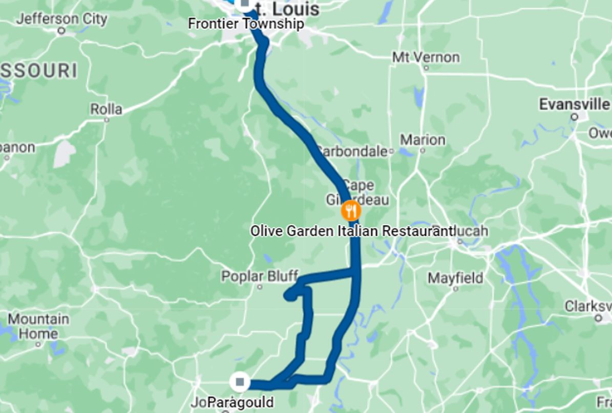
Our Travel Map
Our thanks to Tom for joining us today and helping us with data and navigation. We had a very enjoyable time together.


|
Click
on the link below to see video of some of these
storms.
|