Along
with Brian's input, we settled on a target near
Columbia, MO. We left early and headed for
the Eagle Bluffs Conservation Area to take in some
wildlife. Our friend Tom Stolze shows up
there as well and we spent a couple hours giving
our cameras a workout.
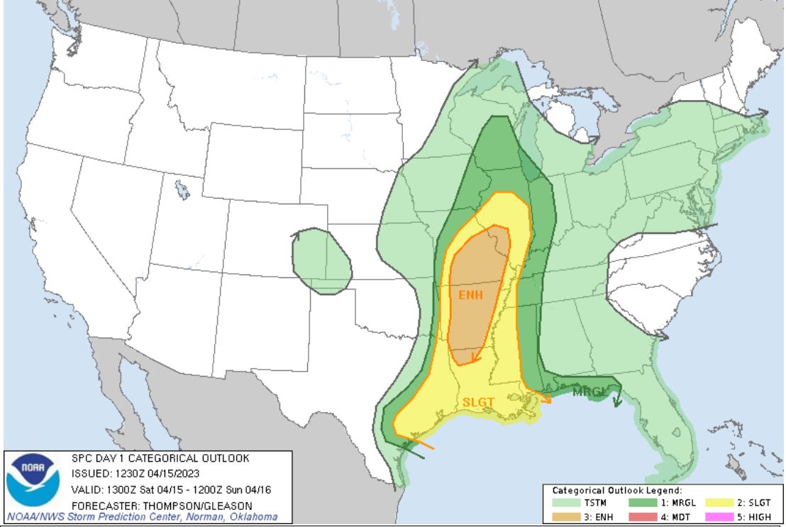
Eventually, we take note of some storm cells that
exploded to our southwest on the Kansas, /
Missouri border.
We watched
radar closely and as hints of other storms began
to show up on radar closer to us, we made our
transition to storm mode. We knew because of
the hilly/wooded terrain along with our current
position that heading down toward those storms
moving up I-44 was not an option, so we choose to
head back to I-70 and head back east as parameters
were increasing back in eastern Missouri.
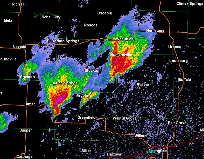
The original storms from the border were now
traveling up I-44 and the lead storm was becoming
a monster. Nothing was happening up on the
I-70 corridor northward, so as we continued our
trek east. We began looking at a couple of warned
storms out ahead of the monster storm to our
southwest.
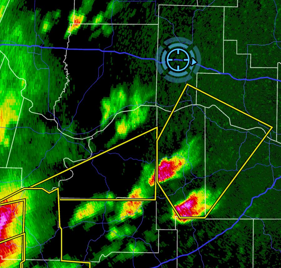
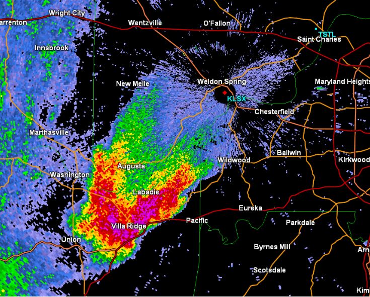
This pair of storms were tracking northeast toward
us, so we planned an intercept point. We got
into position and waited. The two cells
began being influenced by the cell behind them and
began weakening as the were being pulled around to
the north and slightly northwest, but a cell to
their southeast begins to develop.
This new cell
quickly develops and begins moving east.
Seeing this, we decide to leave the two dying
storms and intercept this one. The storm
quickly became warned and was getting a very good
look to it.
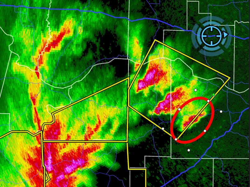
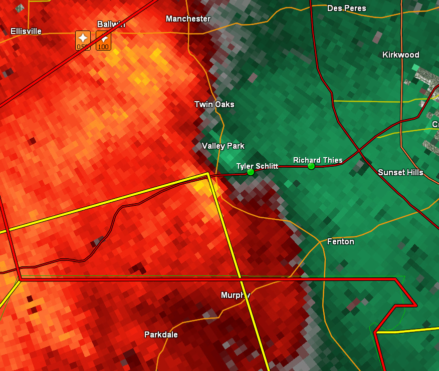
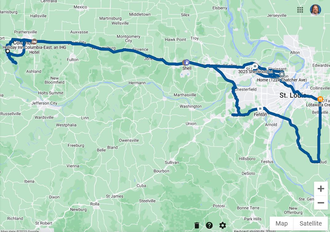
We got on the
move east on I-70, then took I-40/64 into the
Chesterfield Valley where we grabbed 109 down to
I-44 just ahead of the storm. We got on I-44
west bound and drove right up to a rotating wall
cloud. Whoa!! Too close. Grabbed
the Six Flags exit and bolted back east. Not
seeing any reasonable spot to stop and watch in
the hills and trees, we decided to keep going all
the way back to Fenton in the Meramac River
valley.
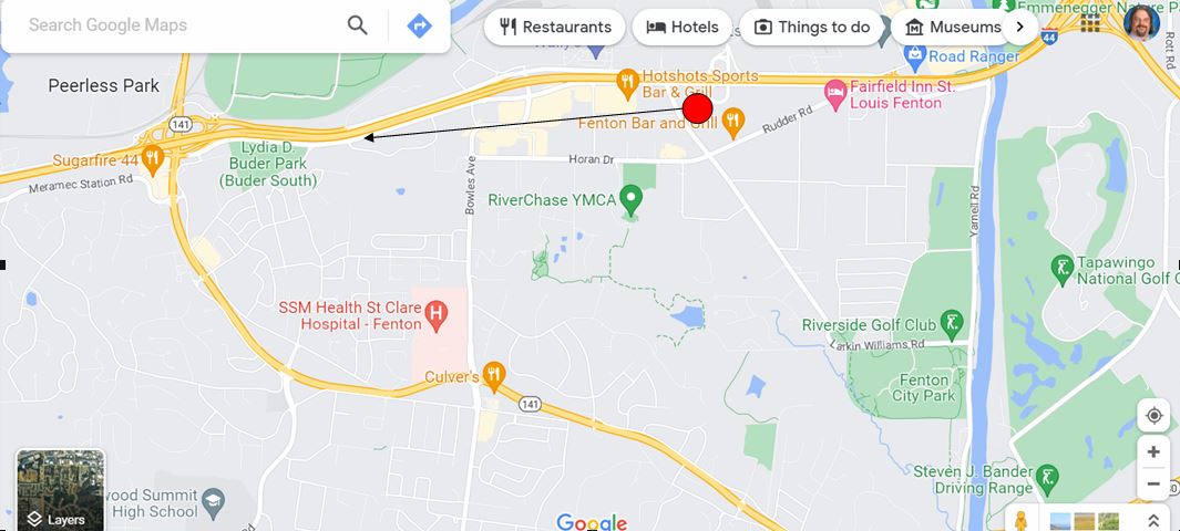
We finally decided on stopping on the abandoned
Stafford Inn parking lot to watch the storm coming
directly at us. We had a less-than-optimal
viewing place as there were some buildings and
trees that blocked the ground view, but it gave us
immediate access to I-44 east as an escape route.
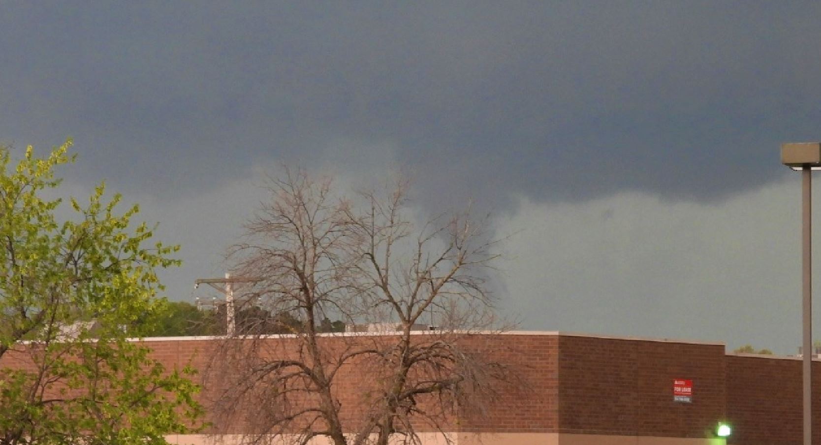
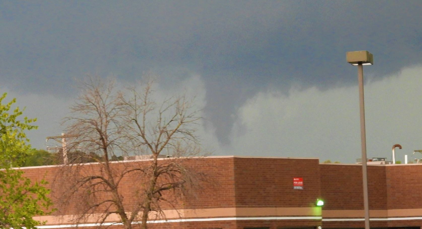
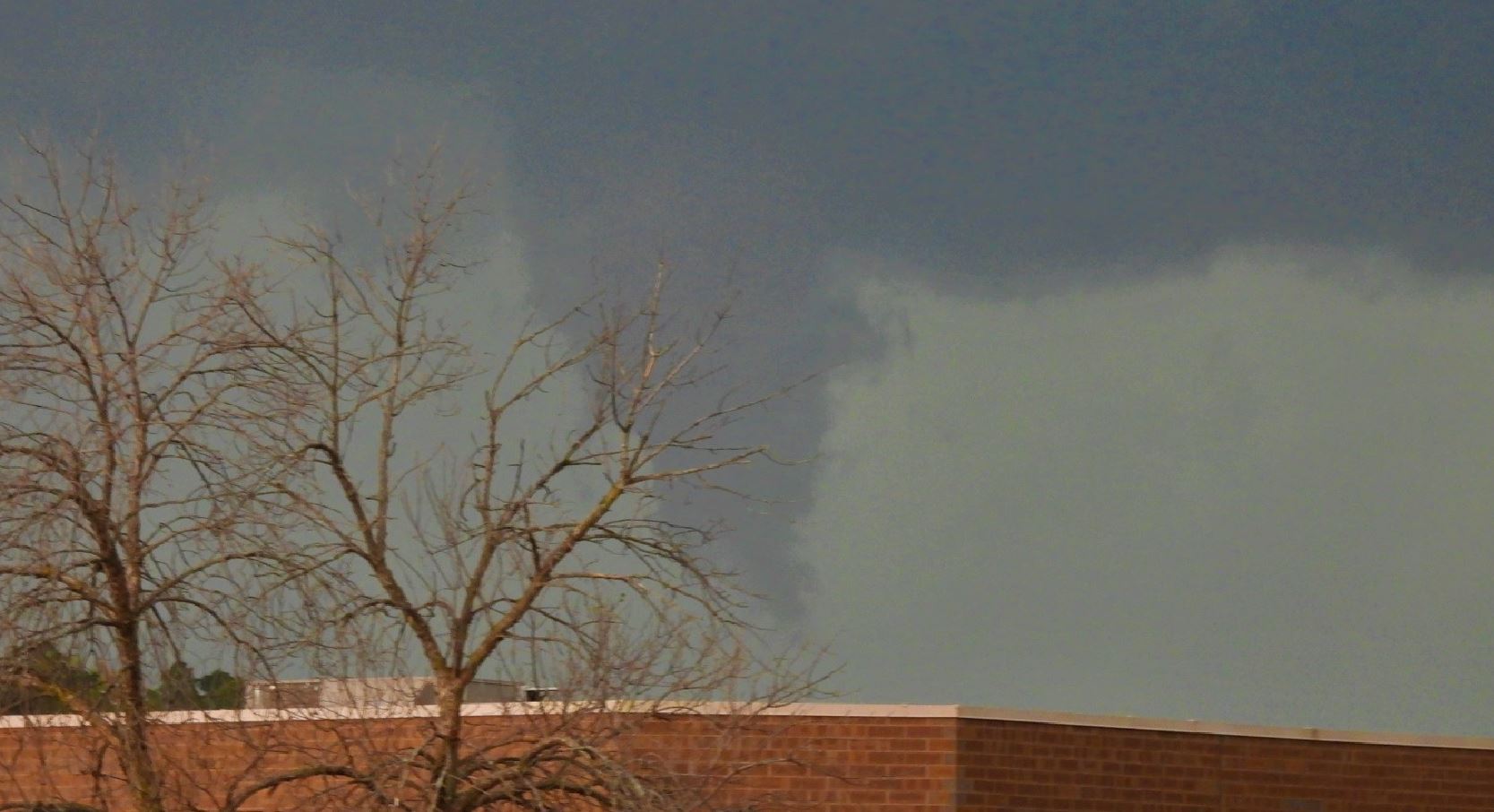
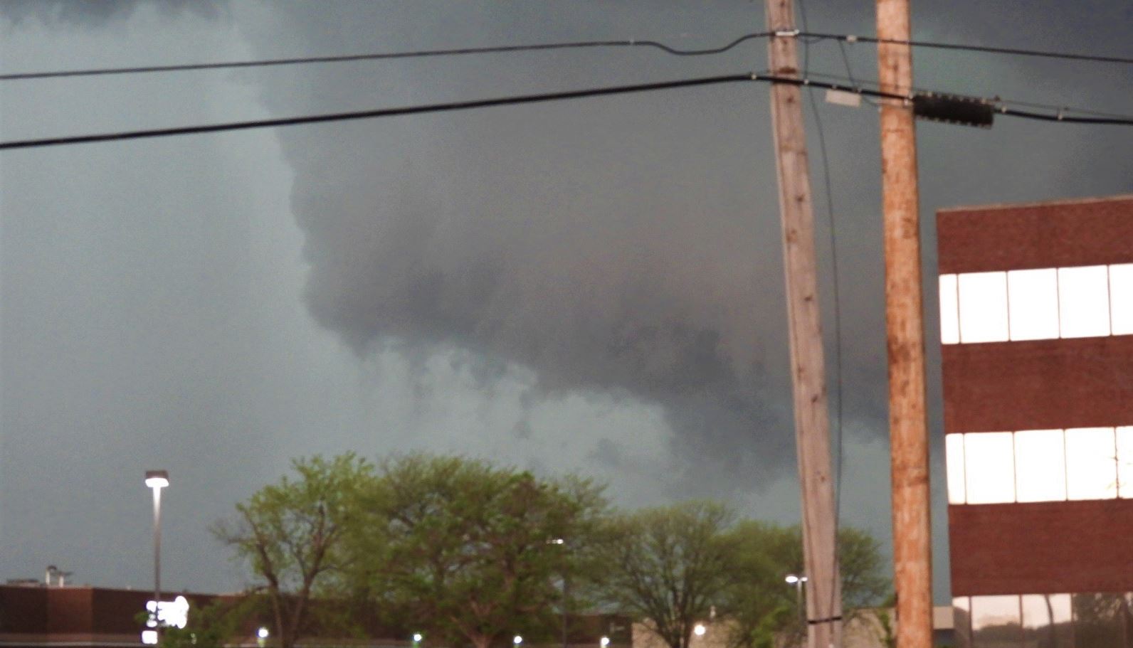
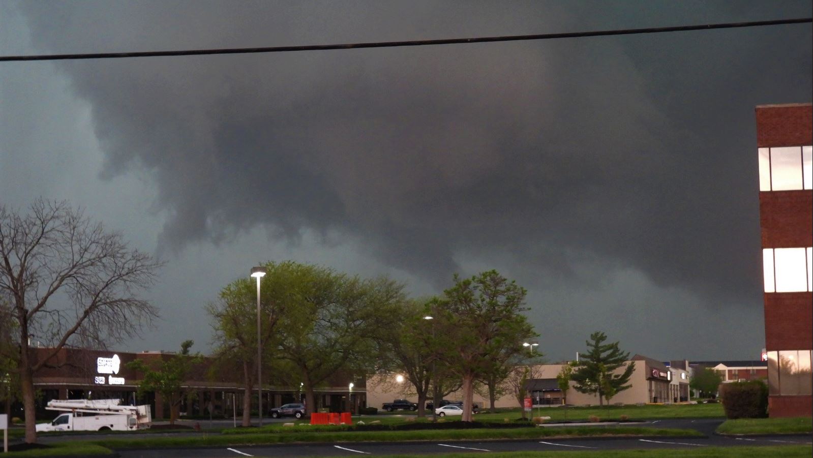
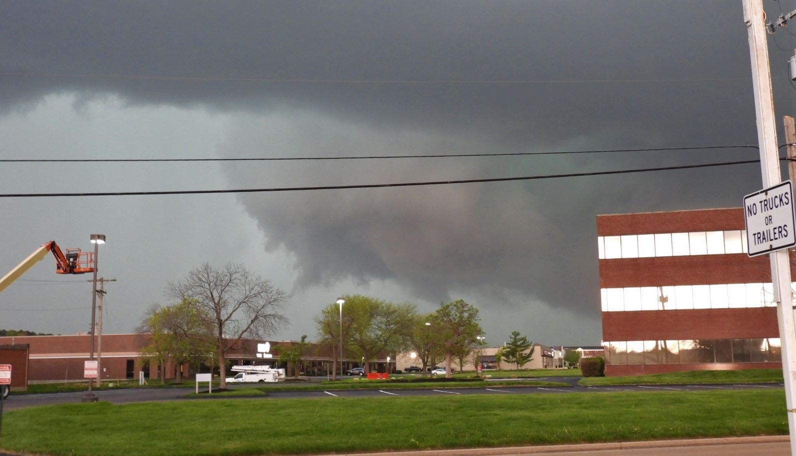
We watched the wall cloud approach, the wall cloud
dropped down a funnel.
A few minutes
later, the wall cloud developed into a huge bowl
shape and produced more funnel clouds.
The wall cloud came right up to us,
so we needed to move and jumped on I-44
eastbound. As Ryan looked back out of
the rear window, he saw the funnel stretch
halfway to the ground. Too bad no camera
on that. Had to make a quick decision
whether to go north or south on I-270.
We chose south in haste. Might have been
better going north to see more, but we also
could tell that rain was wrapping around the
circulation.
We continued
around the loop into Illinois and had a nice
view of the approaching storm coming over the
river. No tornadoes were seen there.
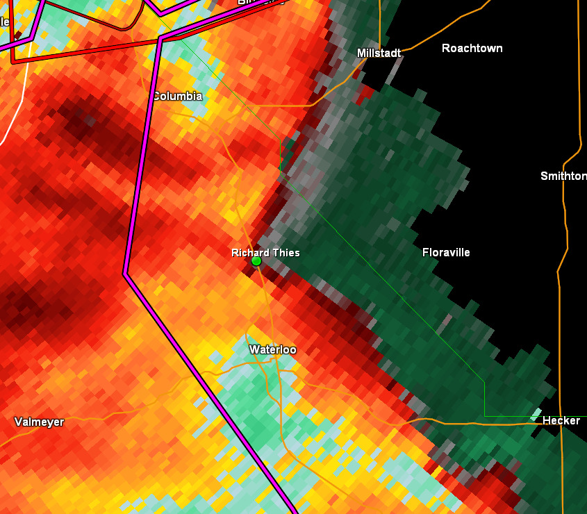
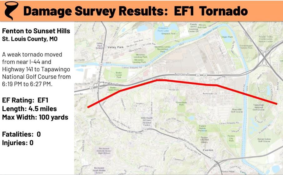
We made an effort to intercept the
incoming storm down Highway 3 near Waterloo, IL
and Redbud, IL. The storm
eventually put down a tornado in Hecker, IL just
to their east. Unfortunately, the rotation
crossed in front of us before we could get
there.
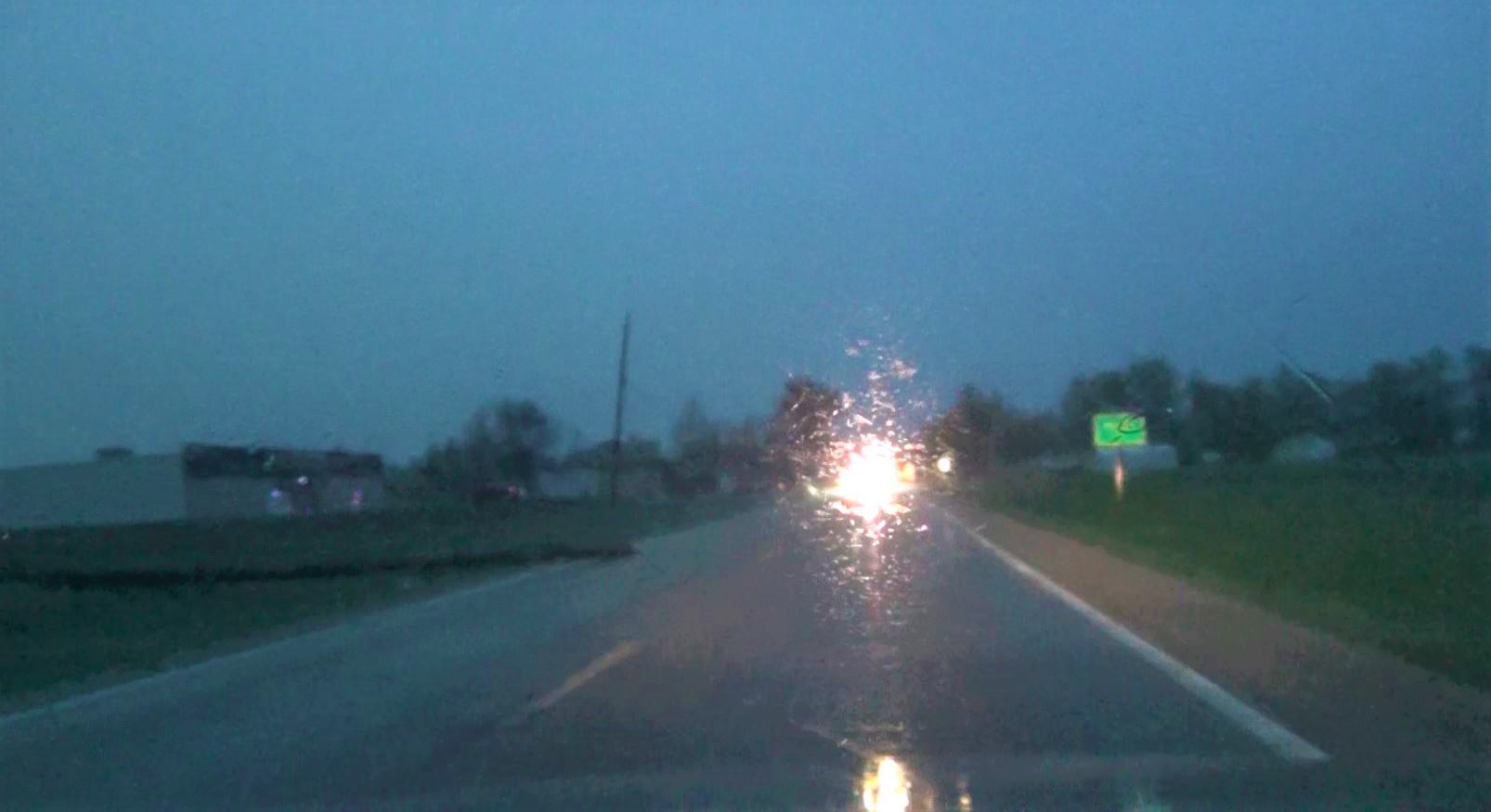
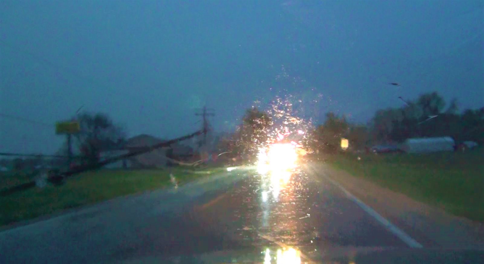
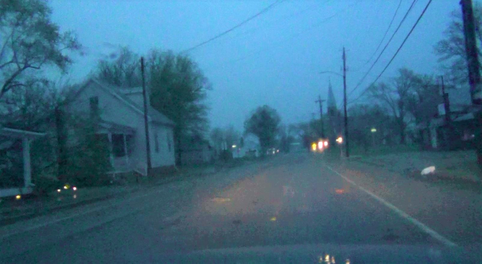
Our trip home
took us through Hecker. Saw many trees blown
over, untility poles snapped, and a few homes with
some damage.
 April 15, 2023