 July 01, 2023
 (Click on images to enlarge them)
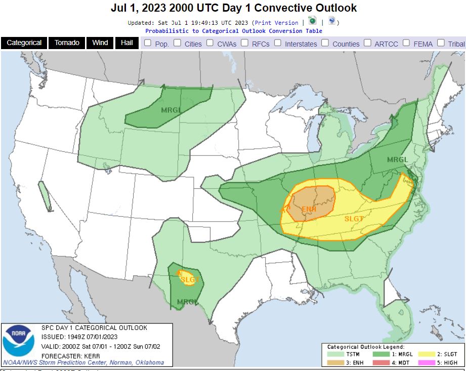
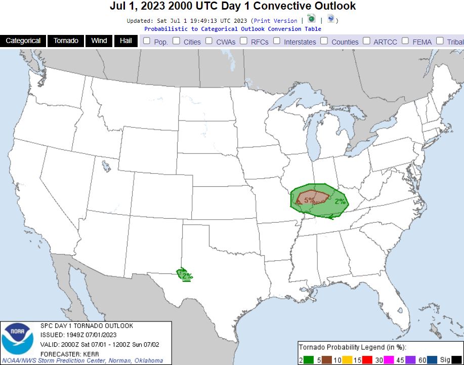
A storm threat with a low tornado risk presented itself and this time on a Saturday. With the threat being within a couple hours of the house, my son Ryan and I took the chance to head out and hope for some luck. The Storm Prediction Center placed an Enhanced Risk in our target area albeit mostly for the hail and wind threat.
We drove out a little early and made a stop in East St. Louis, Illinois to look for a rare bird hanging out there, grabbed some lunch in New Baden, Illinois, then more photo opportunities out by Carlyle Lake. About mid afternoon as we saw the first hints of storms going up, we headed back to I-64 and moved east to our target of Mount Vernon, Illinois.
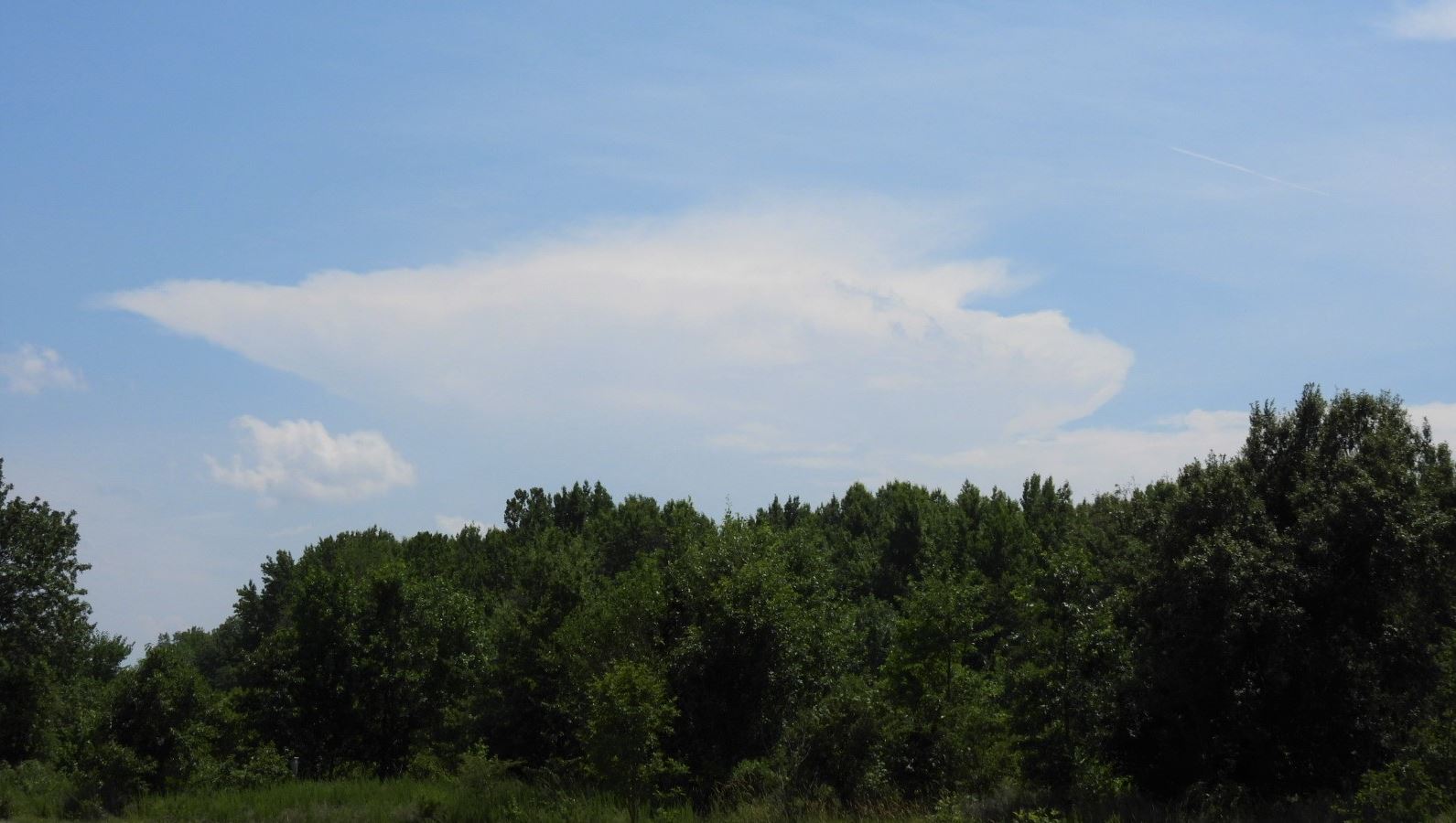
As we moved east toward our target, some isolated storms began to grow. Right before we reached Mount Vernon, a storm to our south caught our attention as it grew. Didn't have much in wind velocity, but had an impressive hail core. We made the decision to get off at the Woodlawn, Illinois exit and position ourselves in a spot to view the hail core and any potential spin up coming right at us. Pulled into a bank overhang directly in the path of the storm looking out at the incoming storm.
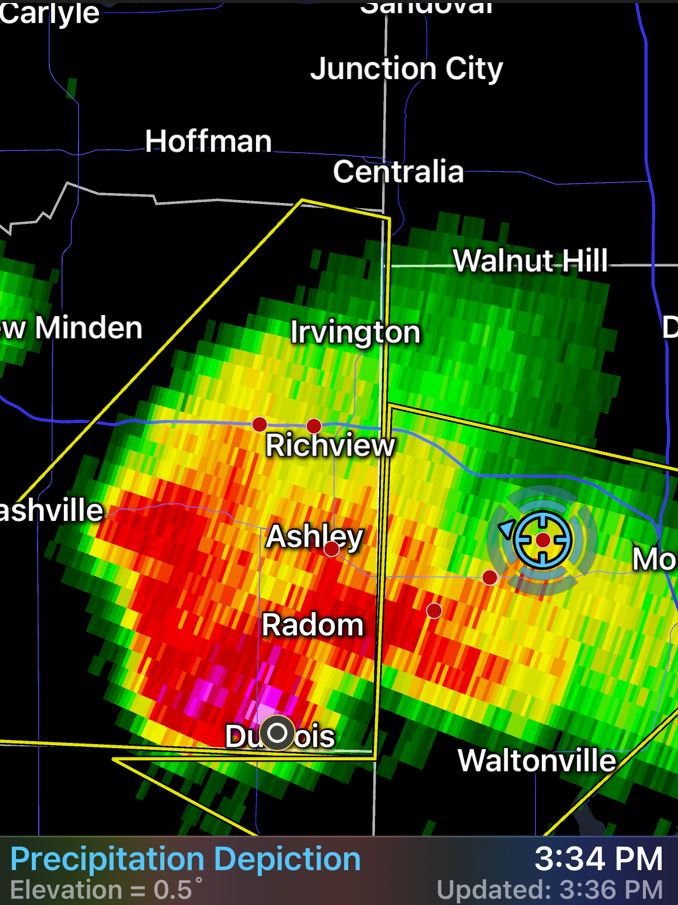
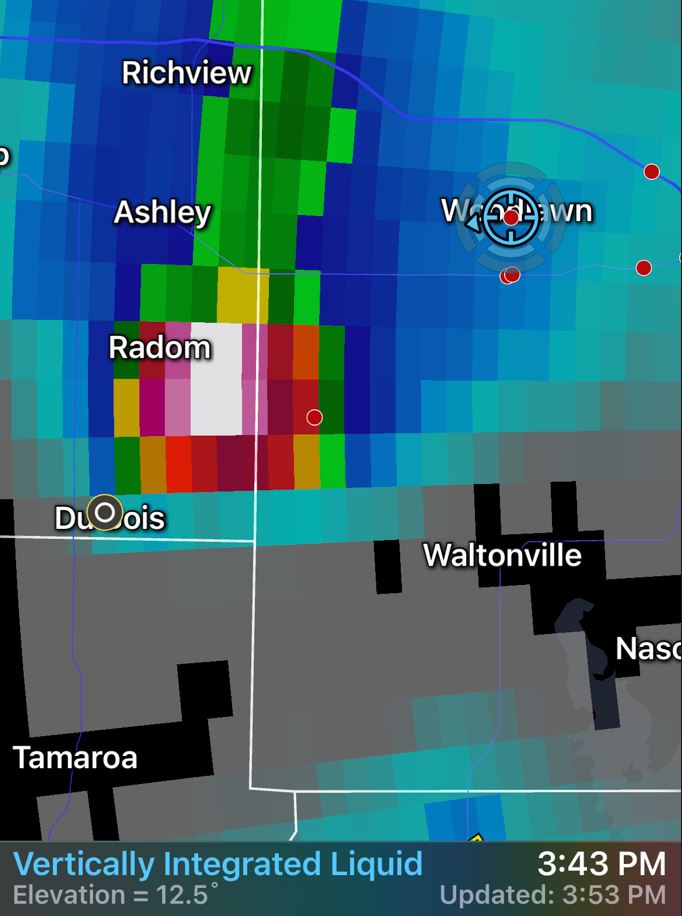
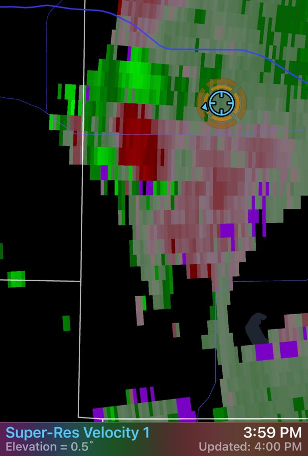
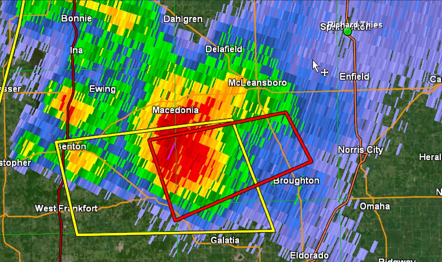
Unfortunately, as the core of the storm got to us, the hail core weakened drastically and no hail was seen. Also, nothing was visibly left in velocity, so we headed east out of Woodlawn and grabbed I-64 east again. We set our sights on another storm to our southeast. We needed to get out in front of the storm to the east before heading south for the intercept. As we moved east, we had the storm in our sight. The storm had rotation and became Tornado Warned, but there was also a storm brewing in front of us that was also looking very interesting also with some rotation and growing rapidly.
Storm to the South
Storm to the East
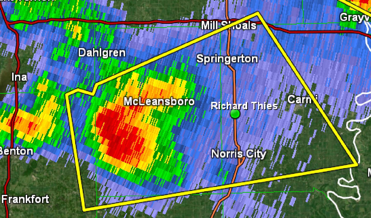
Decision Time. Do we stay with the plan and go south to get to the Tornado Warned storm or elect to go after the storm directly in front of us? After going through some of real time data again, we chose to continue toward the storm to our south. We exited at Highway 242, the Mils Shoals exit and moved south. The storm continued to show rotation, but as if right on cue as we moved into the intercept spot, the Tornado Warning was dropped and rotation quickly diminished.
 |
 |
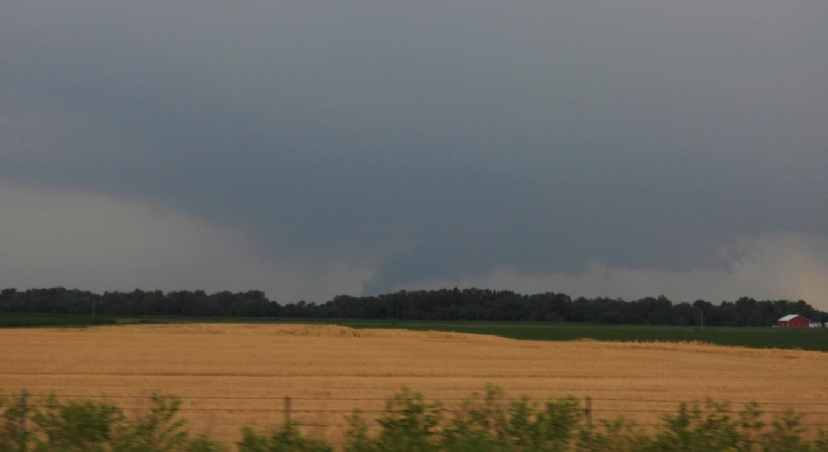
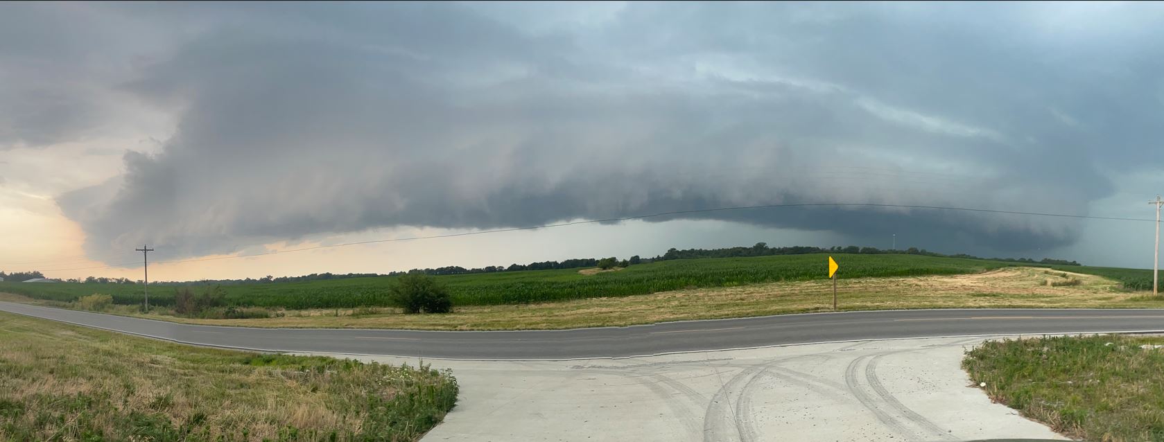
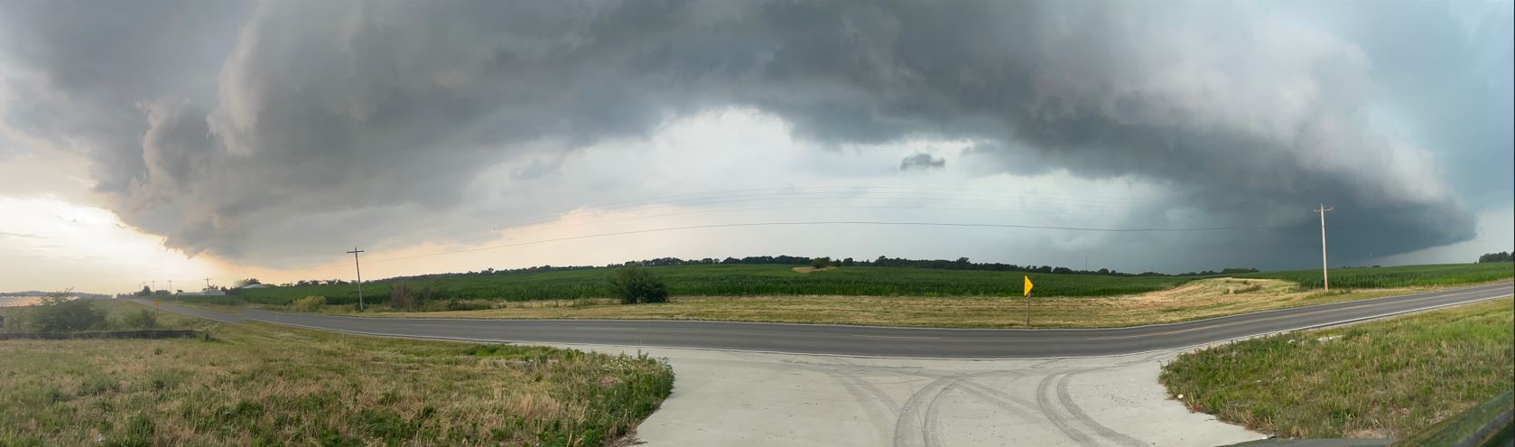
Even with the warning dropped, we found a spot to just watch the storm come over the top of us. We were treated to a nice looking Shelf Cloud.
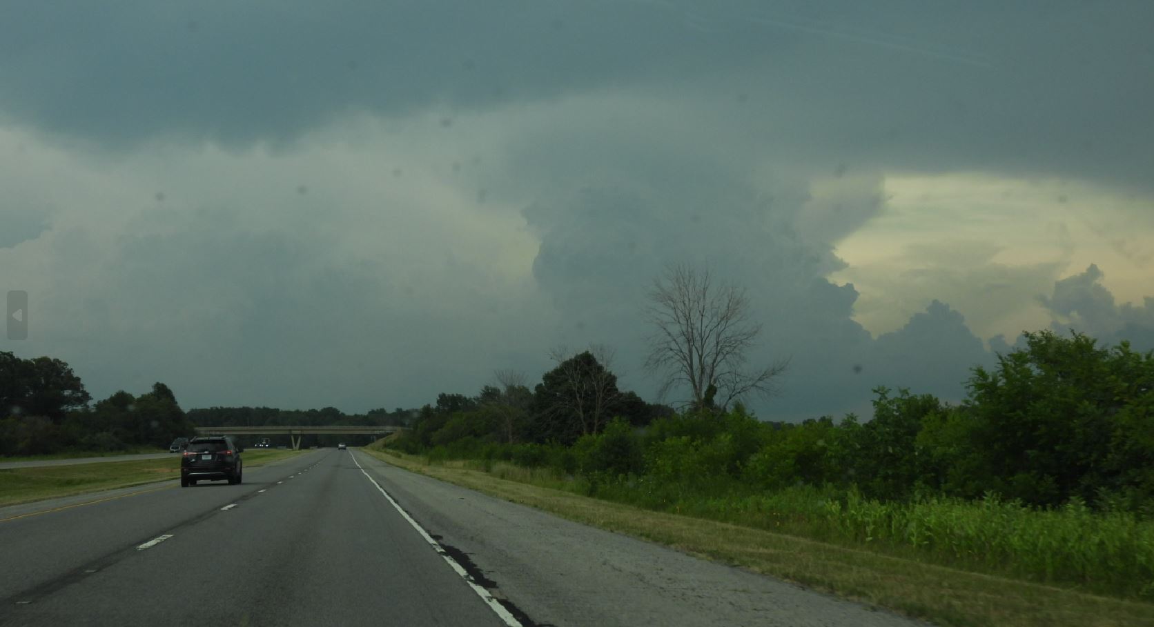
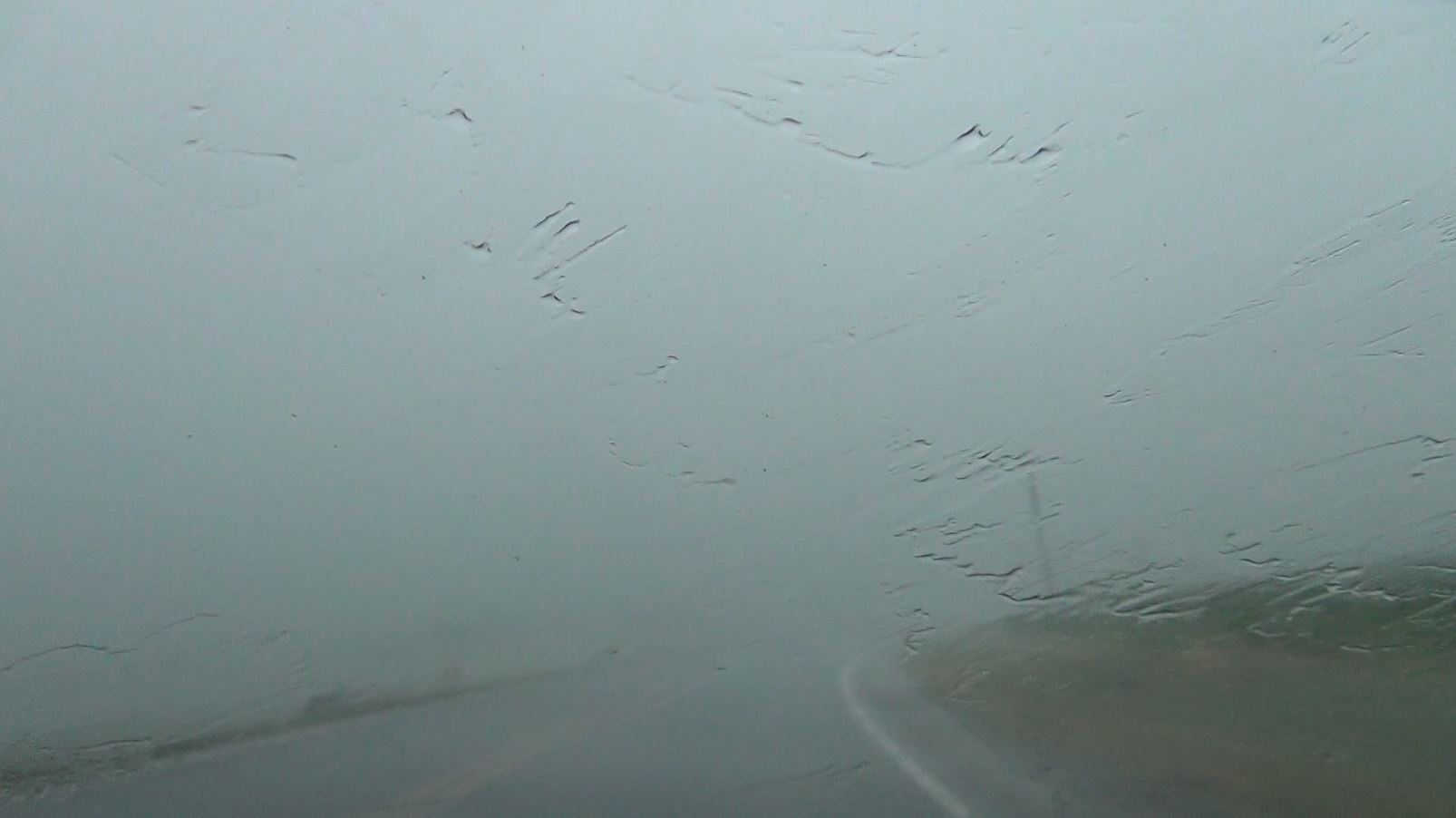
As the storm's shelf cloud and precipition got right up to us, we headed back north to drive through the heart of the storm with the greatest wind. We were not disappointed as the wind was extremely strong as we estimated 70mph give or take. In addition to the high wind, there was a blinding rain cutting visibility to only a few car lengths in front of our vehicle.
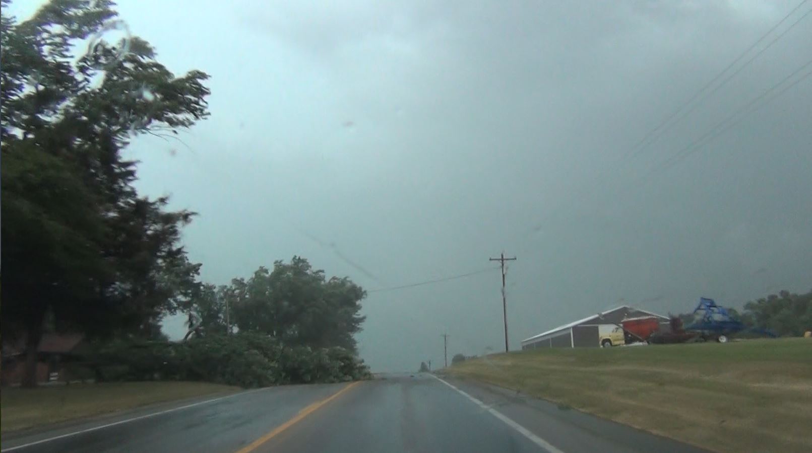
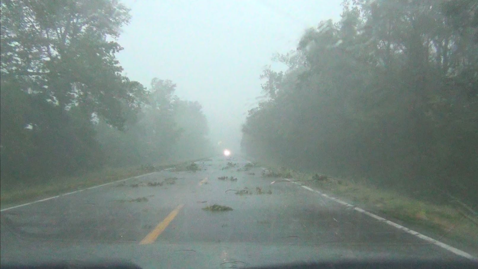
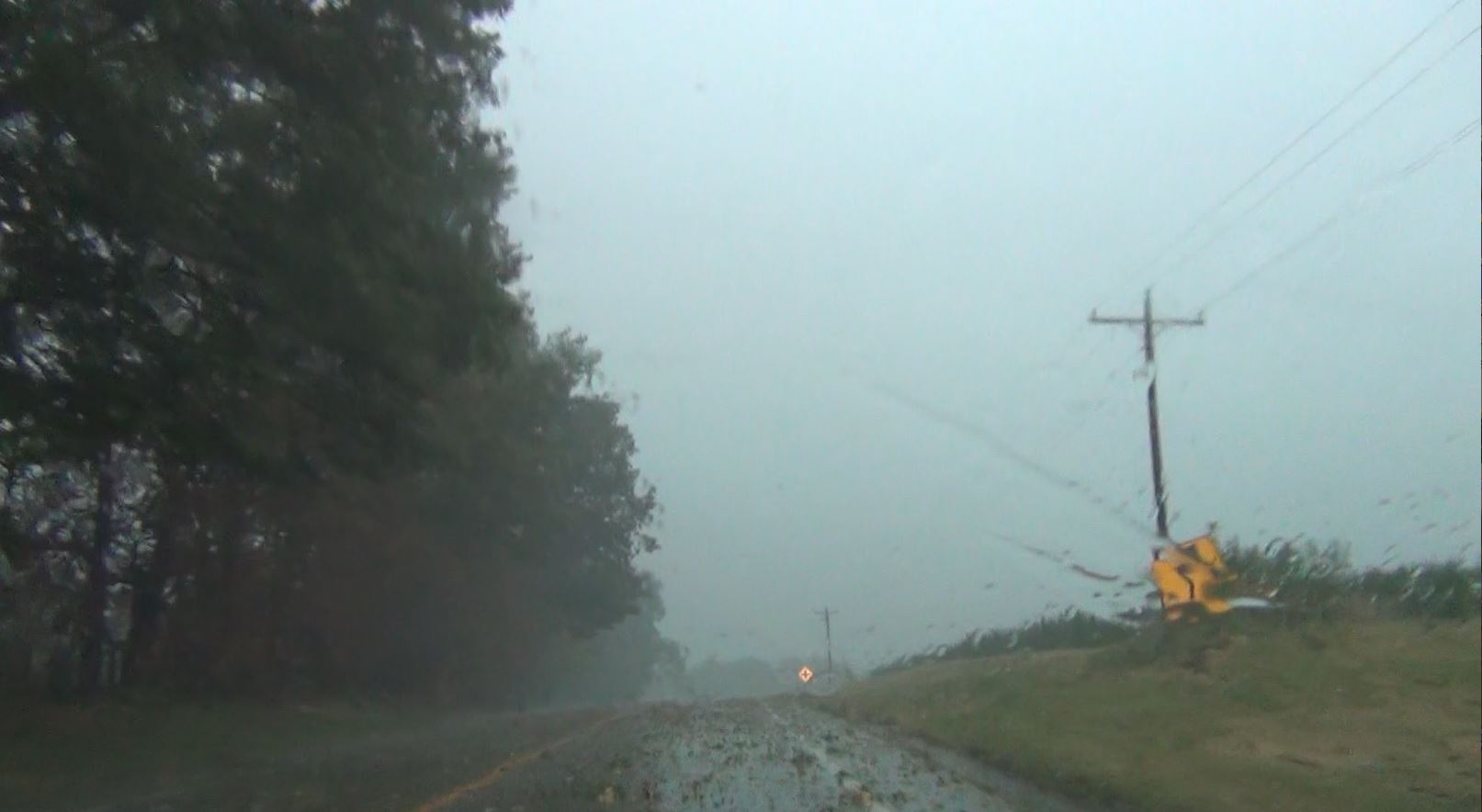
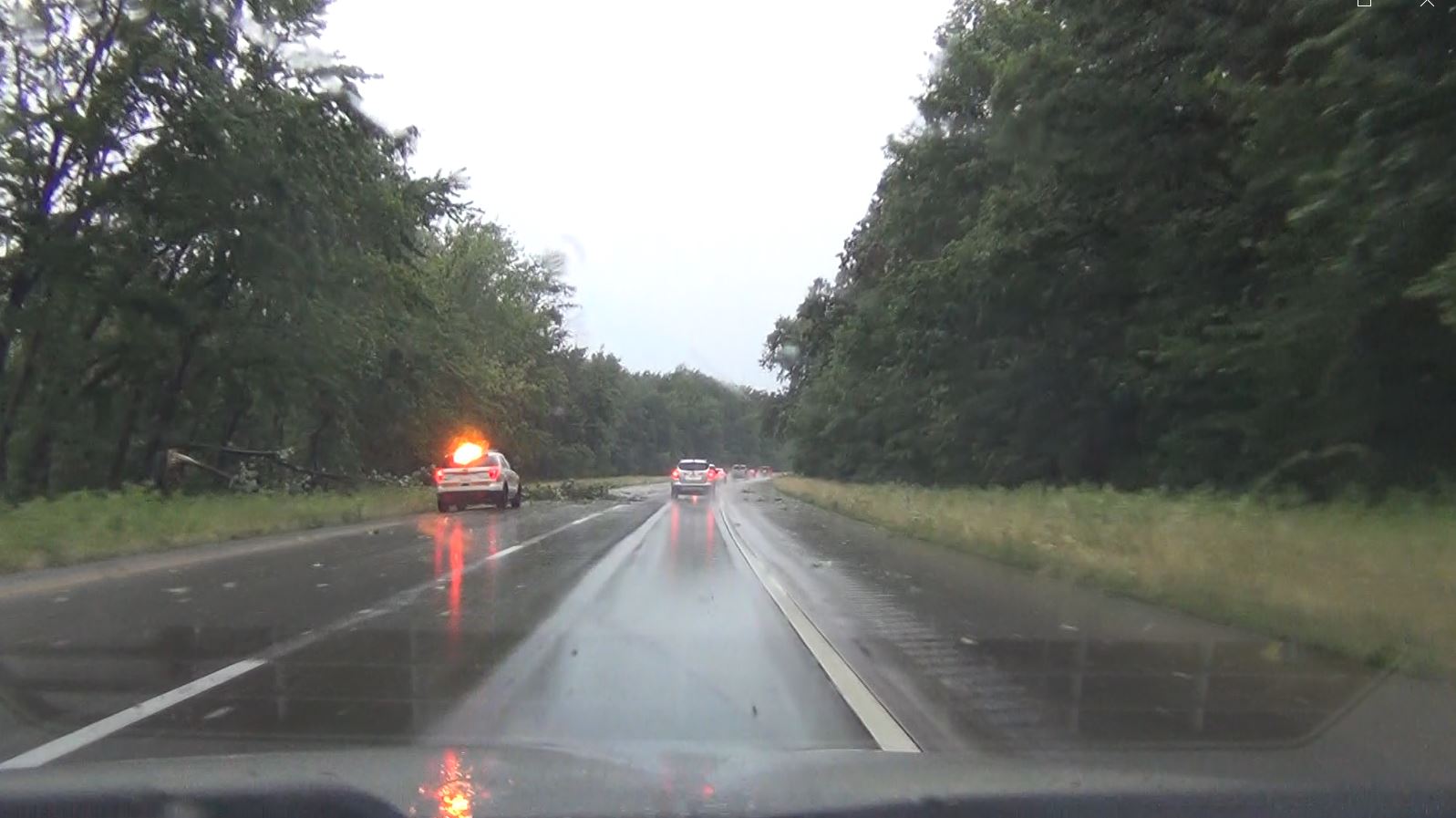
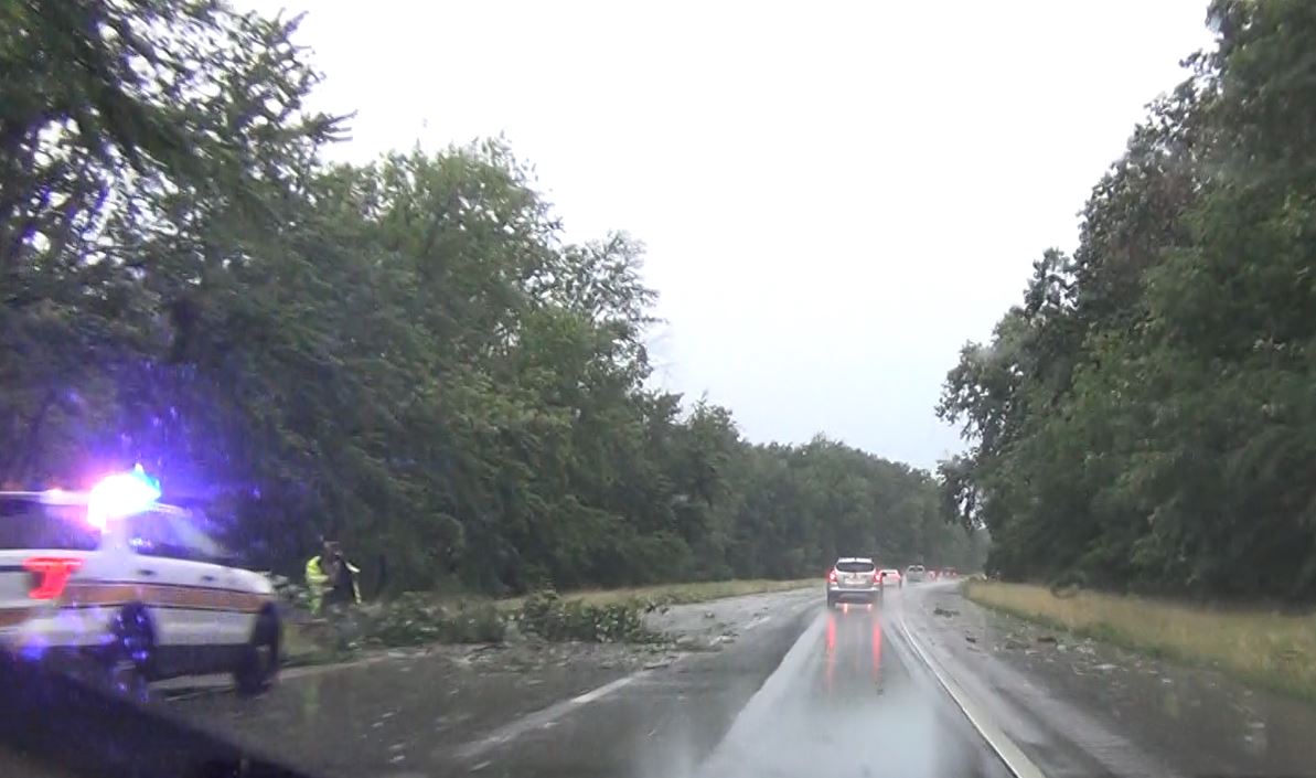
The extreme wind was dropping trees, breaking off branches, and depositing loads of debris across the road as we drove back north toward I-64.
We reached I-64 and drove back west. Even the interstate was not immune to the tree debris as we passed an Illinois State Trooper out of his car in the downpour trying his best to pull a downed tree off the Interstate.W
Back to the west, a squall line had formed on the cold front and had now moved east and caught up to this isolated cell giving us more wind and rain. We exited I-64 again and parked to allow the heaviest of the storm's wind and rain in the line to pass before driving back toward home.
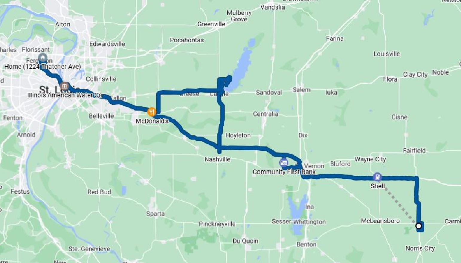 |
8.5 Hours - 322 Miles