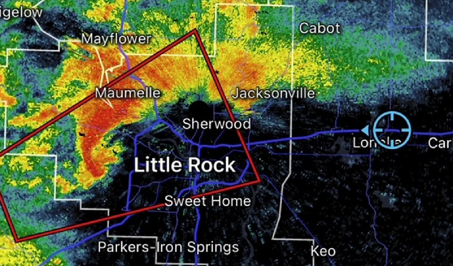
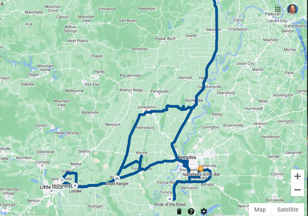
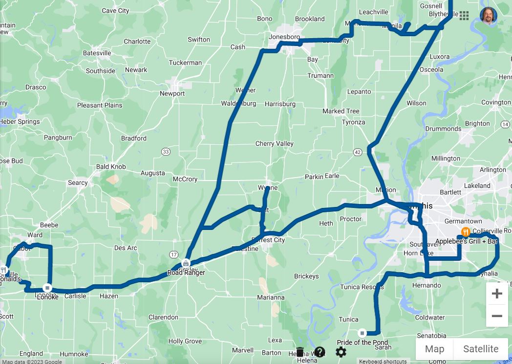
We
set our intercept path to the northeast of Little
Rock in the suburb of Jacksonville,
Arkansas. As we made our way through the
back roads northward toward our intercept point,
the forested area only allowed for a rare, brief
glimpse of the storm as it moved toward us.
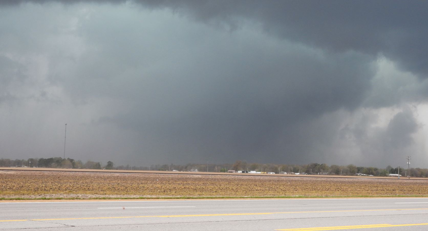
When we arrived in Jacksonville, we found a big
parking lot that finally gave us our view to the
west. What we saw was the tornado coming
toward us. A few indecisive minutes went by
as we watched to determined if we were out of its
path. The tornado would slip by just to the
south keeping us out of the way of the debris that
was rotating around it.
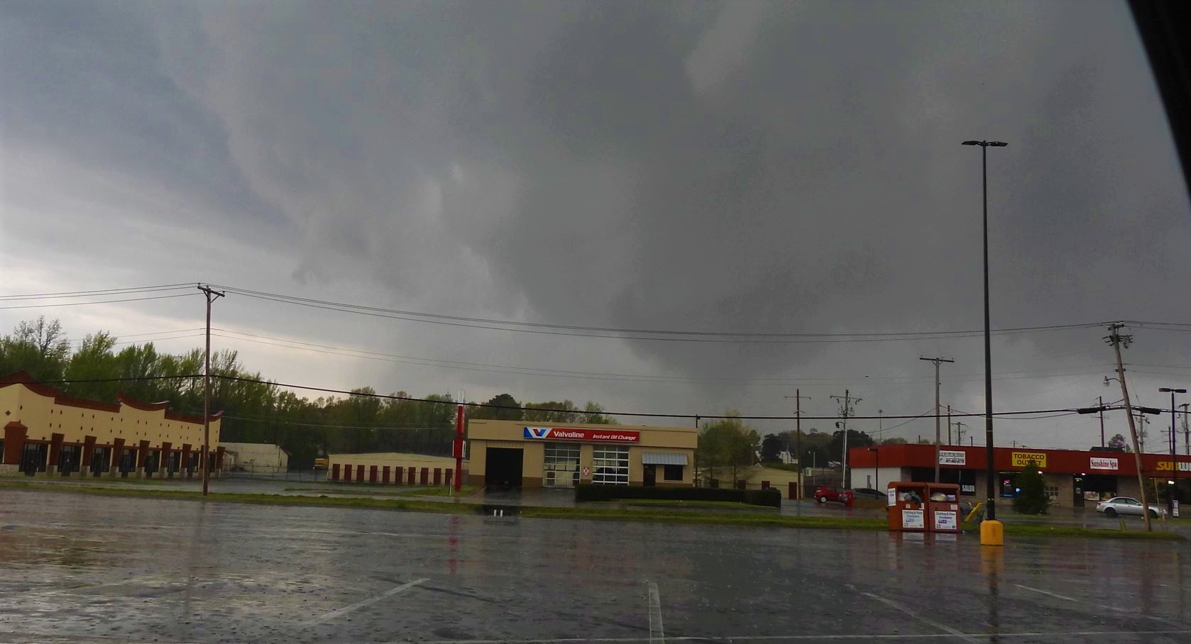
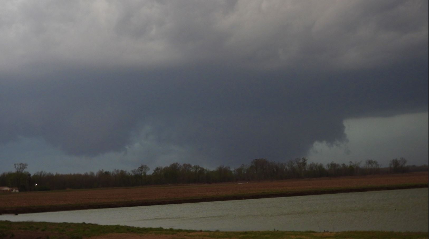
The
tornado was not as strong as it was on the west
side of Little Rock, but was still pulling up
debris and spinning it around its rotation.
We attempted to follow it, but storm speed,
traffic, and road network did not afford us the
ability to keep up with it.
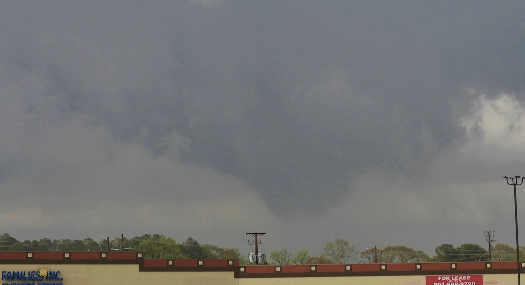
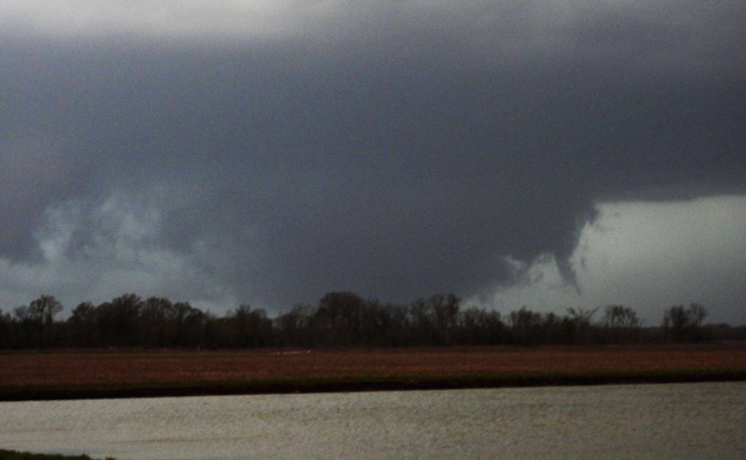
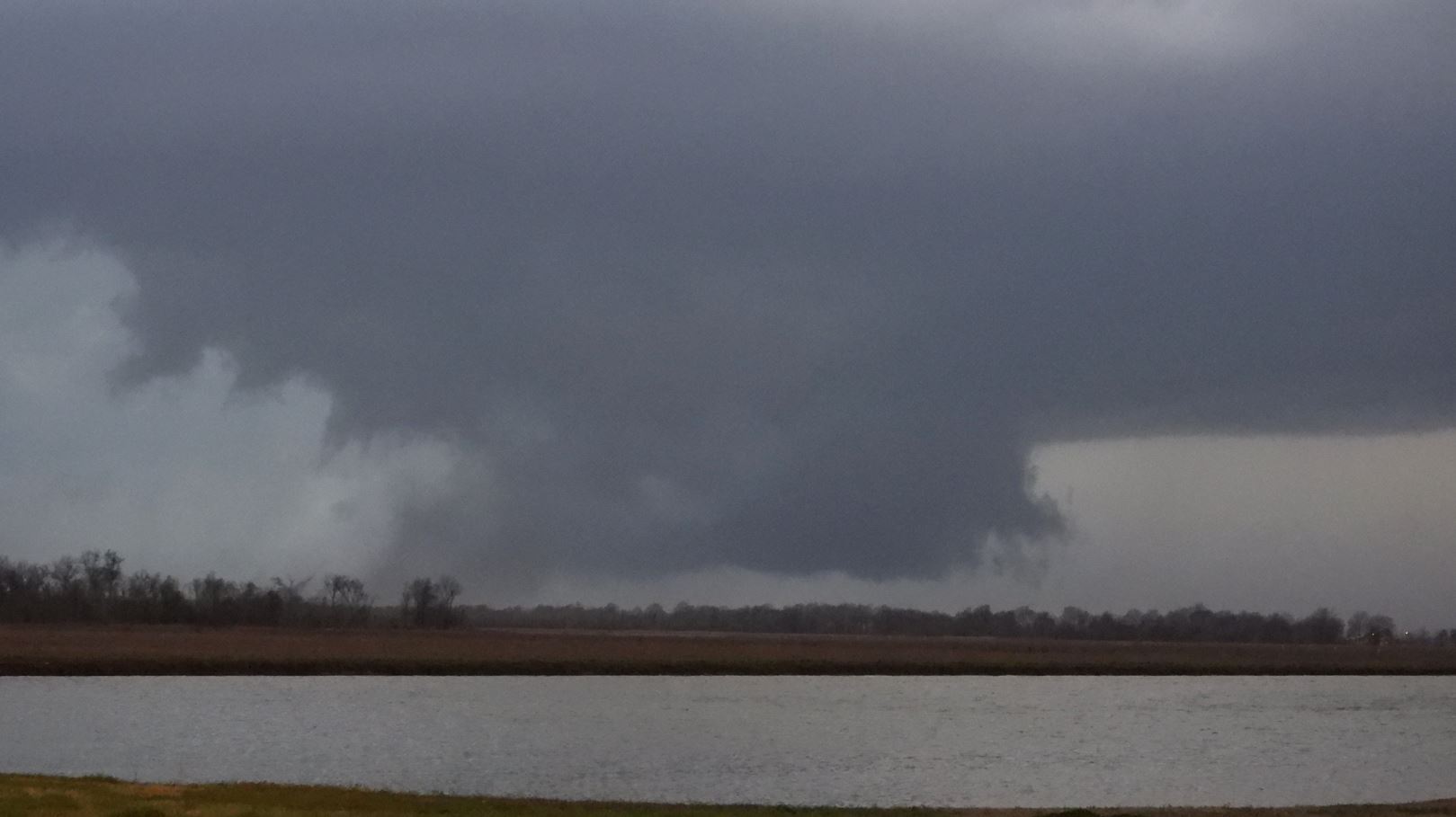
We
worked our way back to I-40 and headed east
gaining some ground on the storms once again and
watching multiple cells north and west of
us. We eventually found ourselves watching
another developing tornadic cell approaching just
to our northwest. We exited I-40 at Forest
City, Arkansas and headed north to
intercept. Since this area was not as
heavily forested. we were able to get an
occasional view and keep tabs on the approaching
storm. It was tornado warned and as we
watched, the tornado came into view and
transitioned into a wedge.
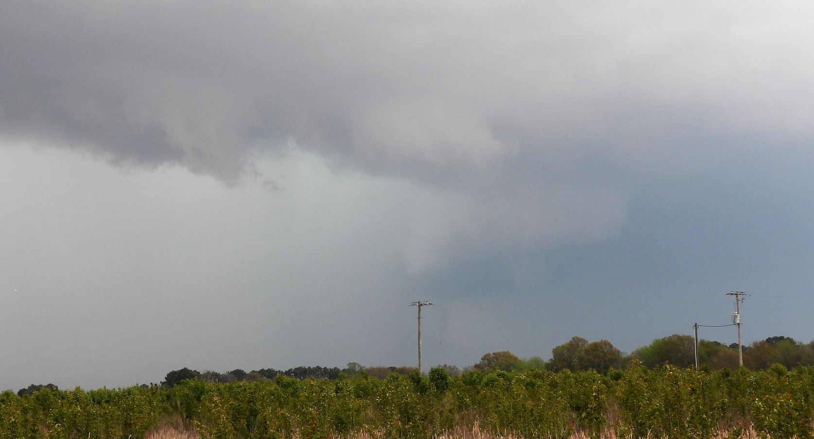
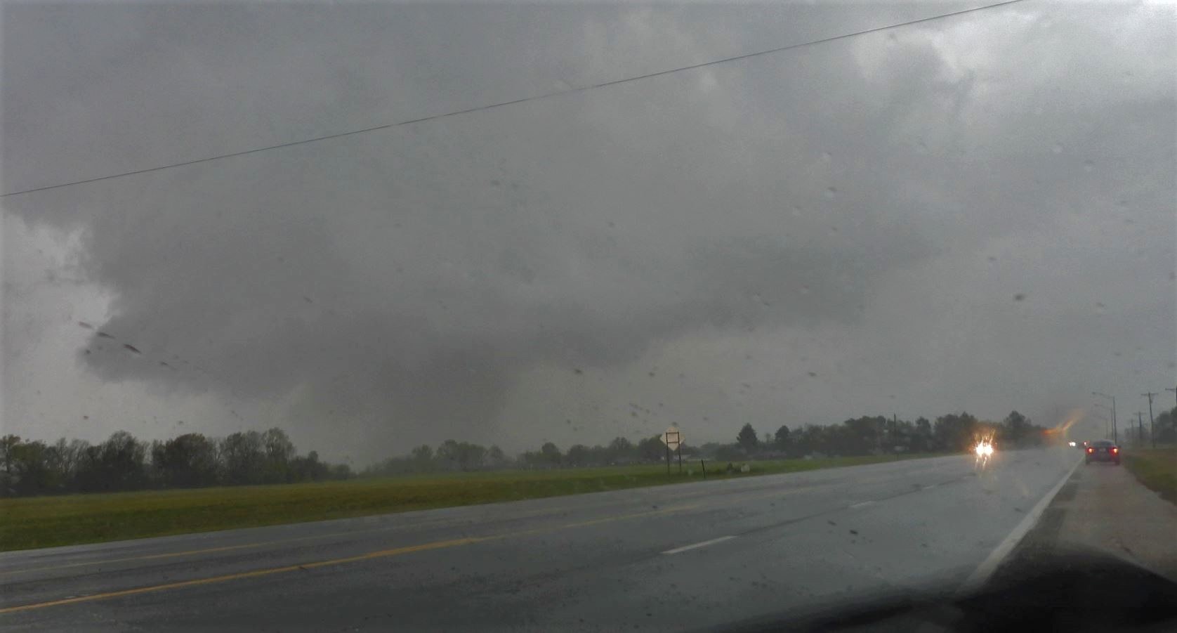
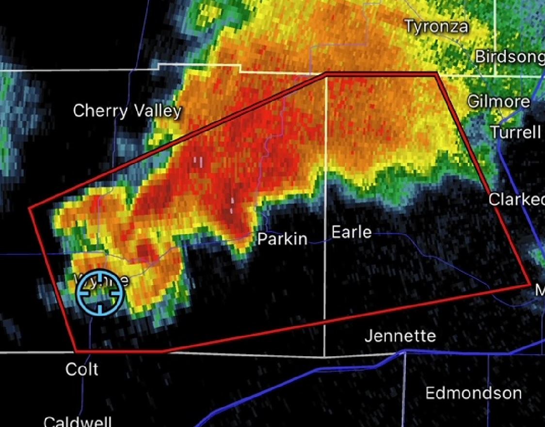
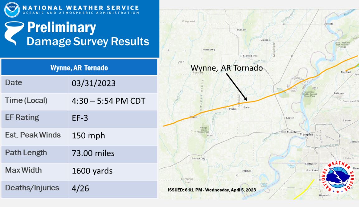
It
was becoming obvious that the tornado was going to
make a direct hit on the town of Wynne. We
crept up to the edge of the storm as it entered
the city. As it roared into town, we let it
pass and then attempted to follow the storm, but
were immediately halted as there was massive
debris and destruction everywhere.
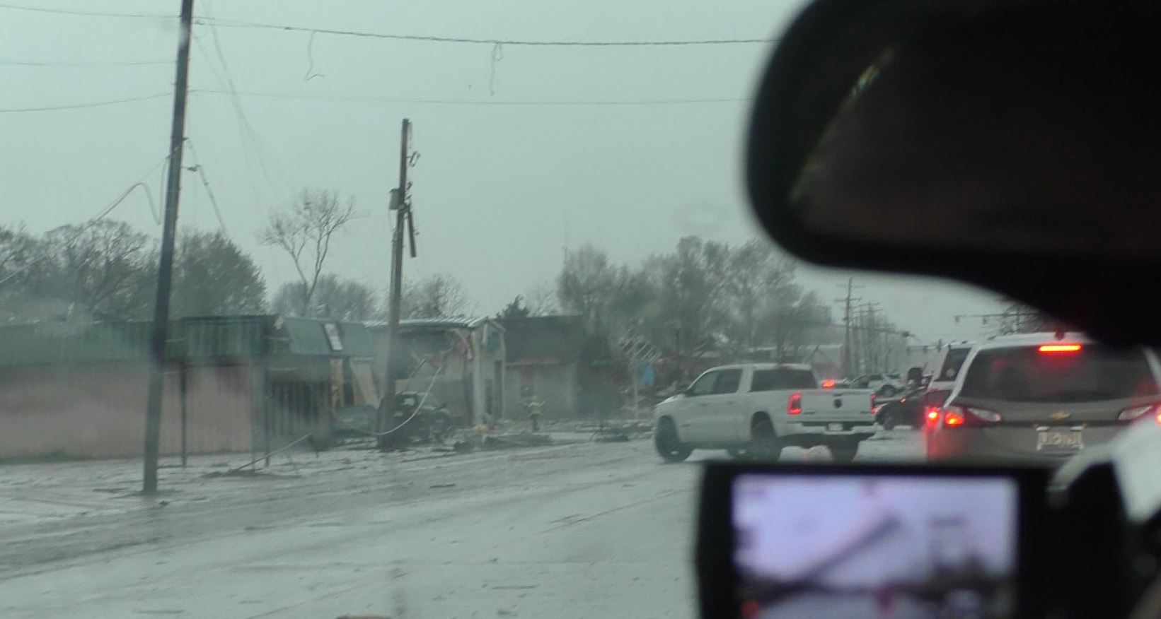
Seeing
the destruction, we immediately turned around
and exited the area to give the first responders
access without us in the way.
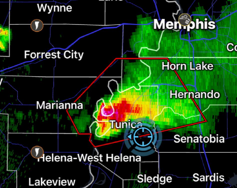
We
back tracked to I-40 once again and continued
east. Wasn't long before we had our eye on
another cell to our south. This storm would
track south of I-40 and was moving toward the
Mississippi River. We made the decision to
intercept this now tornado warned storm on the
Mississippi side of the river, so we crossed the
Memphis, Tennessee bridge and then moved south on
I-55. The intercept point would be somewhere
near Tunica, Mississippi. We got there just
before the storm, exited to drive into the
Mississippi River Valley, and found a wide open
spot to watch it move across the open valley as
twilight began setting in.
There were reports
of a stovepipe tornado firmly on the ground, but
we never got a visual of it as rain curtains
wrapped around it.
As darkness set in, we called it a day and headed
back to Memphis to find a restaurant to enjoy a
relaxing dinner after a very hectic day. We
found a nearly empty Applebees and we ordered our
meal. After ordering, we glanced at the
radar again. "What is that aimed directly at
us?"
The relaxing meal
turned into a semi-rushed meal as we had to check
out this final tornadic storm as it was to pass
over us. Now in complete darkness in the
middle of the east Memphis suburbs, we plotted the
path and waited for the storm to move right by
us. Only visible by the lightning, we
positioned ourselves very close in as we watched
the hook part of the storm go by. We were
able to follow the storm, but were never able to
confirm any funnel lowering or tornadoes.
Ironically, this storm put down a big tornado as
it moved east after we let it go.
We made the long trip back home after a very
successful day.
20.5 Hours
- 1078 Miles
 March
31, 2023
March
31, 2023