 April
18, 2024
April
18, 2024 (Click on images to enlarge them)
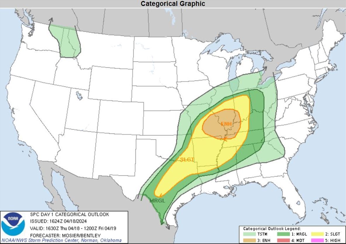
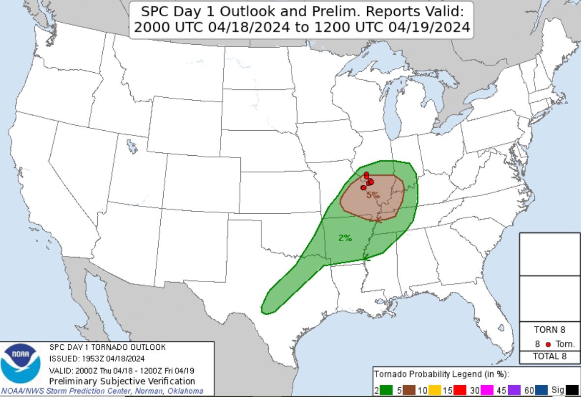
With an enhanced risk of Severe Storms including the 5% potential for tornadoes per the Storm Prediction Center, this day was setting up as a potential chase day. Leading into this day, the forecast suggested there would be a line of severe storms with a limited chance of a tornado or two within the line embedded supercells. Normally, we choose not to chase these line embedded supercells, but Ryan and I decided since it was fairly local, we'd give it a chance for finding a tornado. Our chase partner Brian Stertz chimed in letting us know the possibilities for tornadoes was real.
Once Ryan got off of work, we headed out targeting the area along I-64 out of St. Louis in southern Illinois. We chose the area as it seemed to have the highest tornado parameters. As we were driving, storms that were already on-going in a line approaching from the west were becoming severe on the line to our northwest as it moved eastward. It became obvious the best parameters had moved further north and the I-64 corridor was no longer in the optimal area.
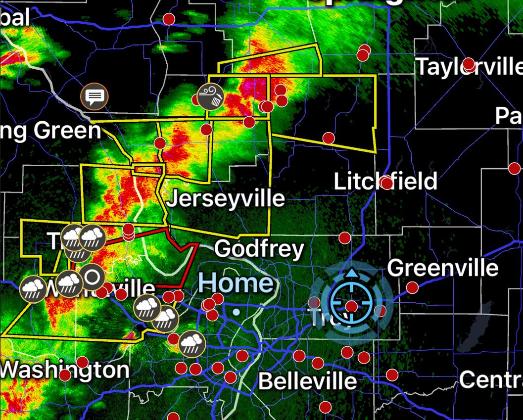
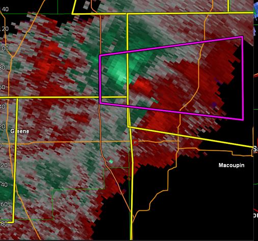
We grabbed Highway 4 north. As we drove northward past I-70, we took note of a cell on the northern most part of the approaching line. It had became Tornado warned and seemed to stay warned as it moved eastward. We figured this must be the cell that latched onto the warm front where the winds were optimized, so that cell became our new target.
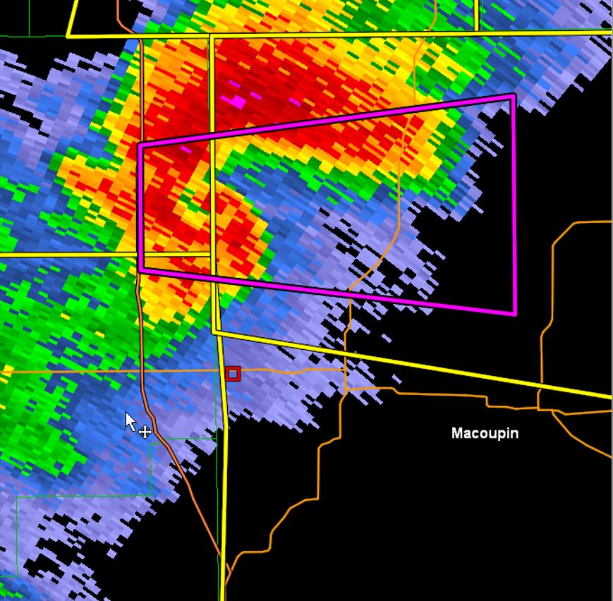
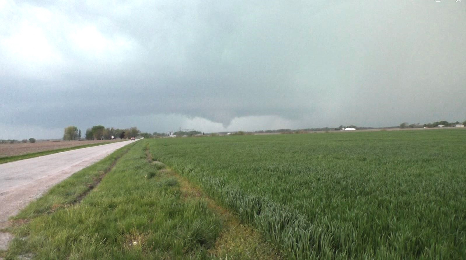
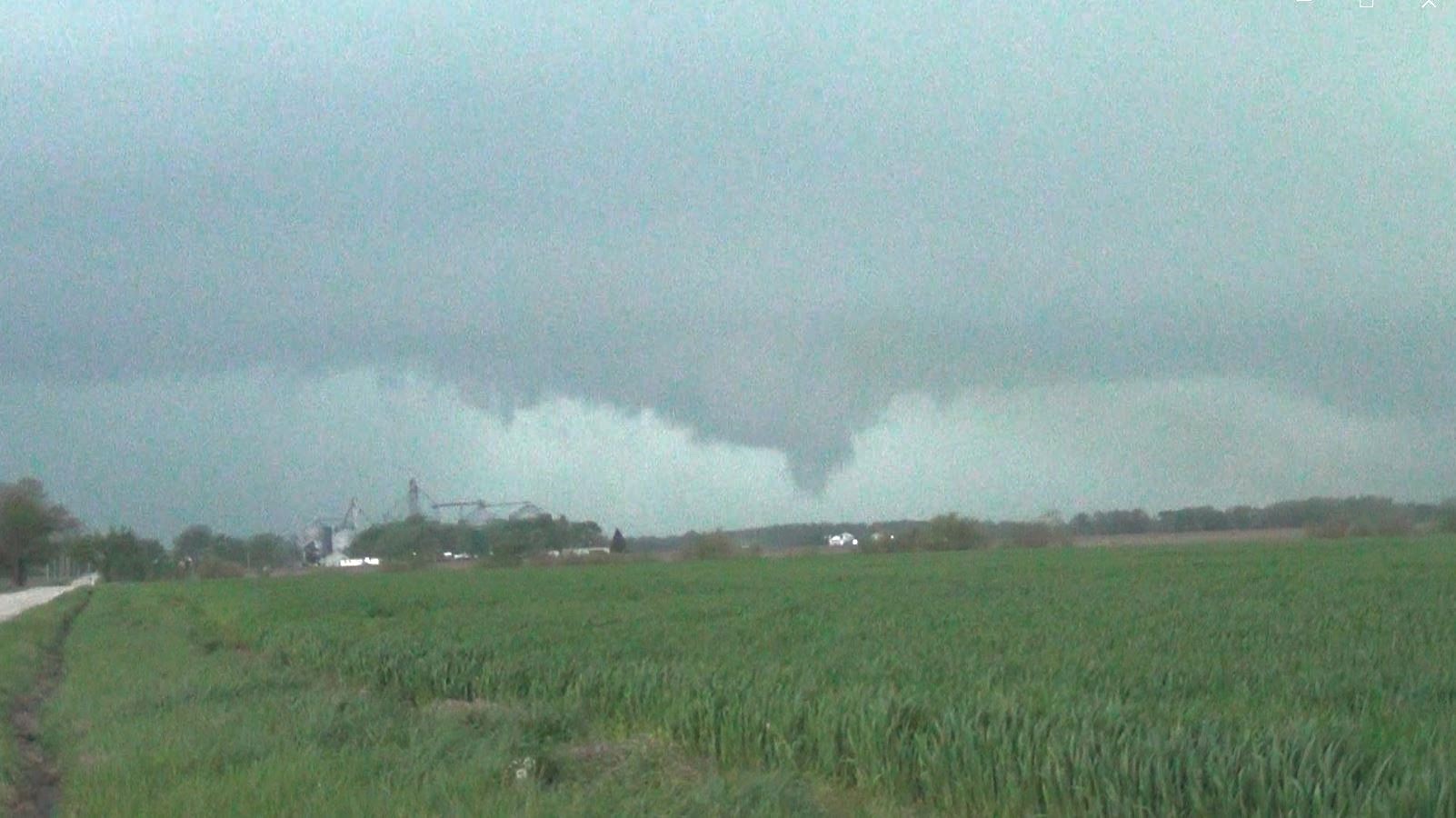
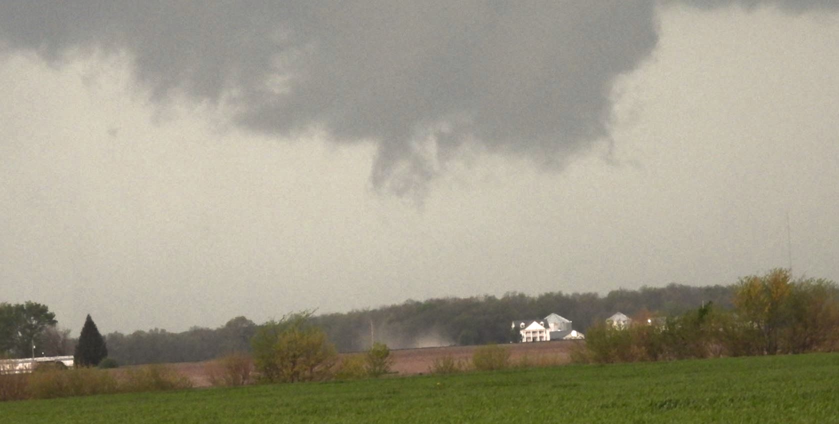
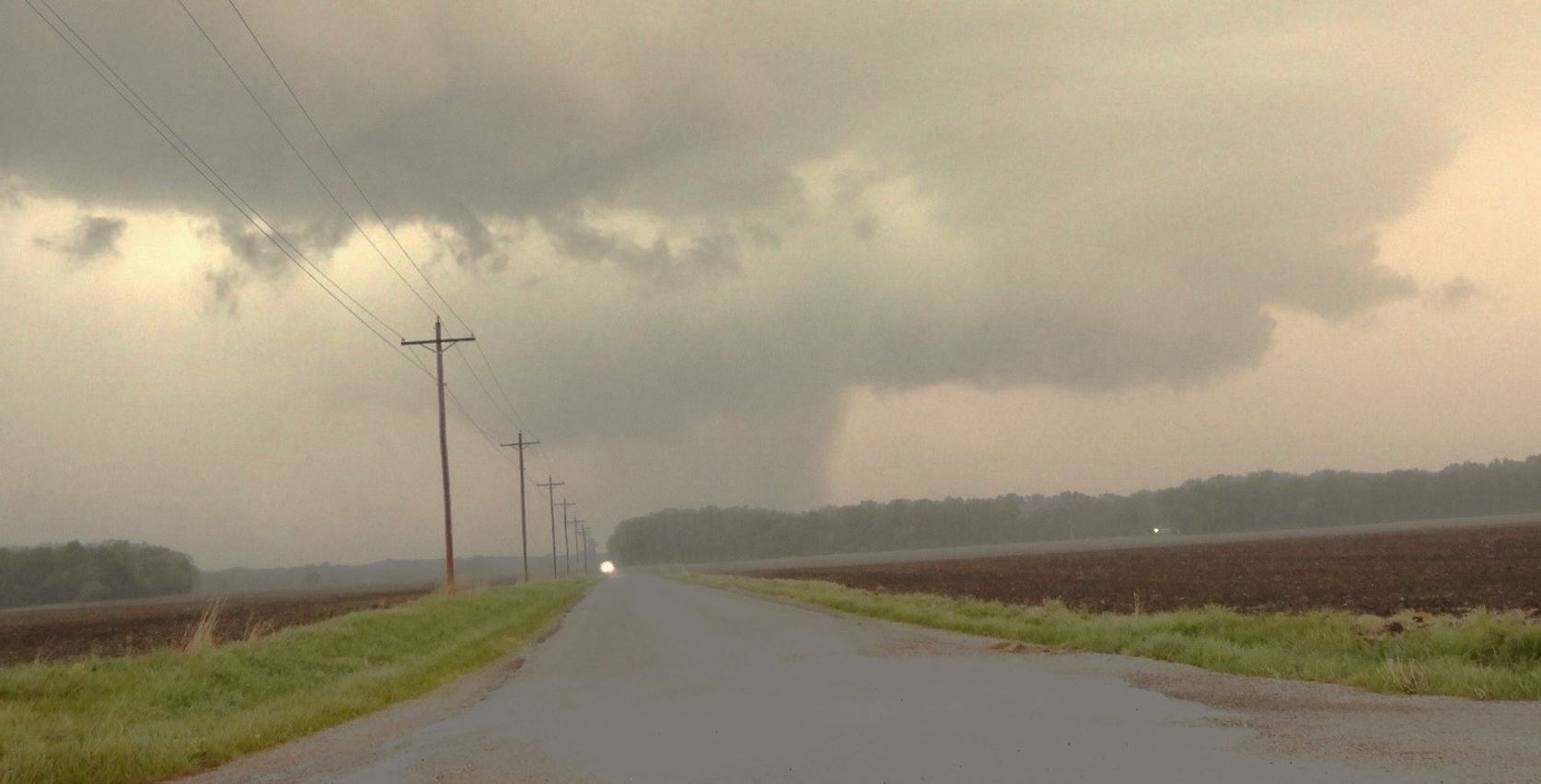
When Highway 4 reached I-55, we continued north on the interstate until we reached this storm coming into Macoupin County. We got off at the Ramsey, Illinois exit and worked our way west. Just to the east of Atwater, Illinois and watched the Tornado warned cell coming right at us. There was a lot of motion under the wall cloud along with several funnel clouds.
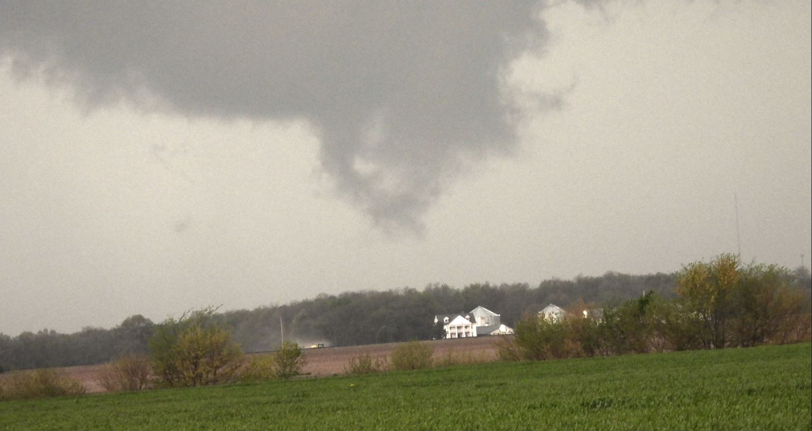
The storm continued to move toward us as we positioned ourselves a bit closer. It continued to exhibit funnel clouds, but could never condense into a full Tornado. It was unclear to us if the dust swirl underneath was from a car on a dusty road, farm machinery working a field, or from ground contact from the swirl from the clouds above.
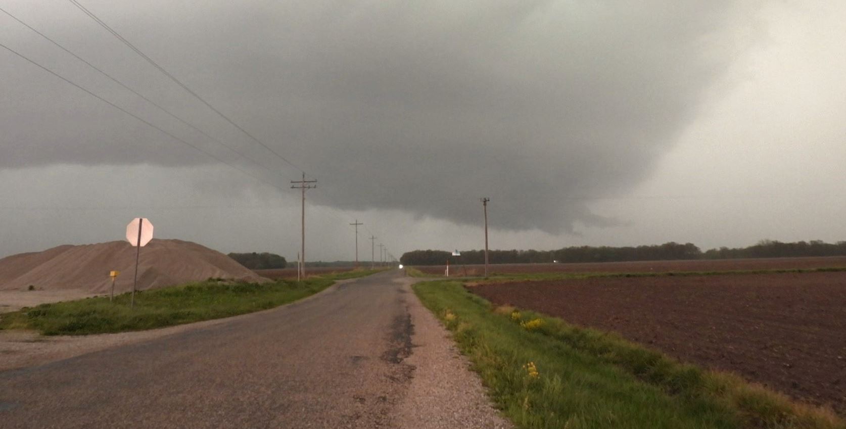
We decided to work our way further into the notch to watch from a closer angle.
As the rain closed in and forced us to retreat, we worked our way back east and grabbed Highway 27 that moved southeast. That allowed us to stay out in front of the line that now had multiple Tornado warnings.
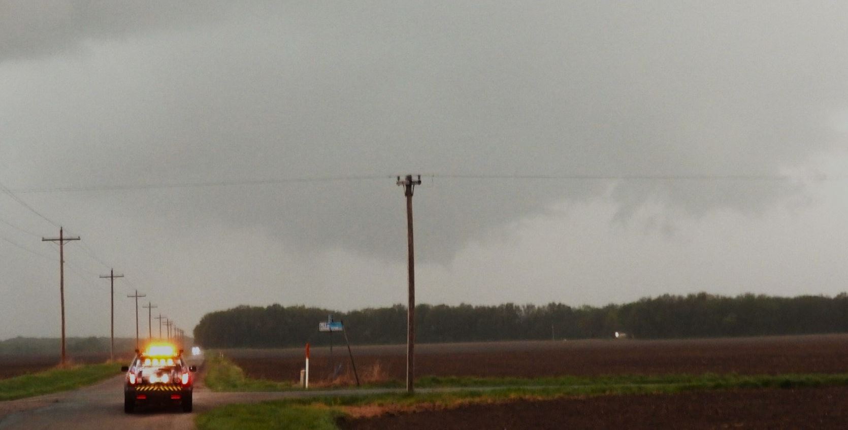
We moved down in front of the line that had a string of tornado warnings, but could never get another view of the next circulation in the line as it became hidden the rain. Eventually, the line passed over us putting an end to our tornado opportunities.
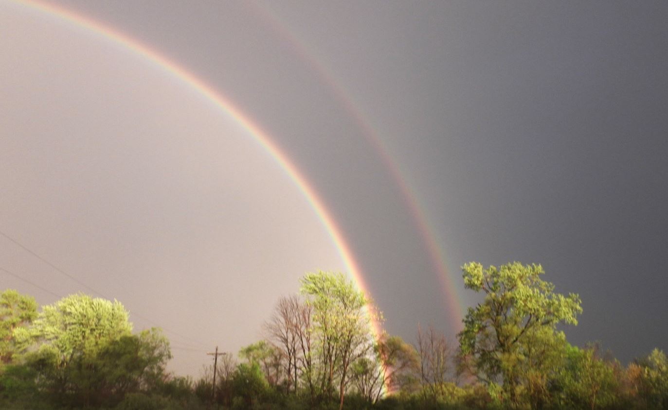
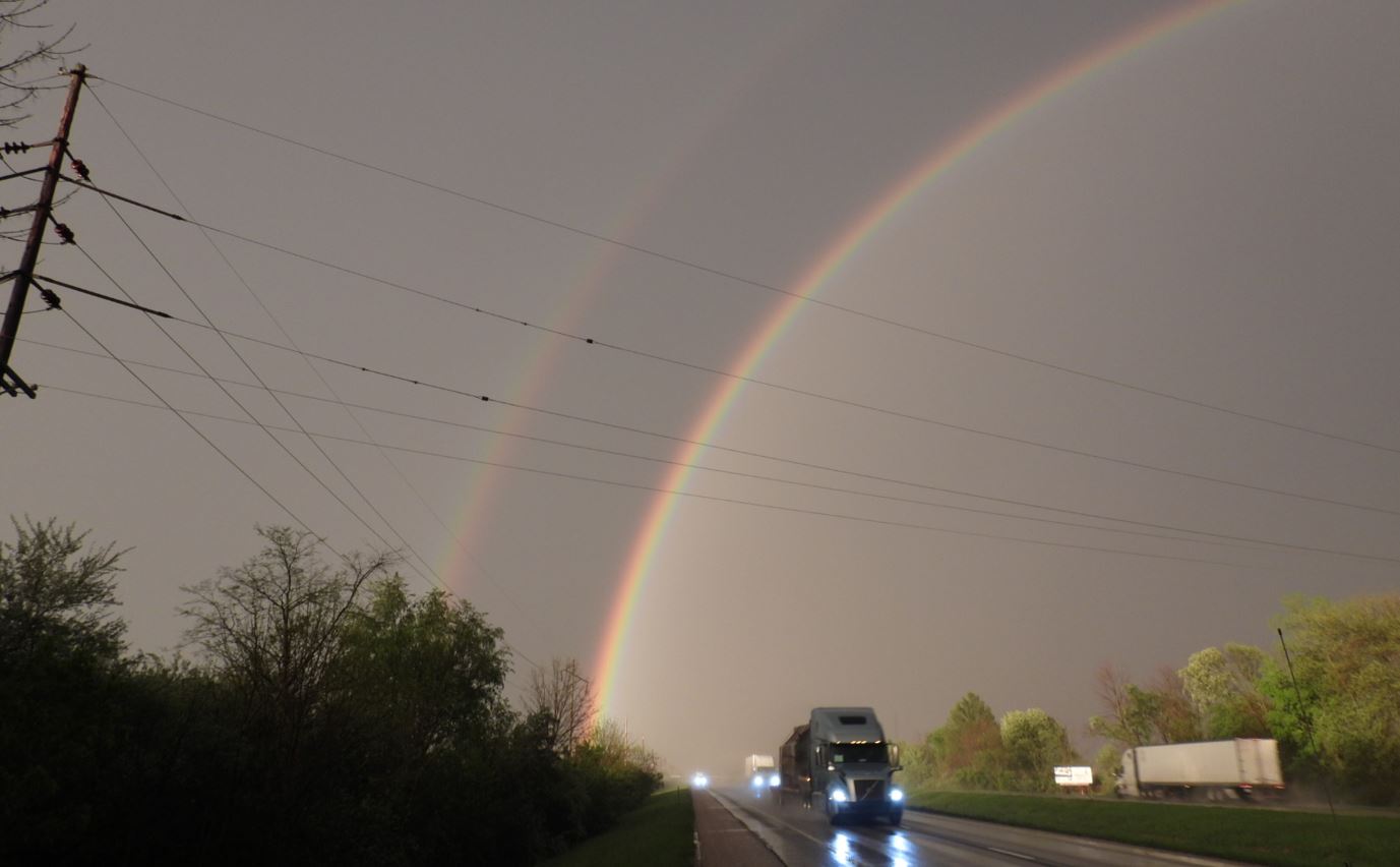
As we reached Interstate 70 and drove west on our return trip home, I happened to look in the rear view mirror and to my delight, noticed an extremely bright, double rainbow. We found a safe spot to pull off the Interstate and grabbed a couple photos.
Overall, this day over achieved for tornado potential. Had we made the choice originally to take Interstate 70 rather than our choice of Interstate 64, I believe it may have increased our chances of seeing a fully condensed tornado. As it was, we seemed to arrive after the storm had maximized.

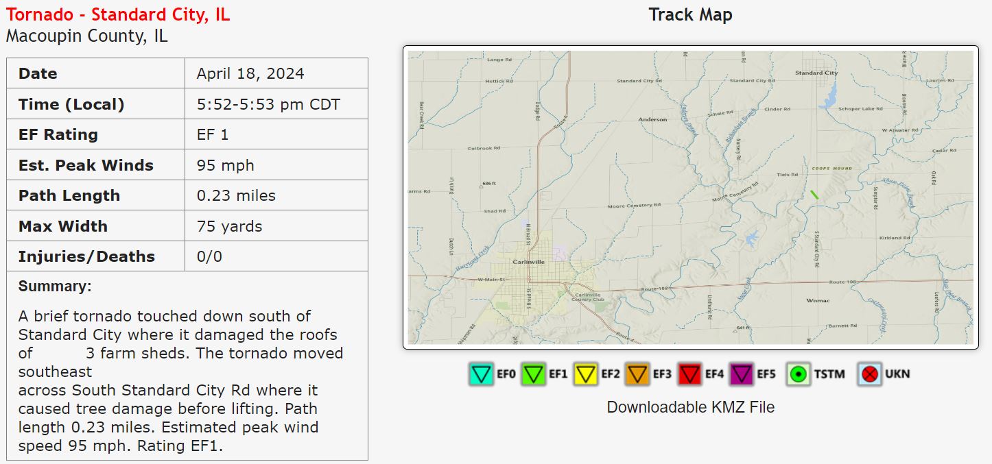
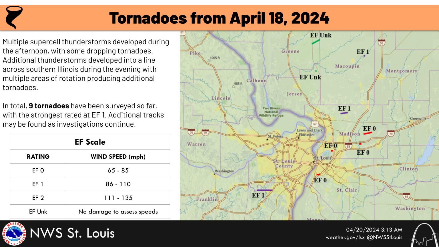
National Weather Service Surveys
 |
 |
Our Trip
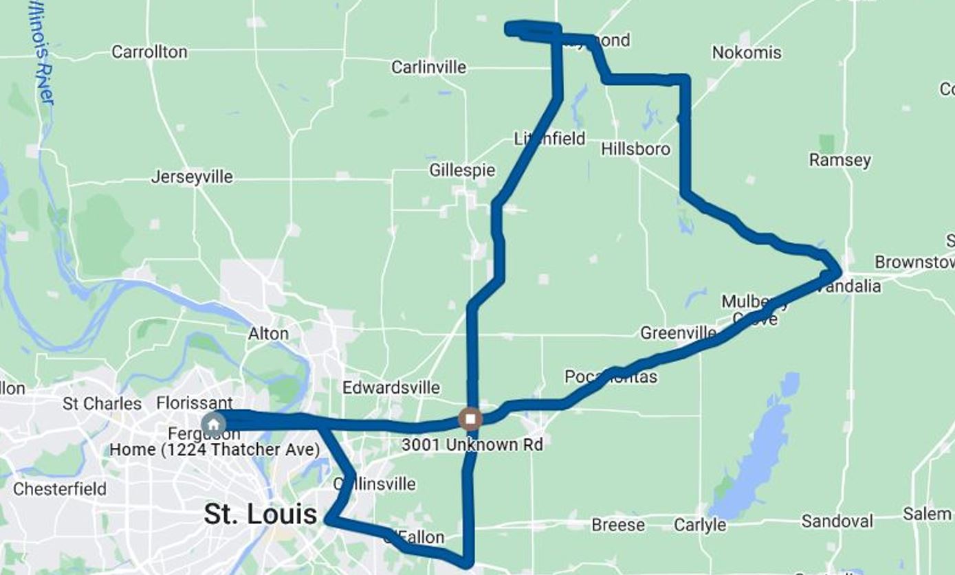 |
4.5 Hours - 237 Miles