Took a
trip out west for a potential multiple day event.
My son Ryan and I drove out the night before to spend
the night at our chase partner, Brian Stertz's
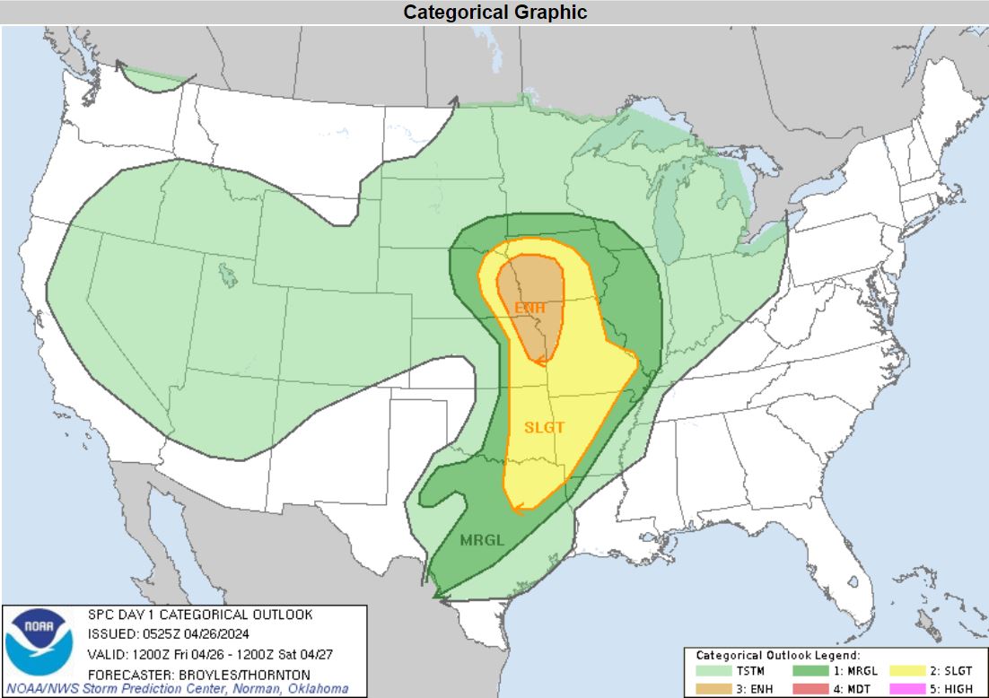
place. Getting up in the morning, the Storm
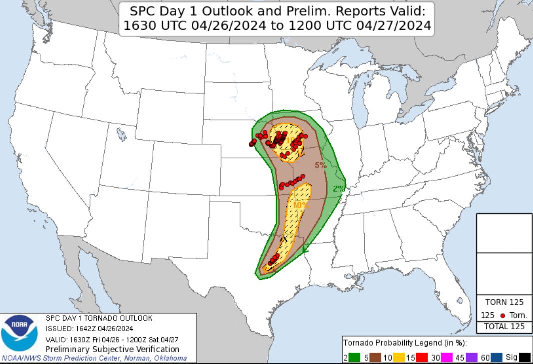
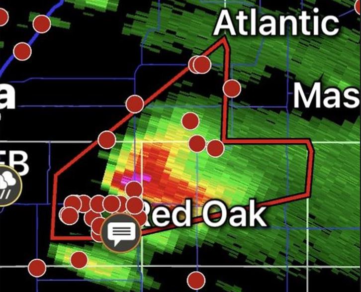
Prediction Center had an Enhanced Risk with a 10%
hatched area for Tornadoes.
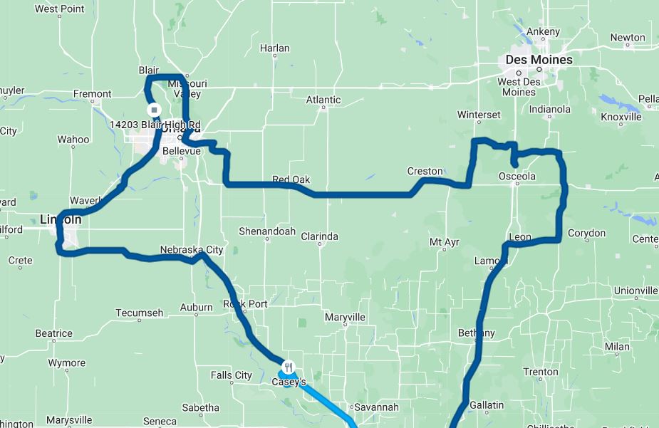
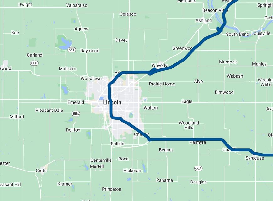
We
left mid-morning to head to our target in Nebraska City,
Nebraska. On the way up, we made a pass through
one of our favorite places, the Squaw Creek (Loess
Bluffs) National Wildlife Refuge for some wildlife
photography. After the drive through, the weather
data suggested we adjust our target a bit further west
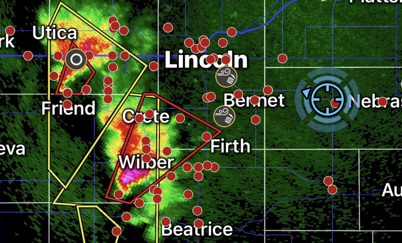
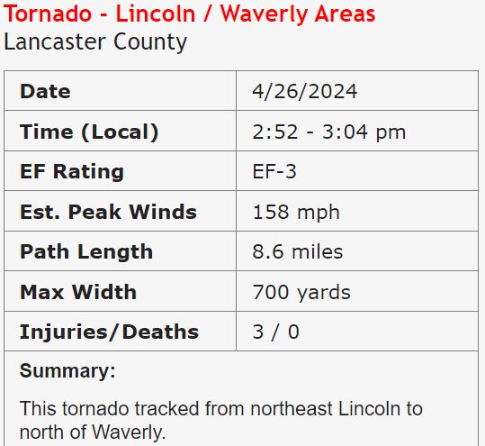
to Lincoln, Nebraska. Storms were increasing in
intensity as we arrived in Lincoln and became tornado
warned as this storm moved off of the dryline.
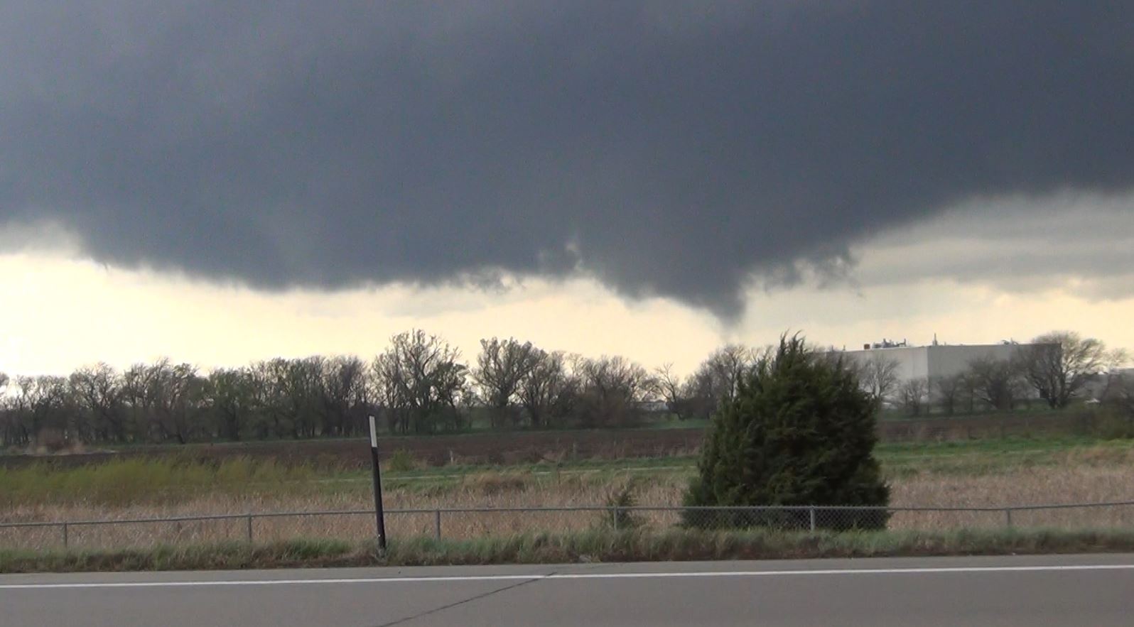
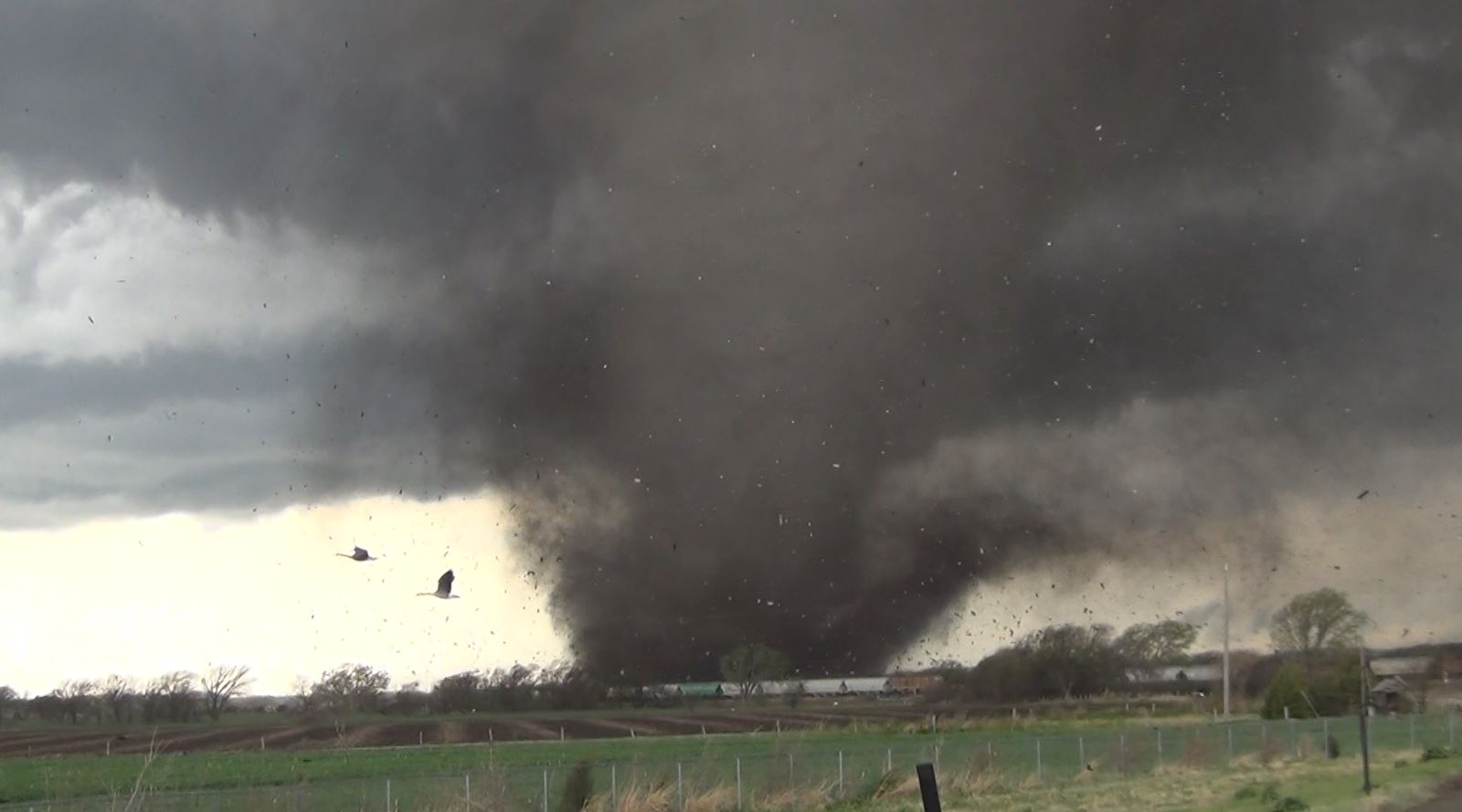
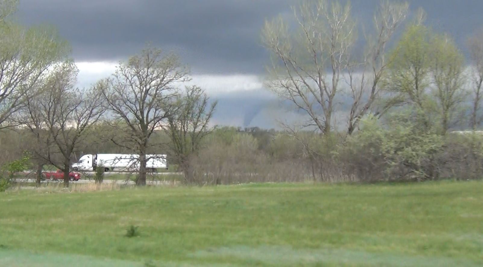
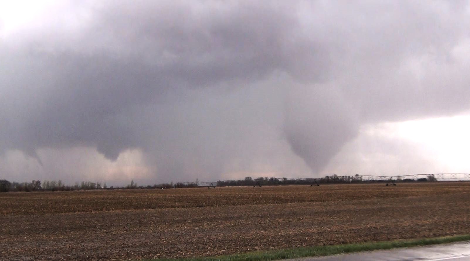
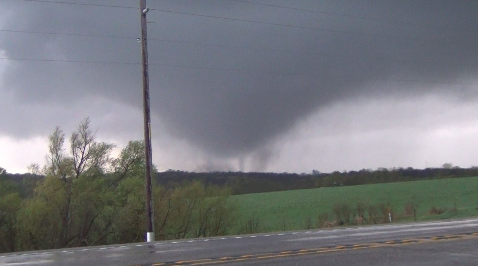
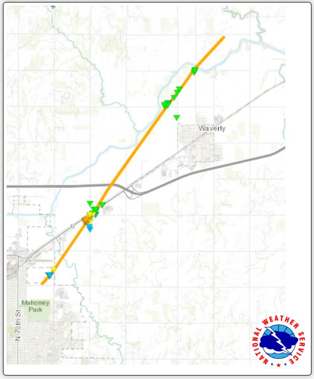
We latched onto the storm
as it moved through Lincoln. On the northeast side
of Lincoln, we found a spot on the exit ramp on Highway
6 off of Interstate 80 to watch the approaching storm
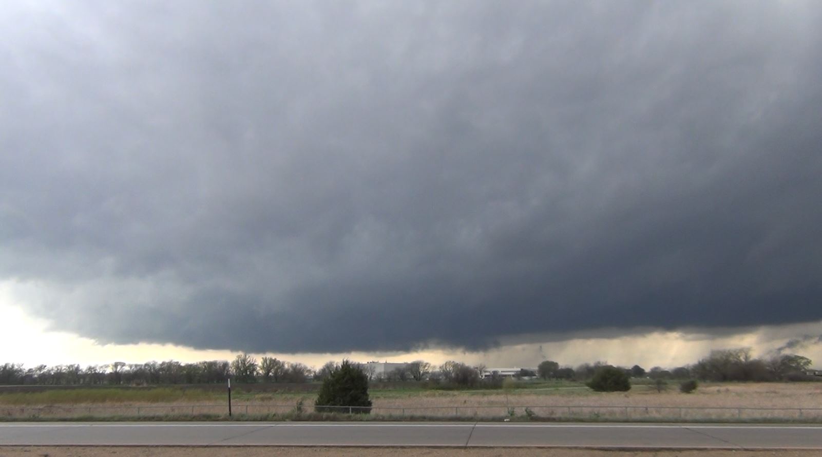
and its rotating wall cloud. As it approached, it
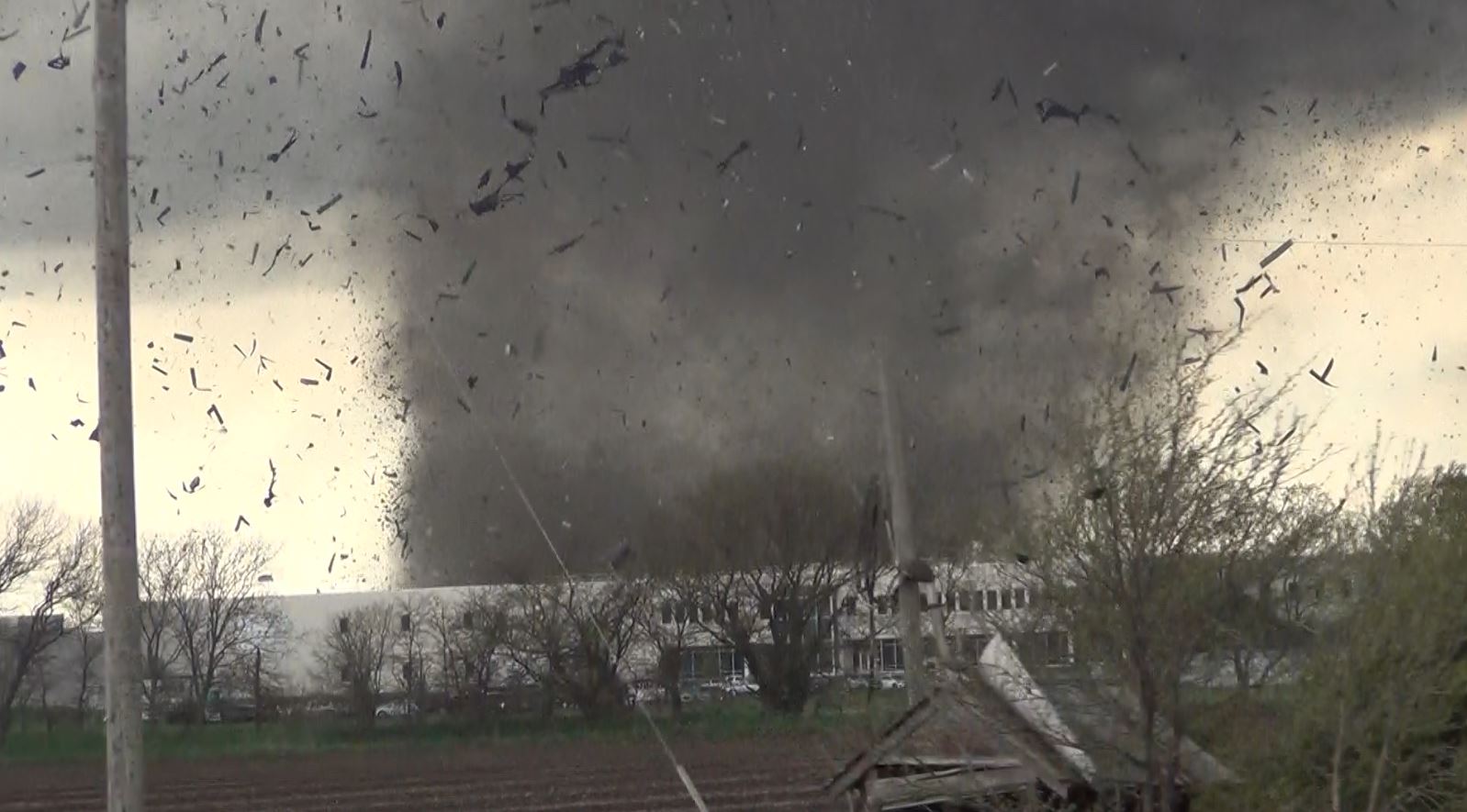
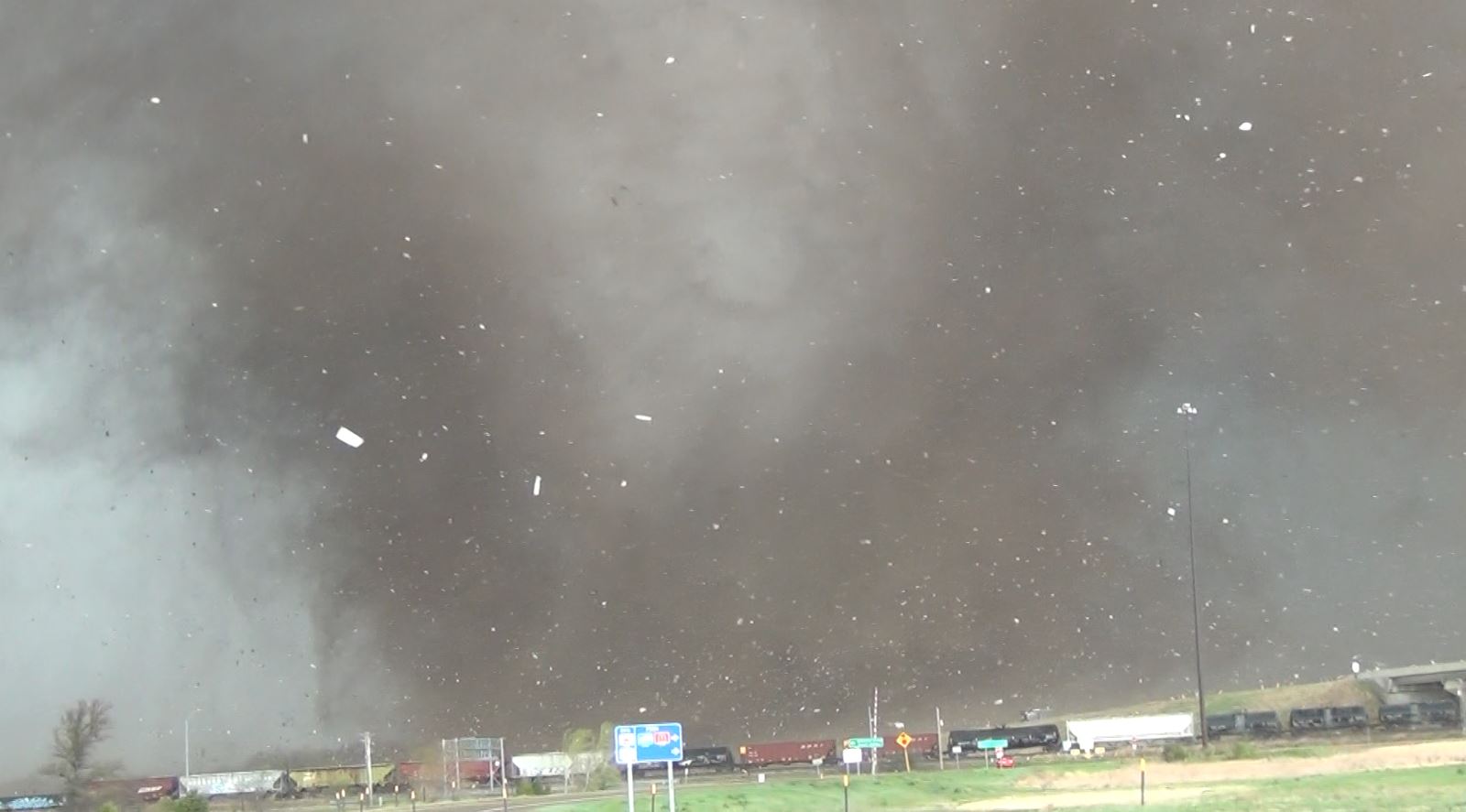
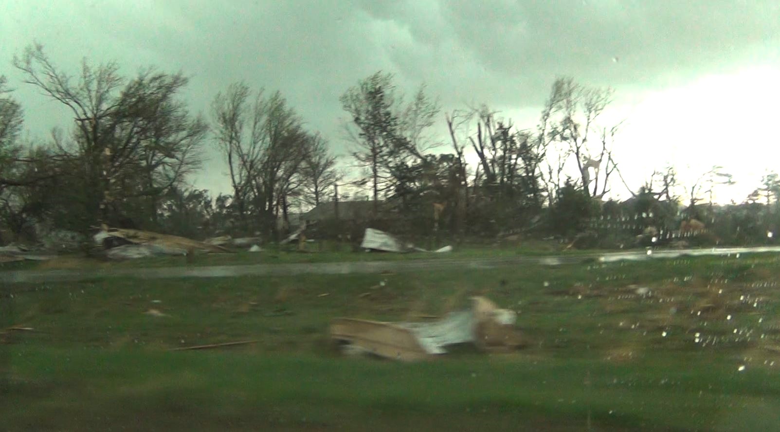
dropped a tornado.
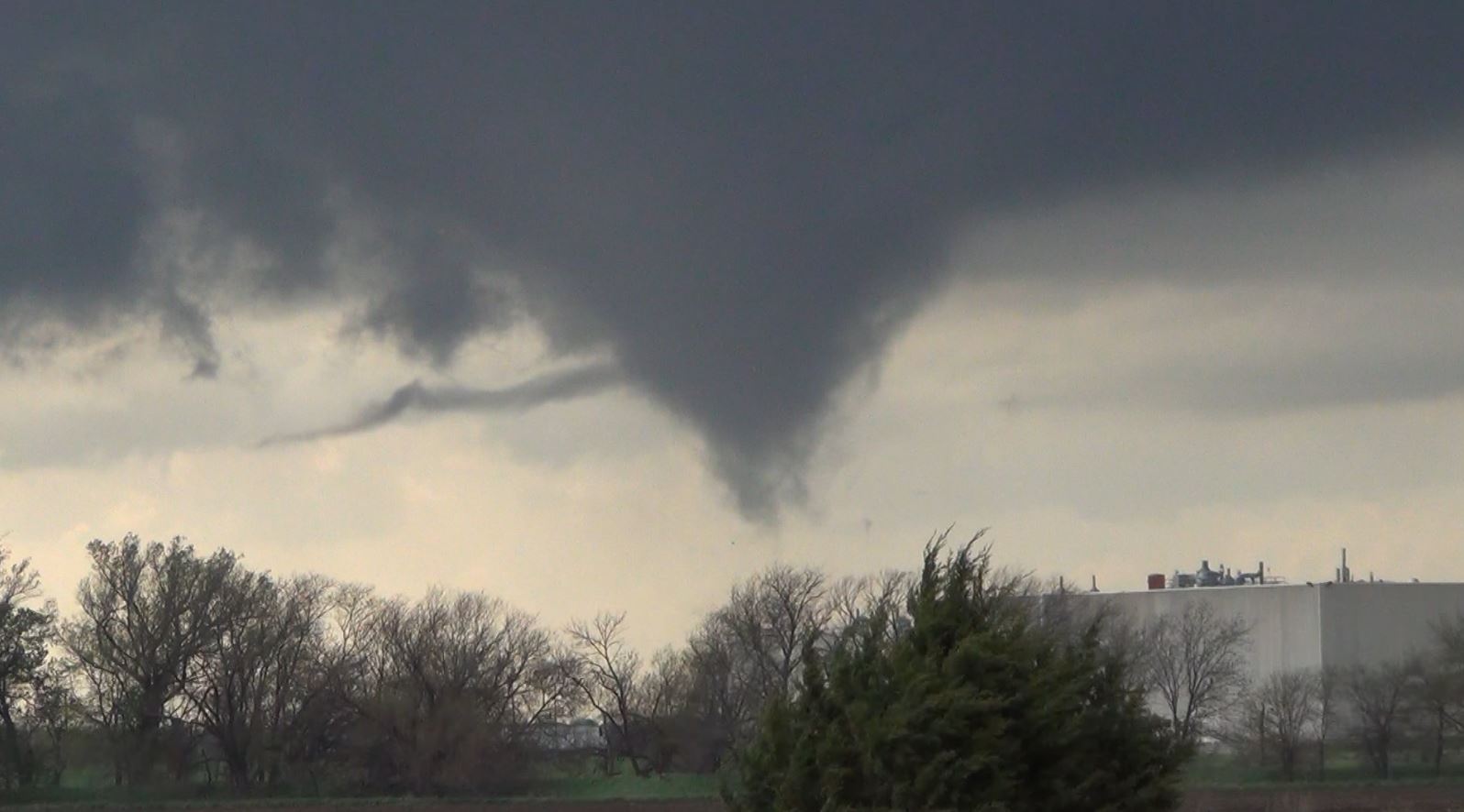
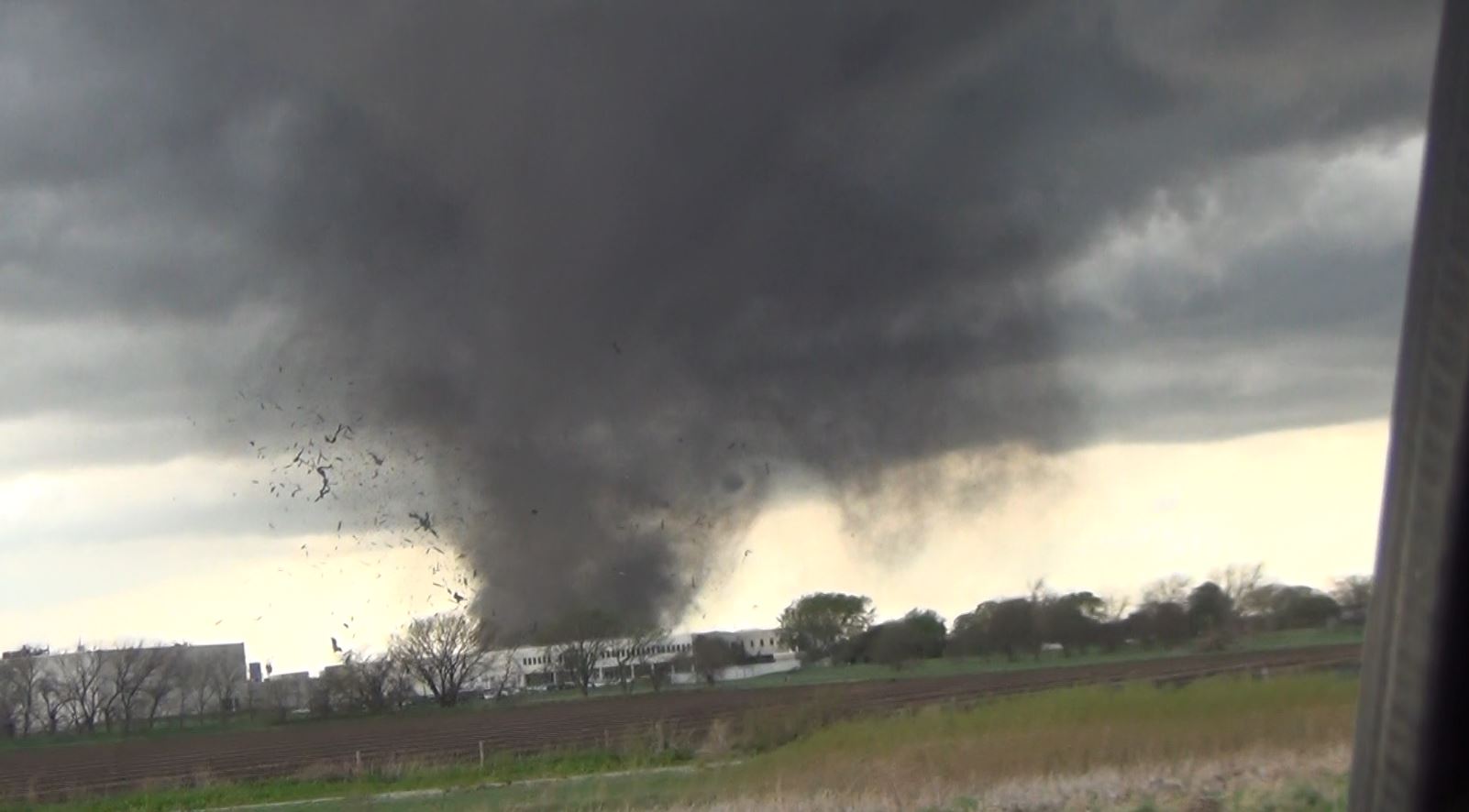
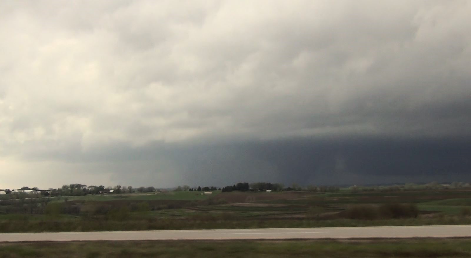
It
quickly went from touching down to a damaging tornado
as it passed over a factory throwing the debris around
its rotation.
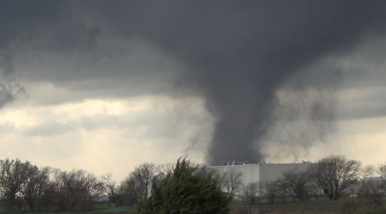
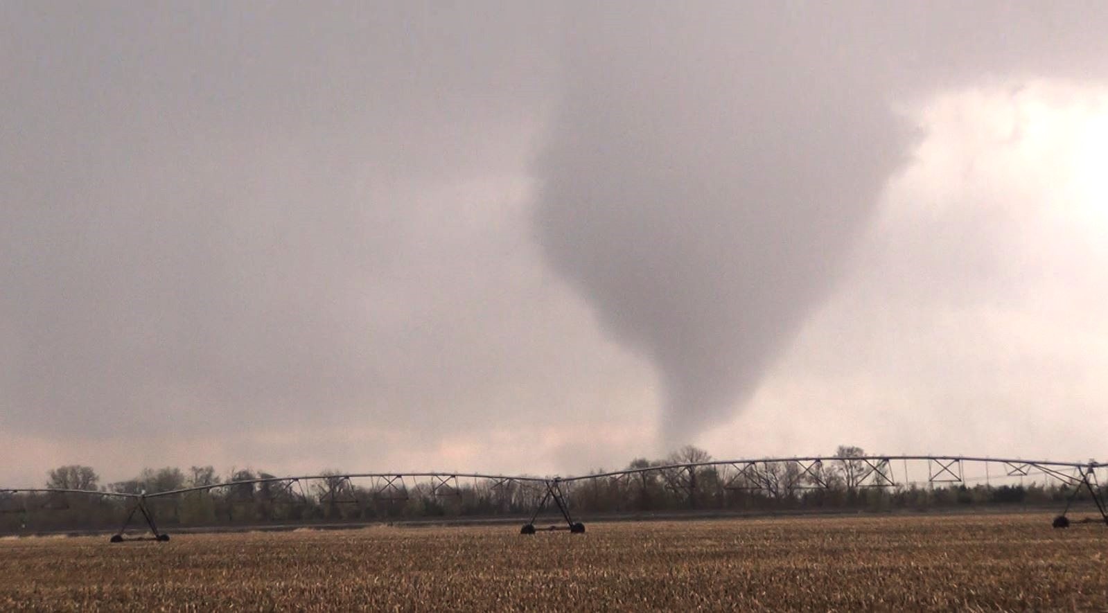
As the
tornado moved past just to our west, it began throwing
its debris on top of us forcing us to move.
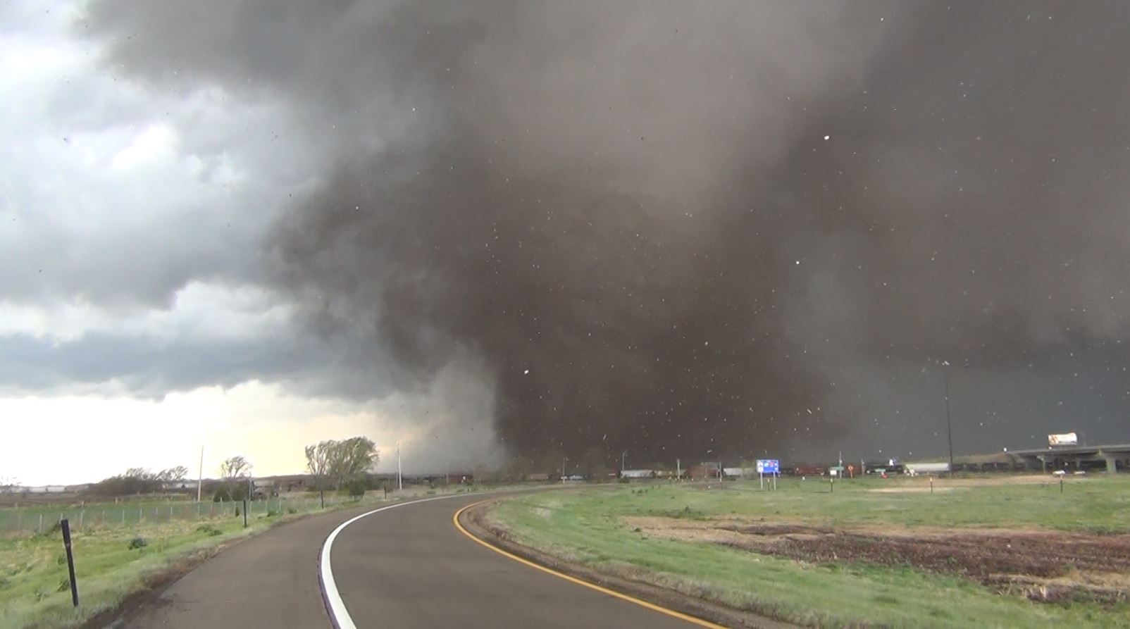
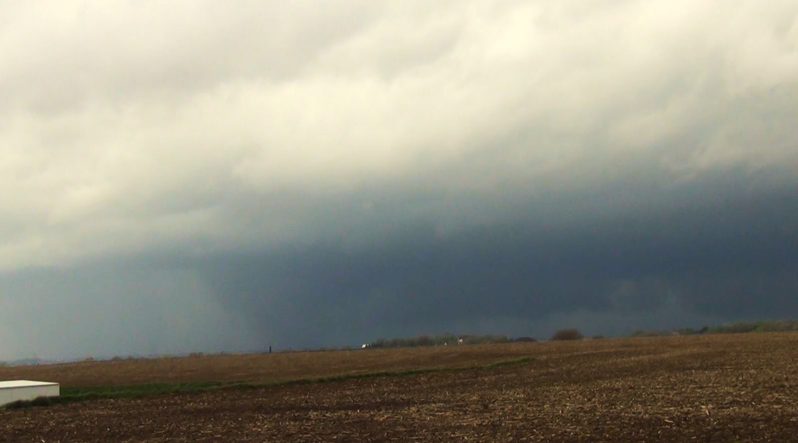
We
traveled northeastward on Interstate 80 with the
tornado moving parallel with us on the highway.
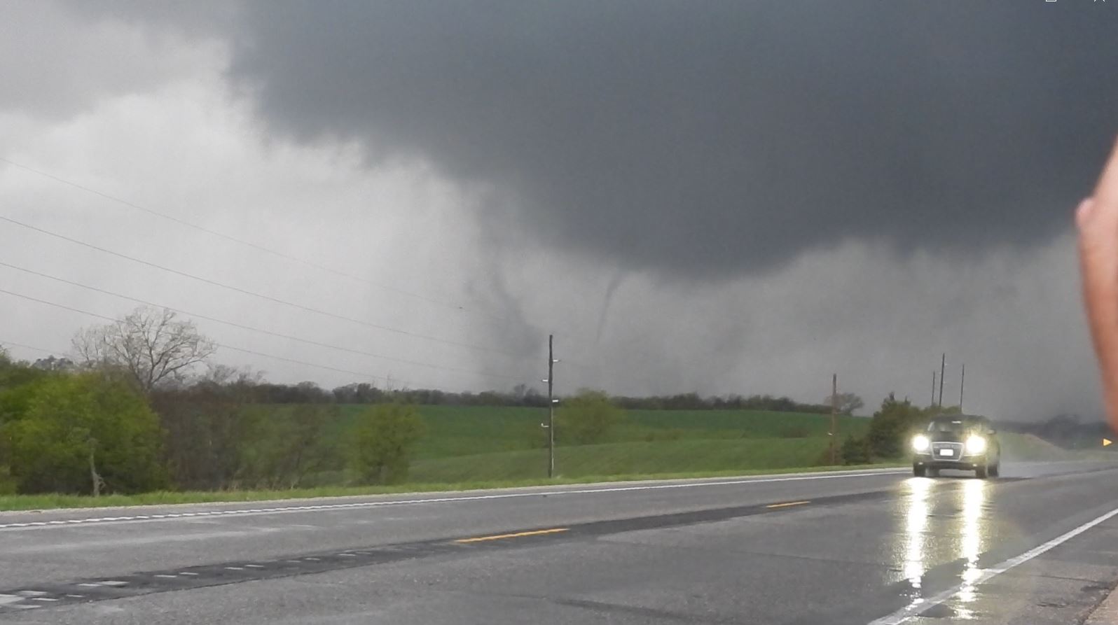
The original tornado roped out and did a hand off to a
new tornado between Waverly and Ashland, Nebraska.
Then another handoff for a third tornado.
The
storm did another hand off for a fourth tornado with
another big tube as we continued on Interstate 80 with
the tornado close behind us. Eventually, that
tornado met its demise as we continued northeastward.wkR
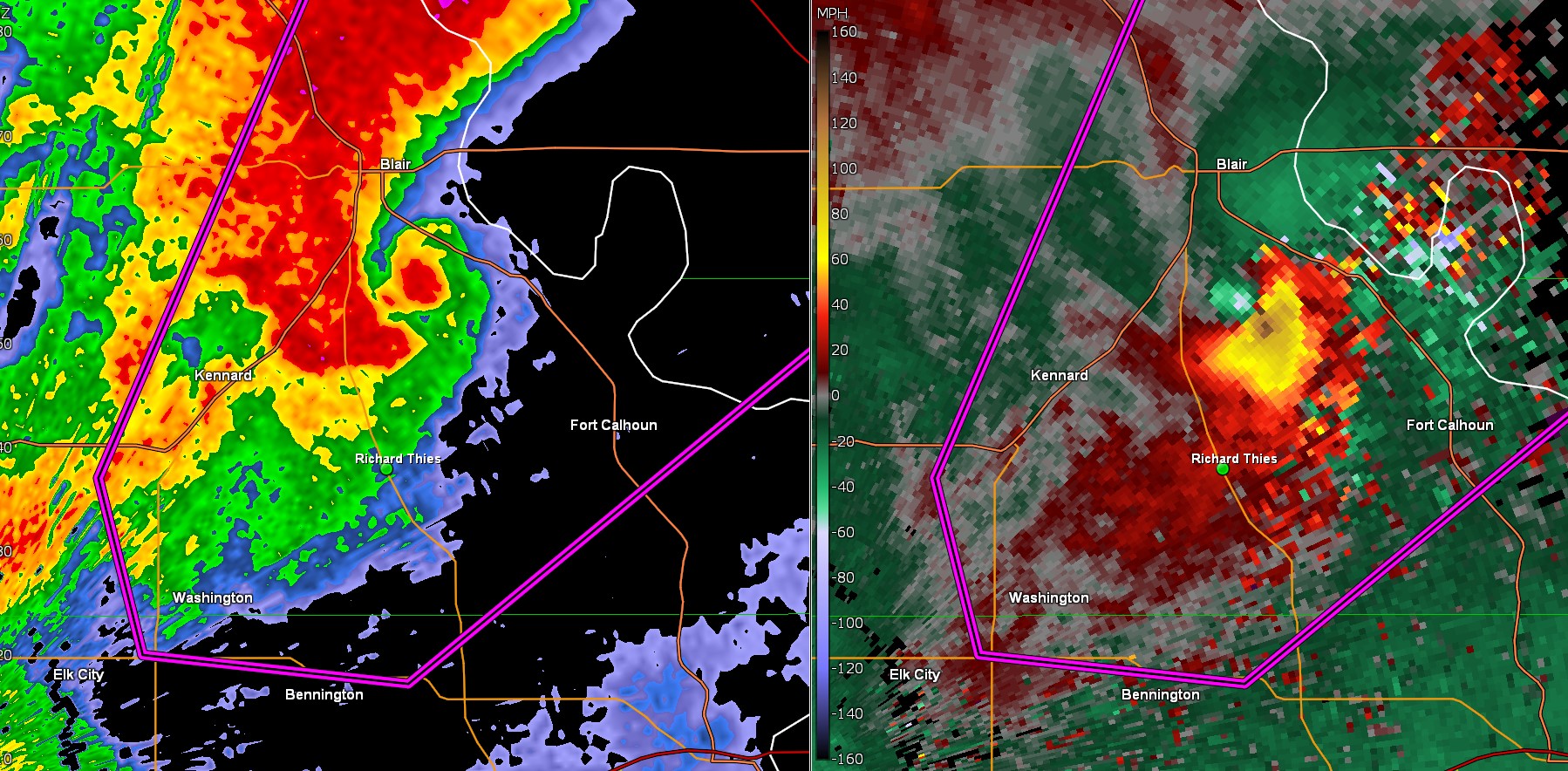
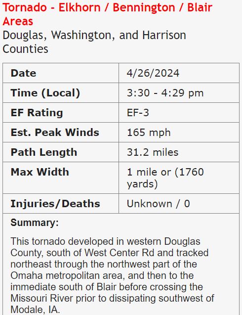
National Weather Service Survey
|
|
|
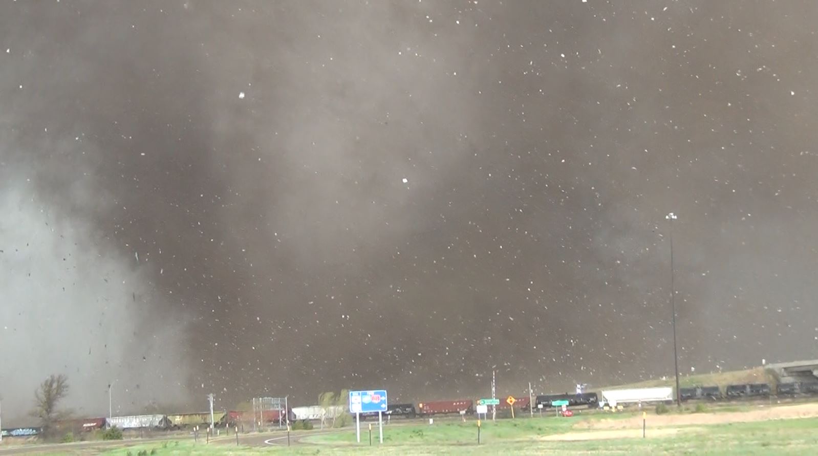
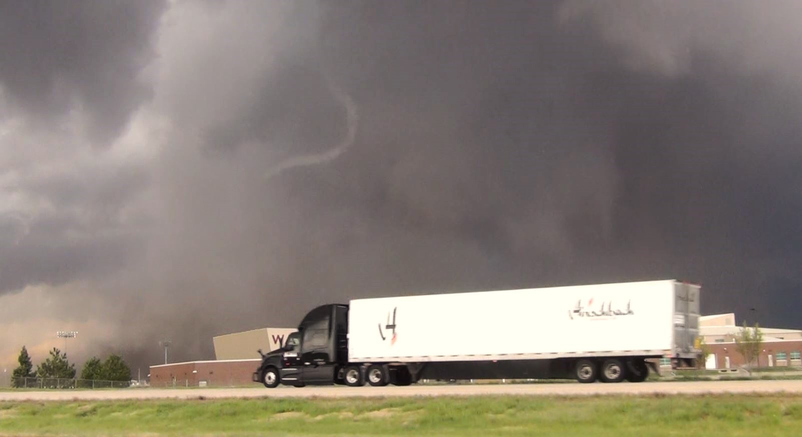
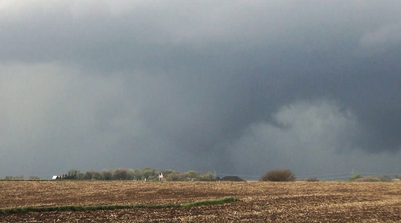
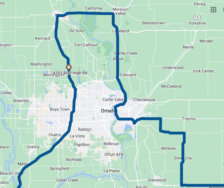
We continued to drive
northeast on Interstate 80 and we soon were observing
a new tornado in front of us. We took the
Interstate 680 loop on the west side of Omaha,
Nebraska to Highway 133 north.
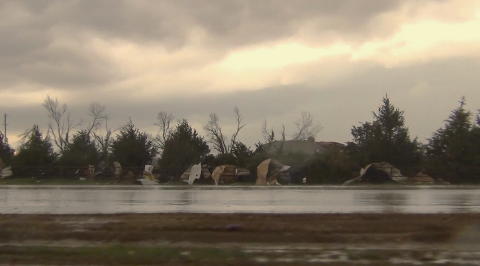
We
allowed the tornado to pass in front of us on Highway
133. We drove through the damage path after the
tornado crossed and saw that the tornado had hit two
properties scattering debris across the road.
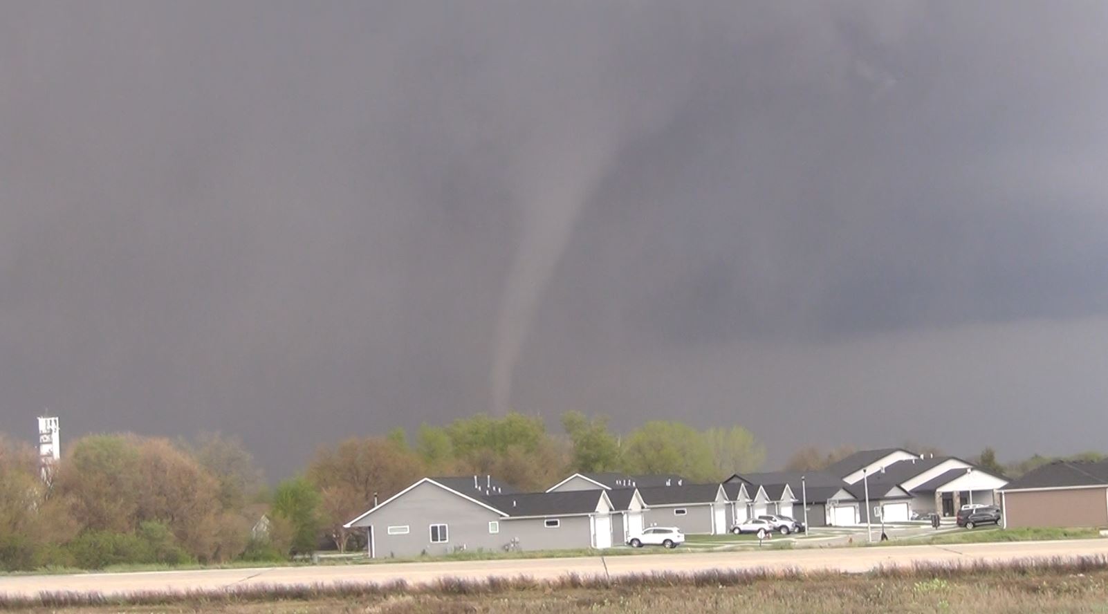
When we reached Blair,
Nebraska, we then grabbed Highway 91 east that took us
over the Missouri River into Iowa. As we drove
through the River Valley, we once again came upon the
tornado in the haze to the north of the road. At one
point, there were 2 tornadoes on the ground with possibly
3 separate areas of rotation. It is even probable
that the original circulation had been handed off to a new
tornado.
National Weather Service
Survey
|
|
|
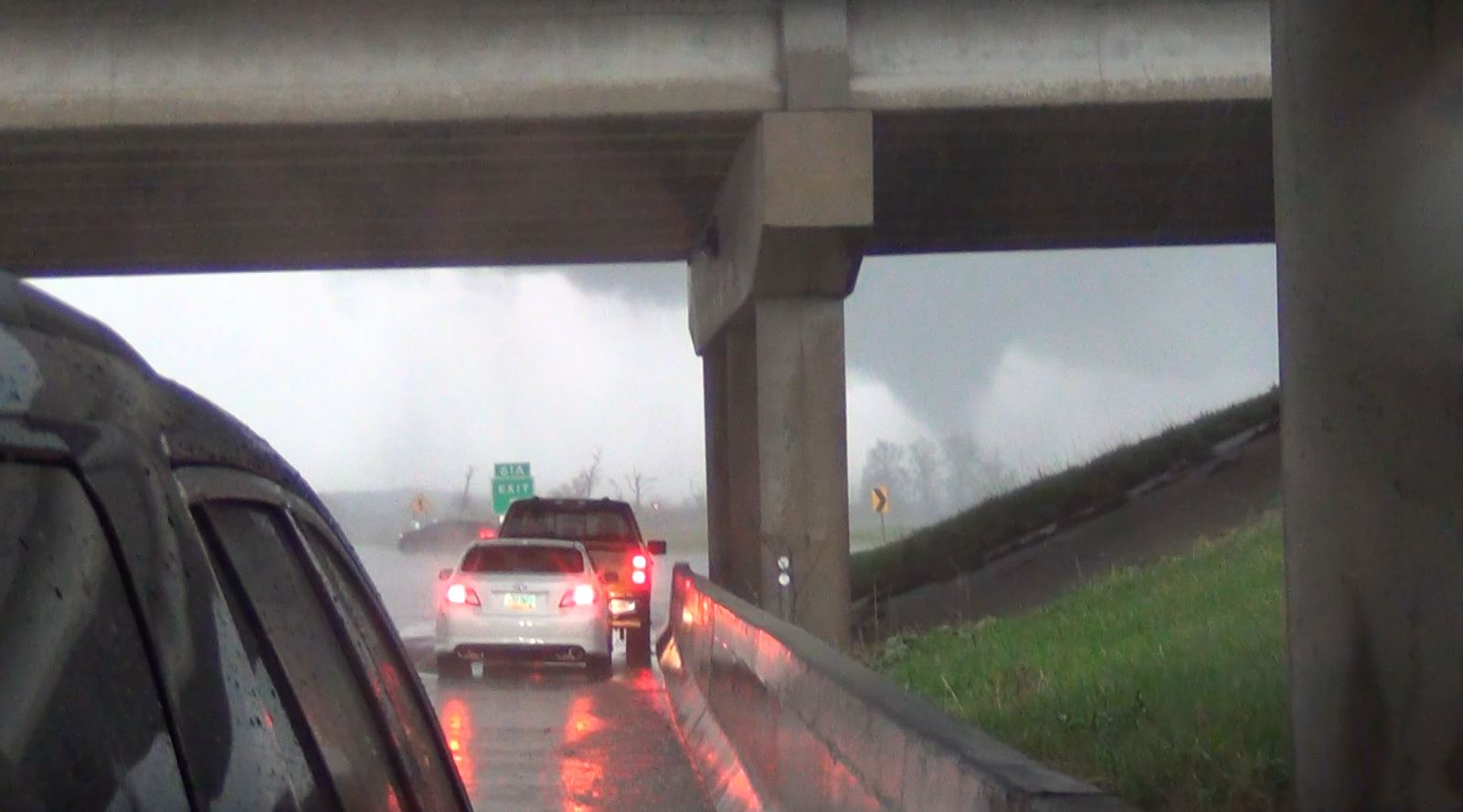
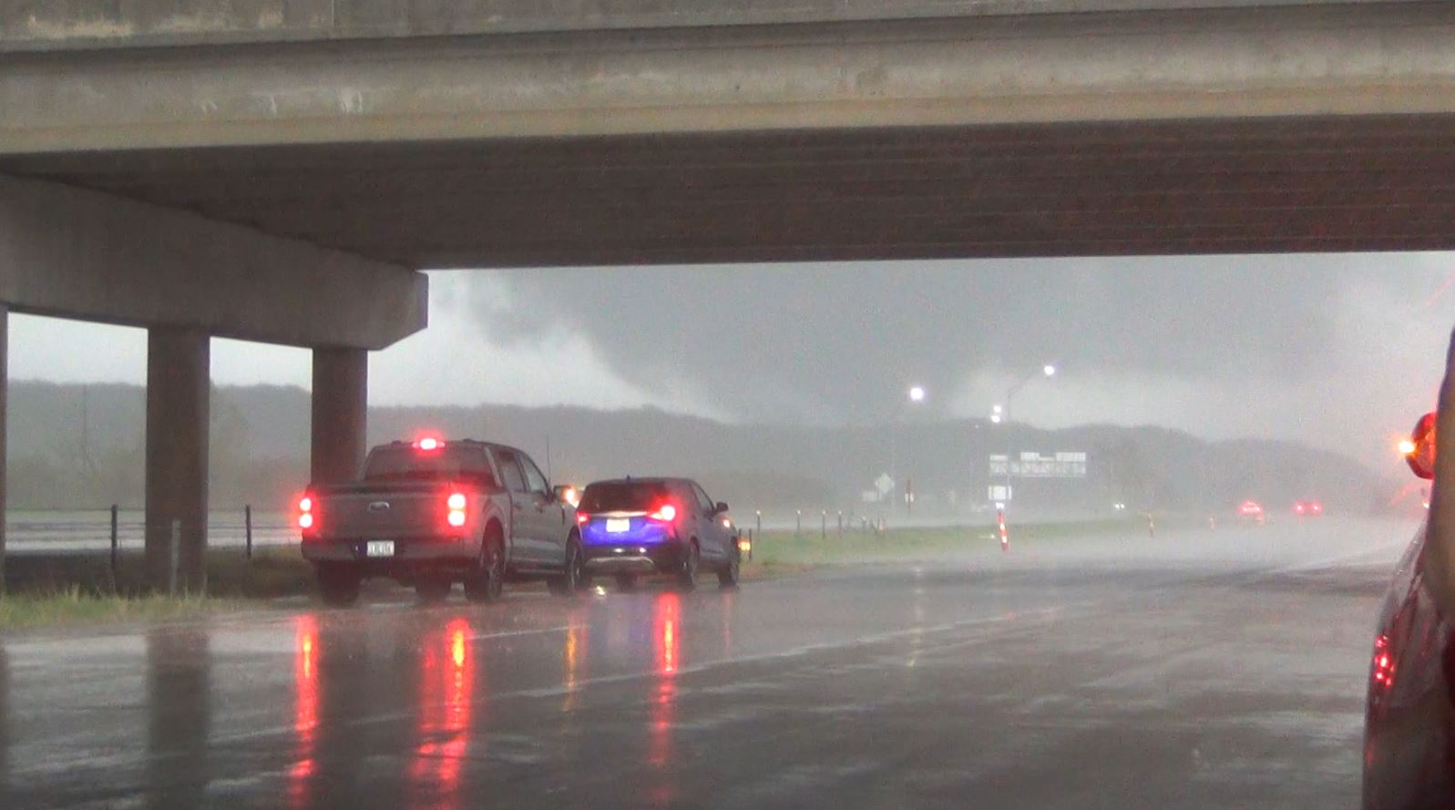
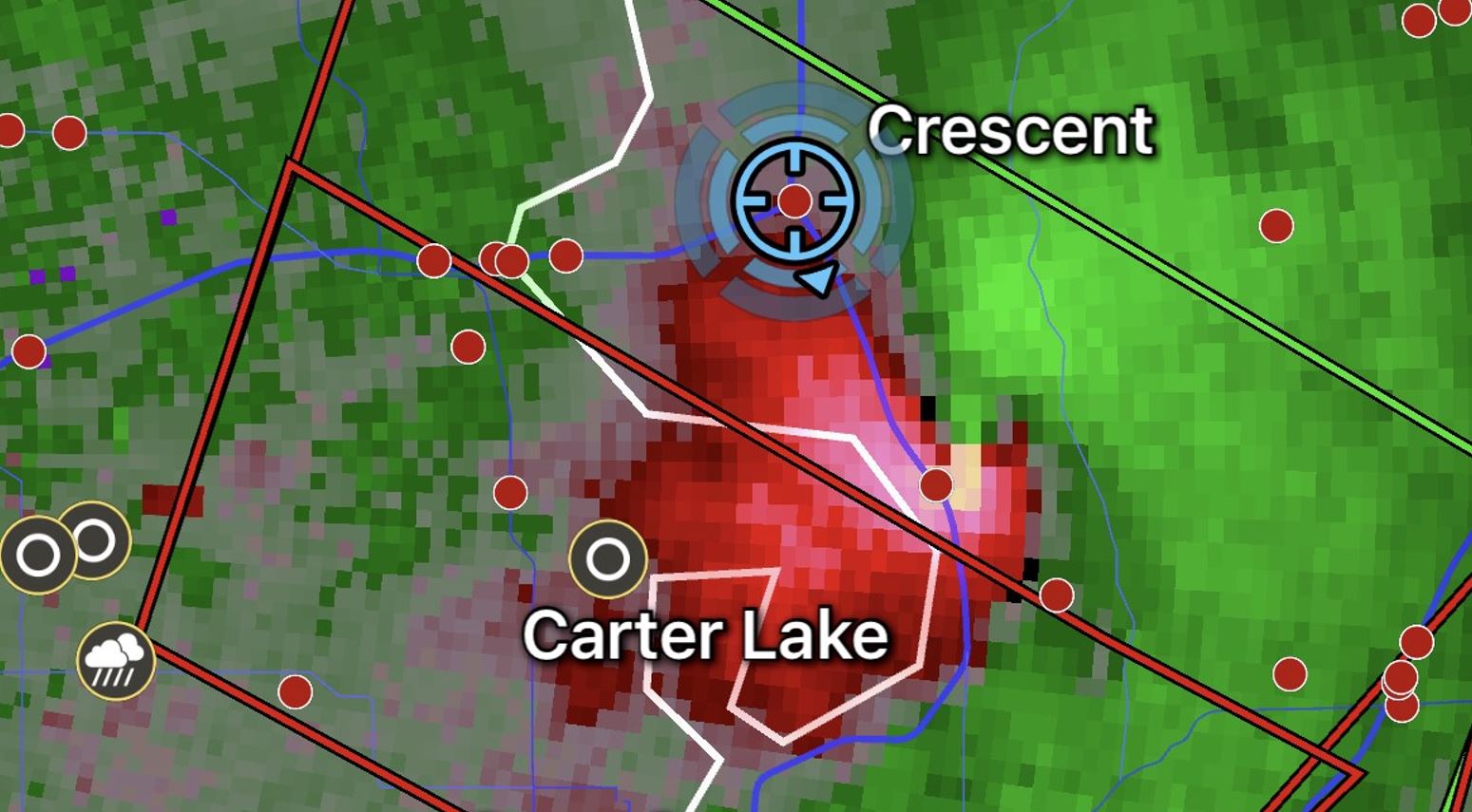
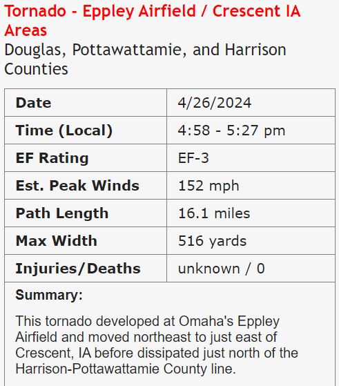
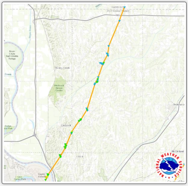
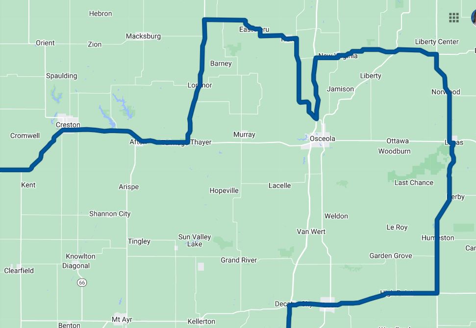
When
we reached Highway 29, we headed south to intercept
some more development to the south. As we
approached the Interstate 680 intersection near
Crescent, Iowa, it was becoming obvious that the
hail core with large hail was going to beat us
coming over the highway. With little choices
in the way of cover, we made the decision since that
Interstate overpass had parking room on the
shoulder, we'd use it as our protection to let the
hail core pass before proceeding. As we sat
out the hail barrage, we were extremely surprised to
see a tornado crossing the Highway out of the front
windshield. Unfortunately, the view was not
optimal and we were squeezed in by other vehicles
that had also taken shelter, but we watched the
tornado cross the highway and continue to the
northeast.
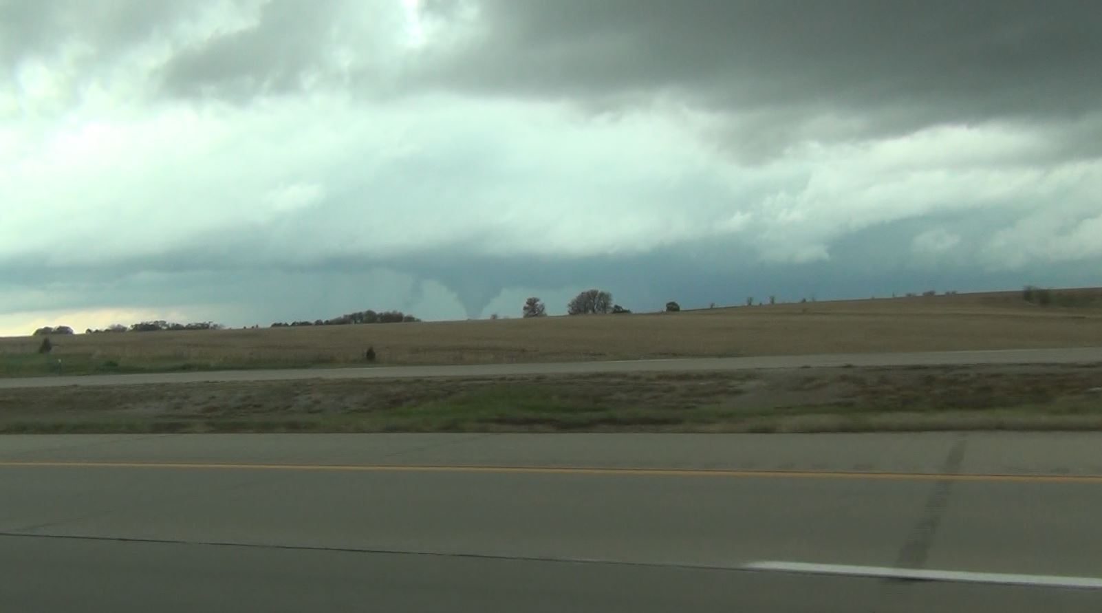
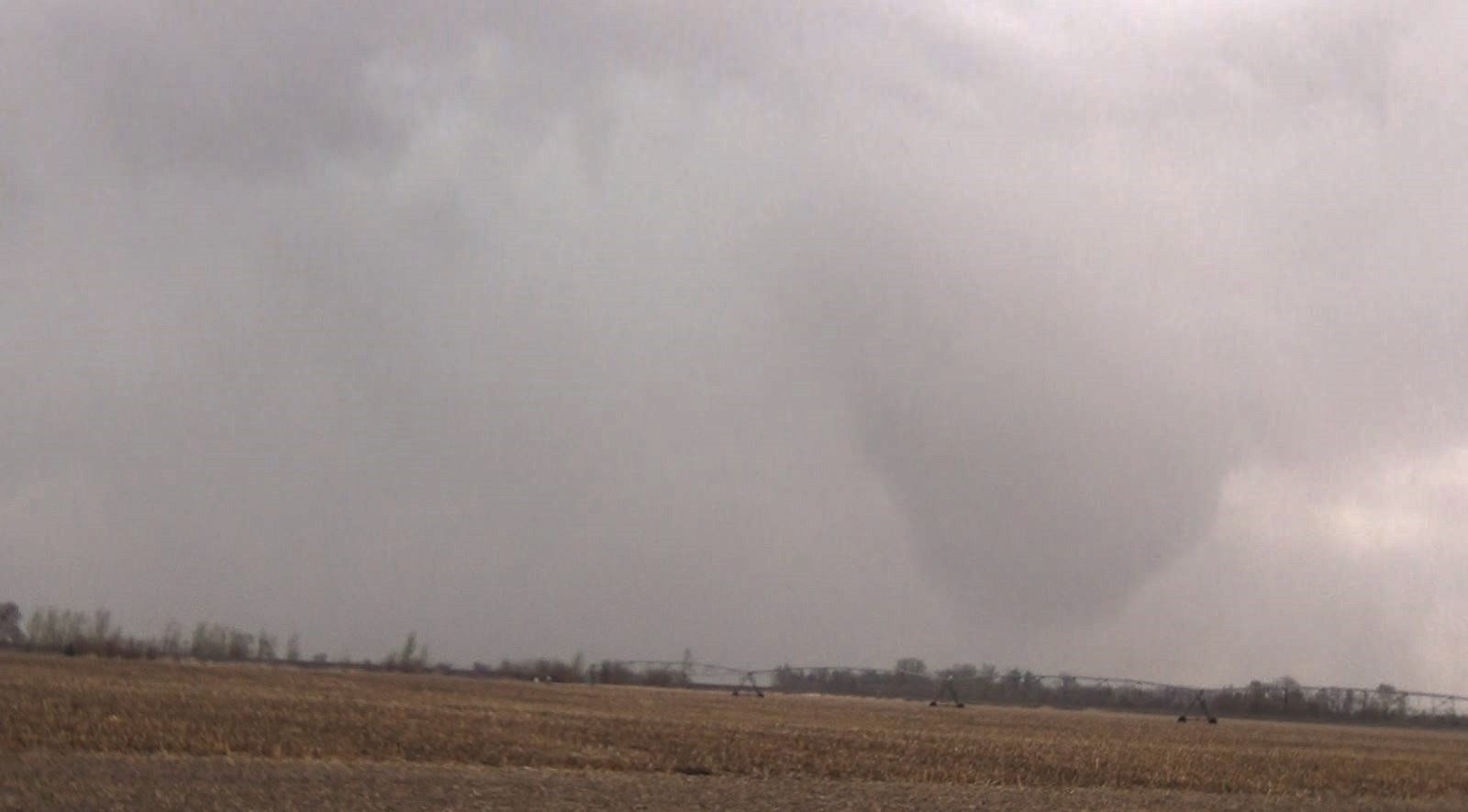
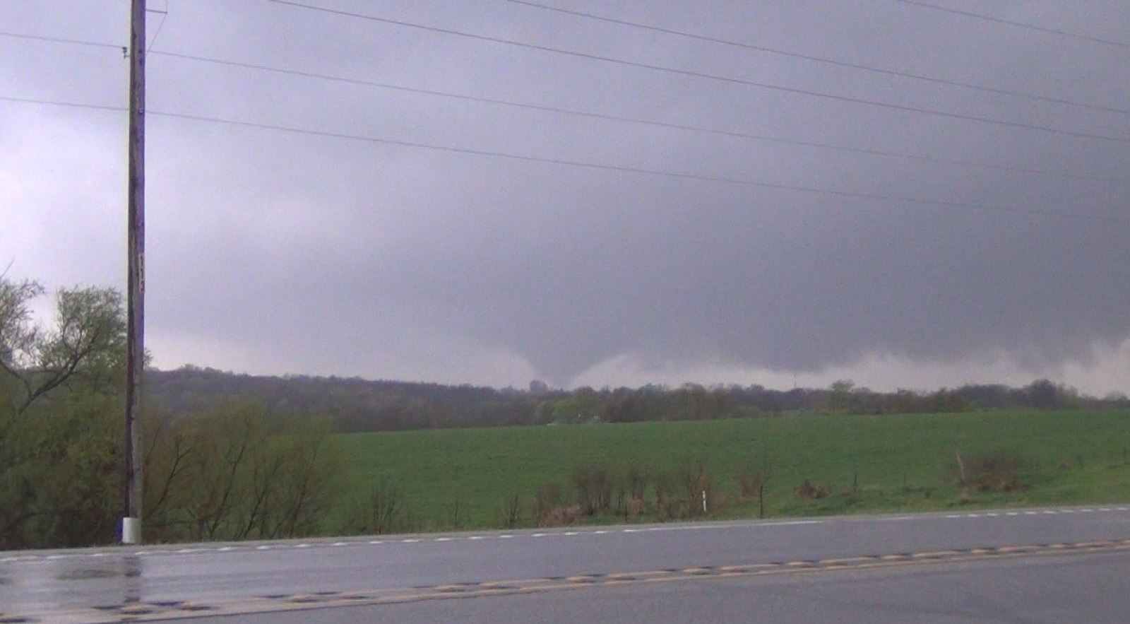
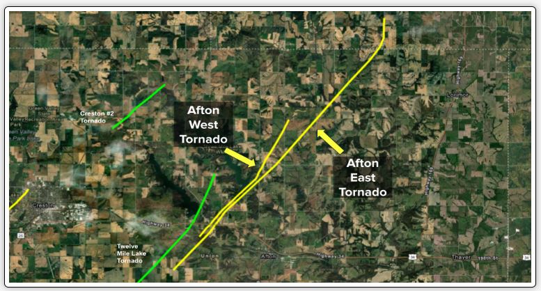
We
worked our way east on Highway 34 and just west of
Afton, Iowa, another tornado was working its way
toward us. As it came into view and moved
closer, it was a multi vortex tornado and we watched
it walk (dead man walking) across the road in front of
us.
National Weather Service Survey
|
|
|
 April 26, 2024