 May 06, 2024
May 06, 2024
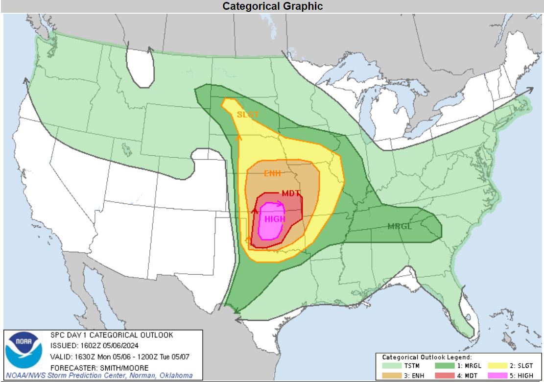
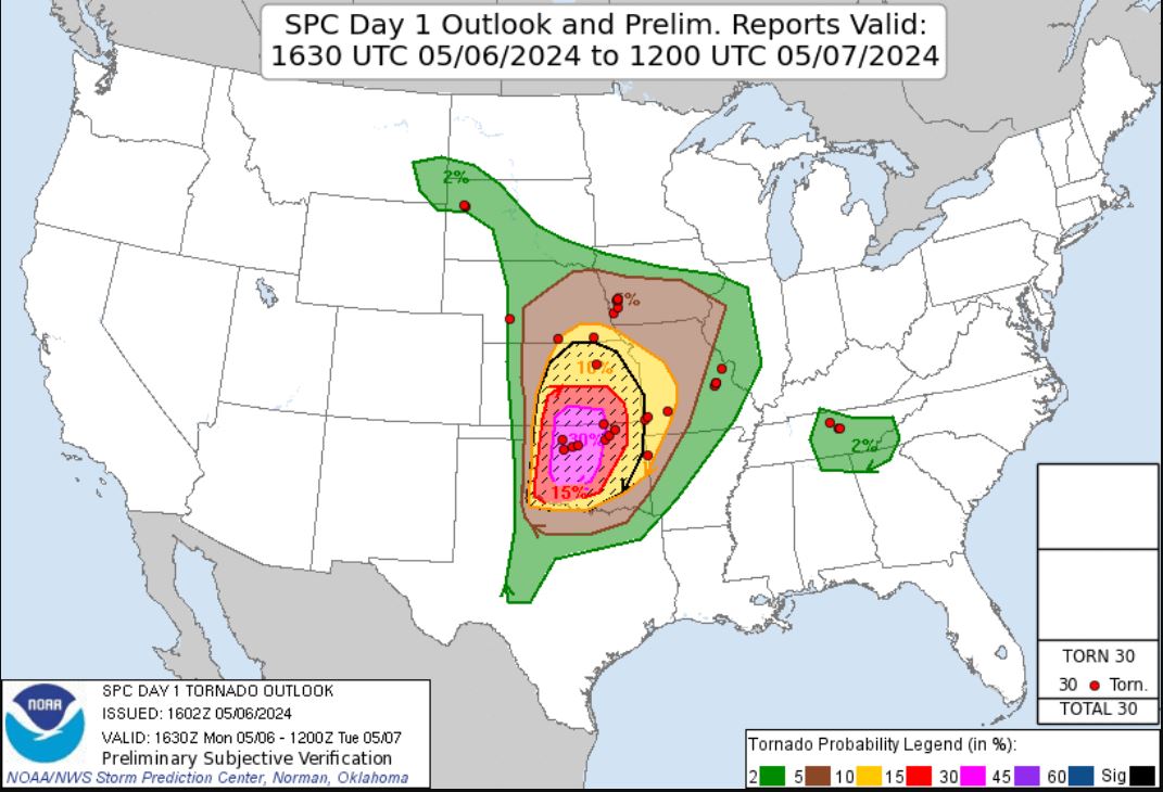
May 06, 2024 This was a highly advertised day that was forecasted to have high tornado potential. The Storm Prediction Center put out a High Risk for Severe Storms with a 30% hatched area for Tornadoes .
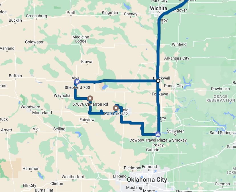
My son Ryan and I headed west and met up with Brian Stertz. Early in the morning, we headed for Oklahoma. We had lunch in Blackwell, Oklahoma and then moved west to our target Alva, Oklahoma where the best storm parameters were setting up.
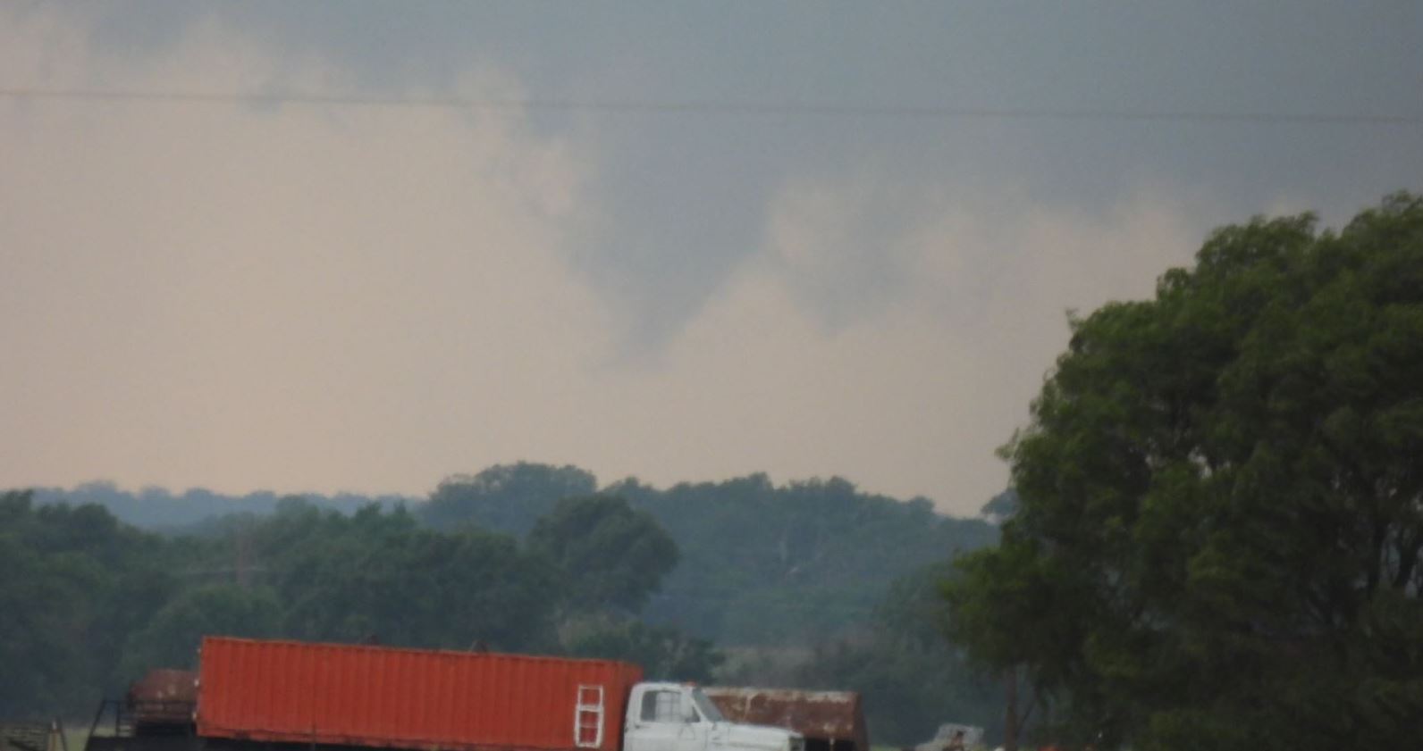
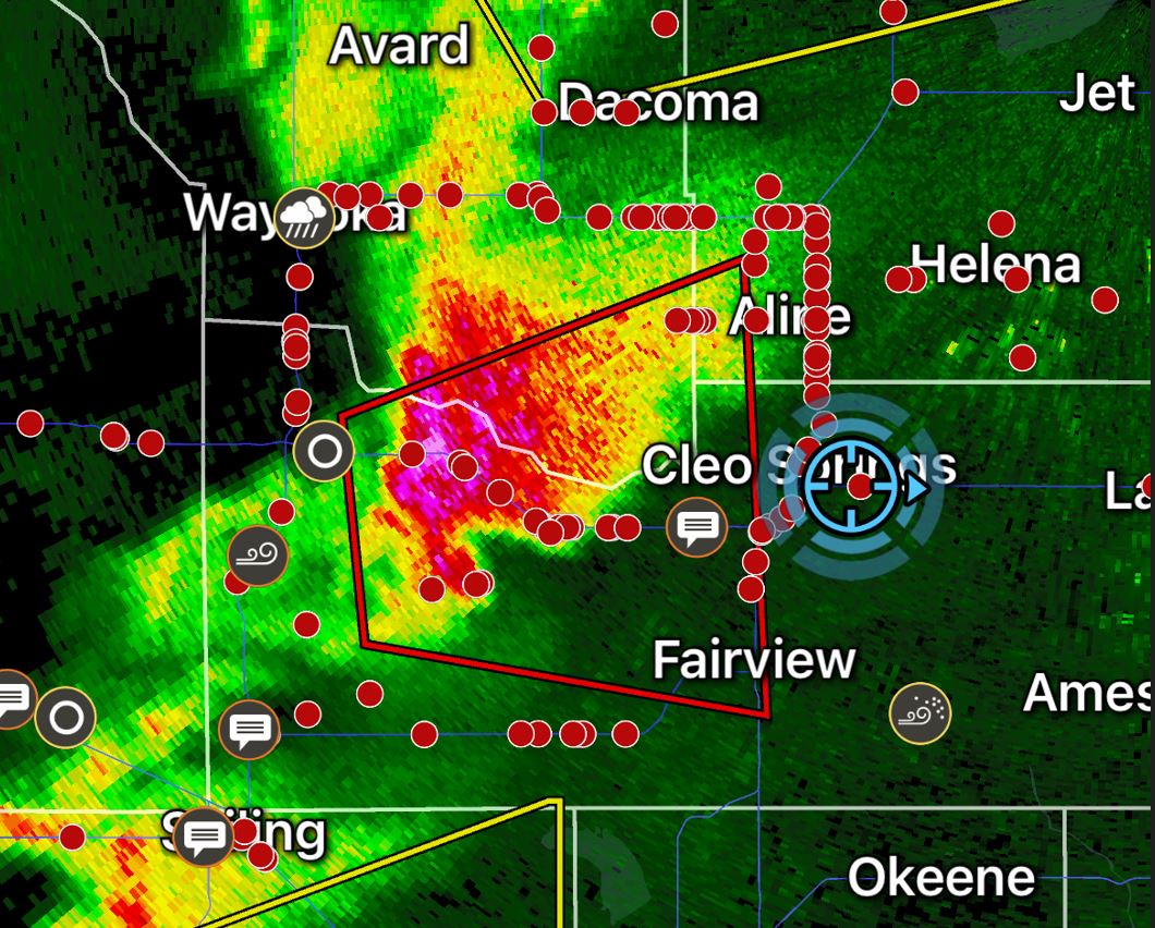
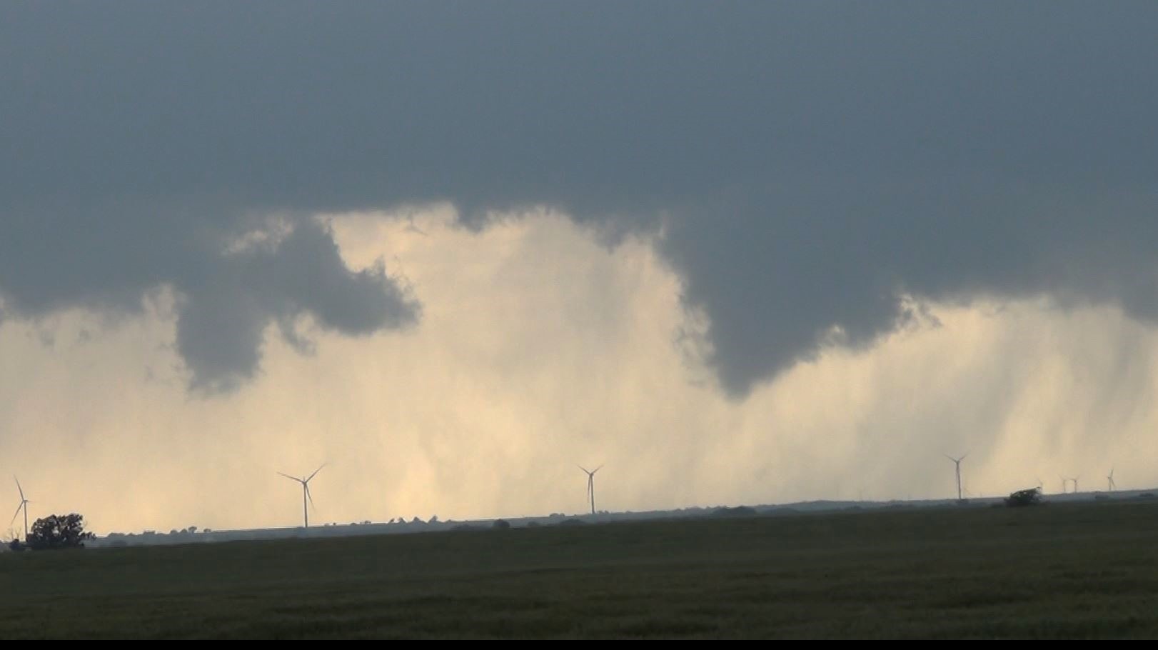
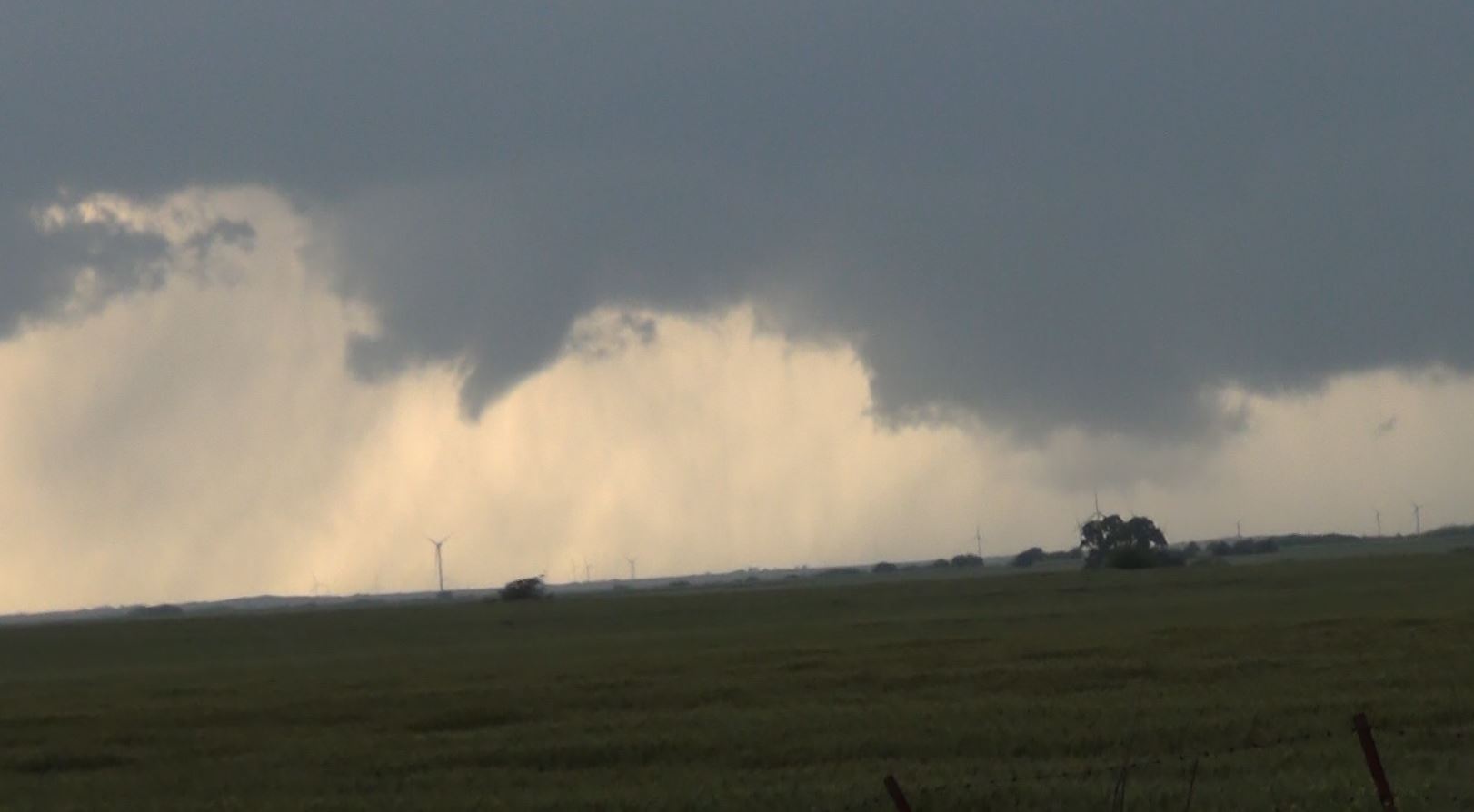
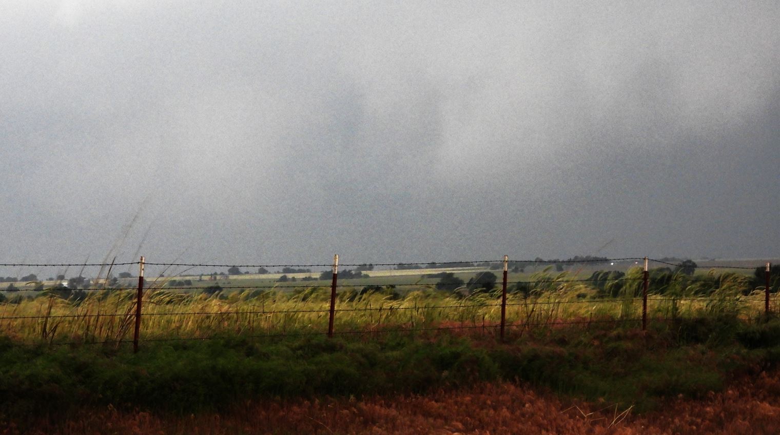
Supercells developed out by the Texas/Oklahoma Border. We lined up a storm that had become Tornado Warned and latched on to it as it worked its way east. As it approached, there were many fingers, scud clouds, and funnel clouds dancing under the wall cloud of the storm.
We positioned ourselves to view the hook as it came by us.
As the storm reached us, we were looking at the base when a confirmed Tornado report came through. We had a clear view of the wall cloud and saw the funnels, but from our location, we were not able to see any ground contact from the funnels.
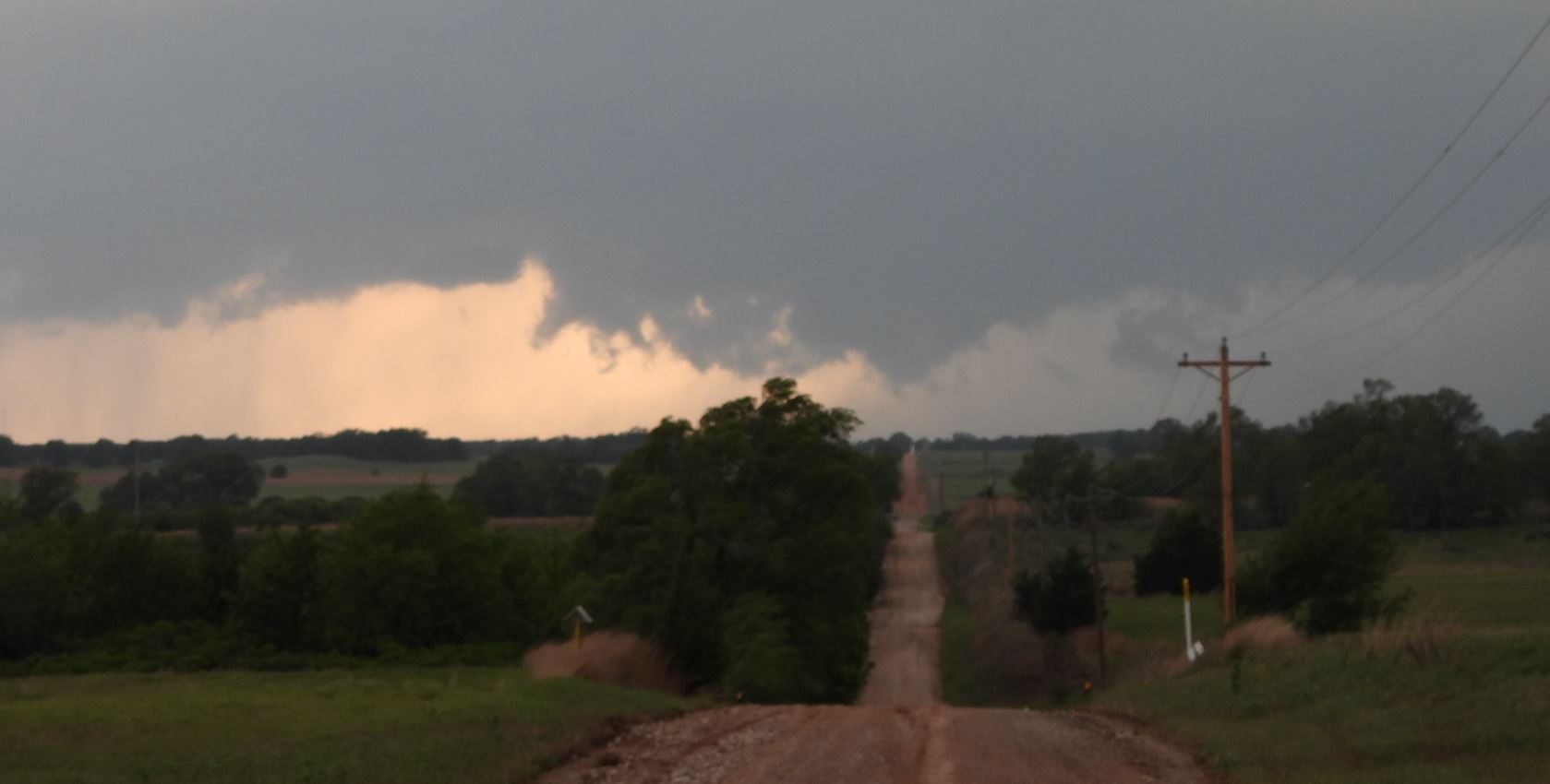
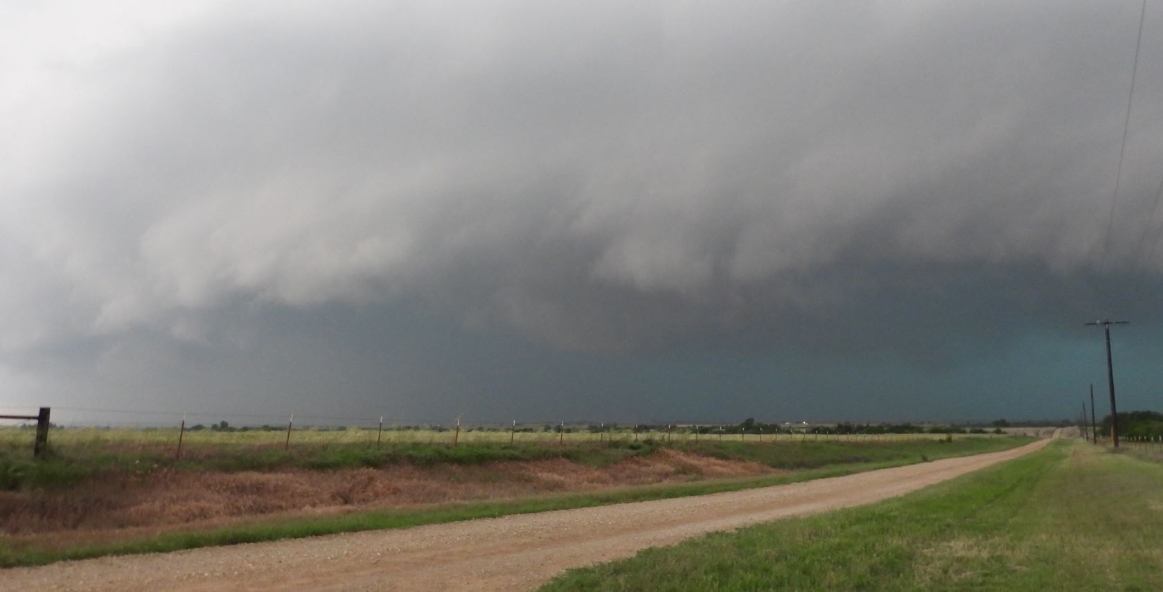
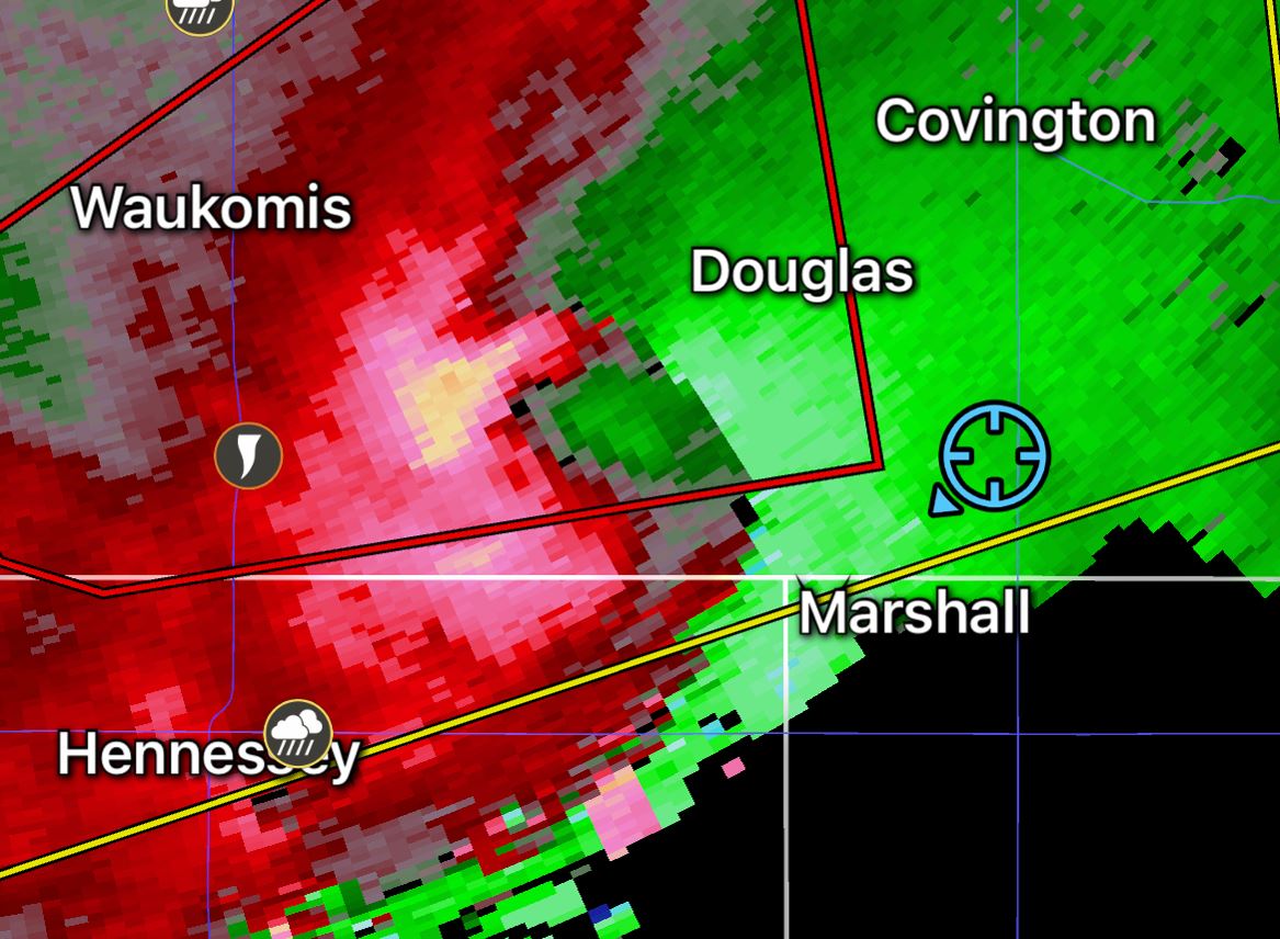
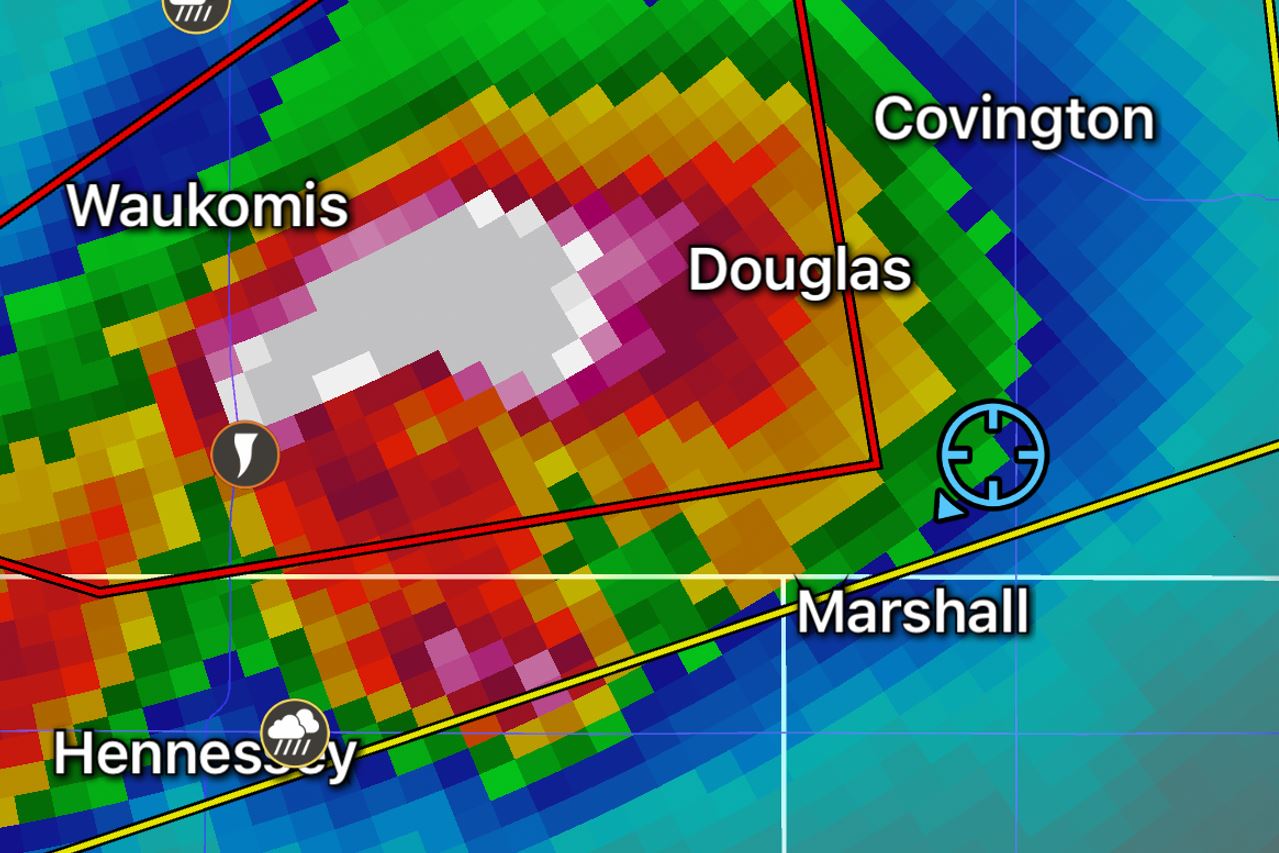
The storm weakened as it moved east, so we moved south to the next supercell to the south. This supercell coiled up aroud Okeene, Oklahoma and moved eastward.
The storm produced a tornado hidden in rain as it moved toward us giving us no view of the tornado inside.
We moved out of the way of the circulation and the hail core to let the storm go by.
At this point, we found ourselves in the middle of the 2 mile long, storm chaser conga line. That ended our day as the highly anticipated tornado outbreak failed to produce during the daylight hours.
With a High Risk Outlook and the advertising of many Tornadoes, some being long tracked, the expectation was much higher. It wasn't until after dark when the bigger Tornadoes would become more numerous.
 |