April 02, 2025
April 02, 2025
April 02, 2025 For the second time in less than a week, a storm system was forecasted to impact the area within a few hour drive. The Storm Prediction Center put out a High Risk to the south of us with a 30% hatched area for tornadoes.
Leading up to this day, the weather models had alot of difficulty locking in on a final solution to what the day would bring. This made for tough decision making for my son Ryan and I even as we walked out of the door mid-morning for this event. Our decision upon leaving was to head down to Cape Girardeau, Missouri as our target and then reassess if we should head down to the High Risk area in Arkansas or play the storms from Missouri into Illinois. We altered the target as we headed down Interstate 55 and stopped off for lunch at Perryville, Missouri. We hung around after lunch still unsure what our next move would be as we watched the radar with the storms coming toward us from the west. Eventually, a storm to our west became Tornado warned.
 |
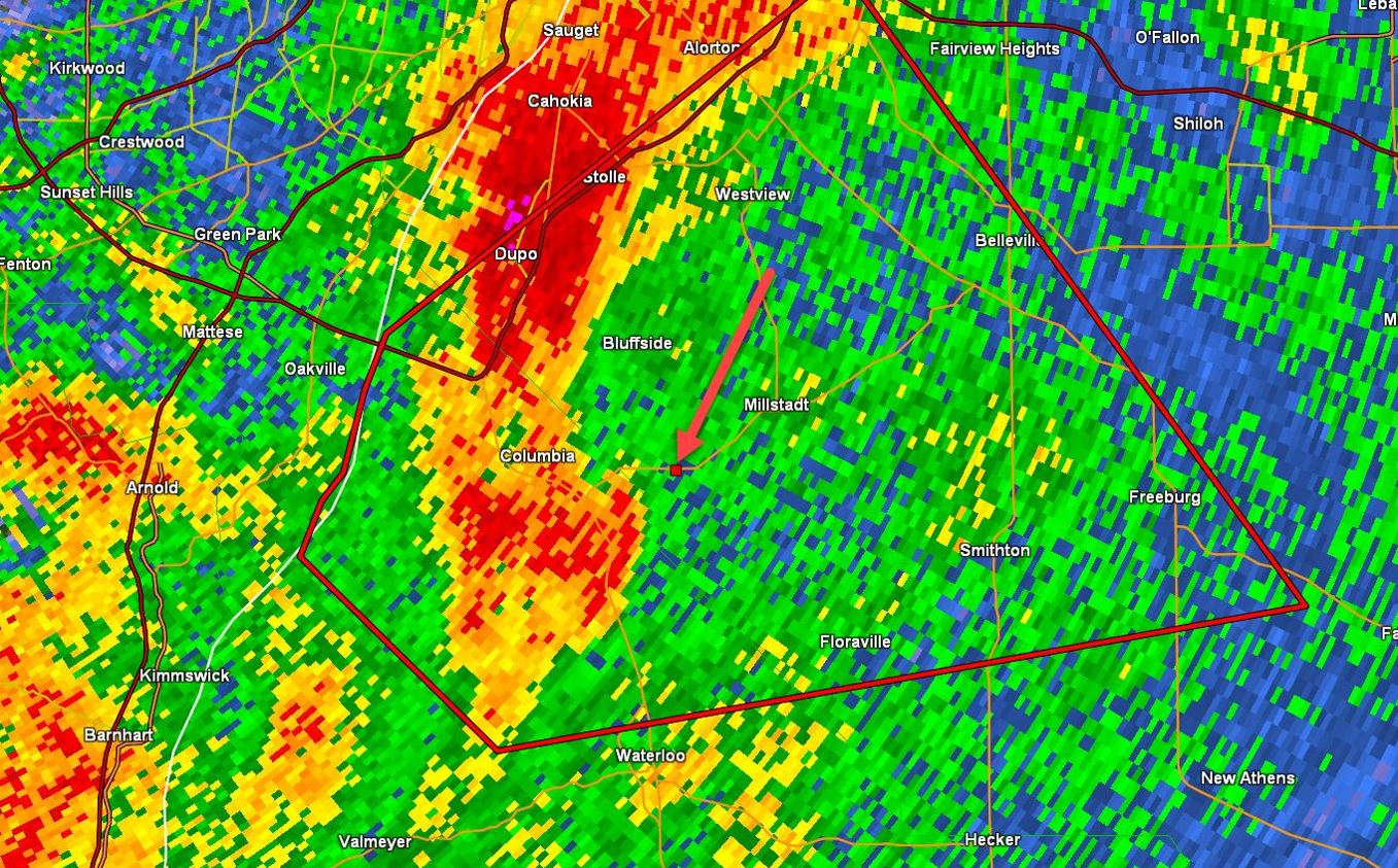
We held our location and watched the storm to our west to see if it would sustain or die off. Meanwhile, we also kept an eye on what was happening to our south and with the first storms going up in Tennessee versus Arkansas, we chose to stay where we were. As the storm moved closer to us, it maintained the rotation and sustained the tornado warning, so we finally pulled the trigger to intercept this storm. We worked our way to the Chester, Illinois bridge to cross over the river into Illinois and then move north up Highway 3.
We continued north until we were lined up with the path of the storm. We exited Highway 3 at the Highway 158 exit and drove east until we reached a wide open area (red arrow) to look back at the storm.
As we pulled off to watch the approaching storm, we were surprised to find rotating rain curtains rapidly rotating around a funnel cloud over halfway to the ground.
The rotation and funnel cloud did not stay visible long as rain wrapped around the rotation cutting off the view and engulfing us in the heavy precipitation. We attempted getting out in front of it again, but with no success on the fast moving storm. When we reached Interstate 64, we reassessed our situation and made the decision to end our adventure and return home.
Looking back at our decisions on the day, we certainly picked the correct storm as our storm produced a tornado near Potosi, Missouri and again near Greenville, Illinois, but our positioning was in between those tornado cycles as it went by us. After that storm had fled and we chose to end and head home, the storm system went bonkers on producing circulations within the storm line both in Missouri, Illinois, and south in Arkansas with many Tornadic Supercells. Most Warnings had their circulation completely wrapped in rain and did not produce tornadoes, but those Supercells in Eastern Arkansas were a storm chaser's dream and a few of those did produce tornadoes.
Our Trip
|
Summary 2025 Page |
Storm Index Page |