 April 30, 2025
 (Click on images to enlarge them)
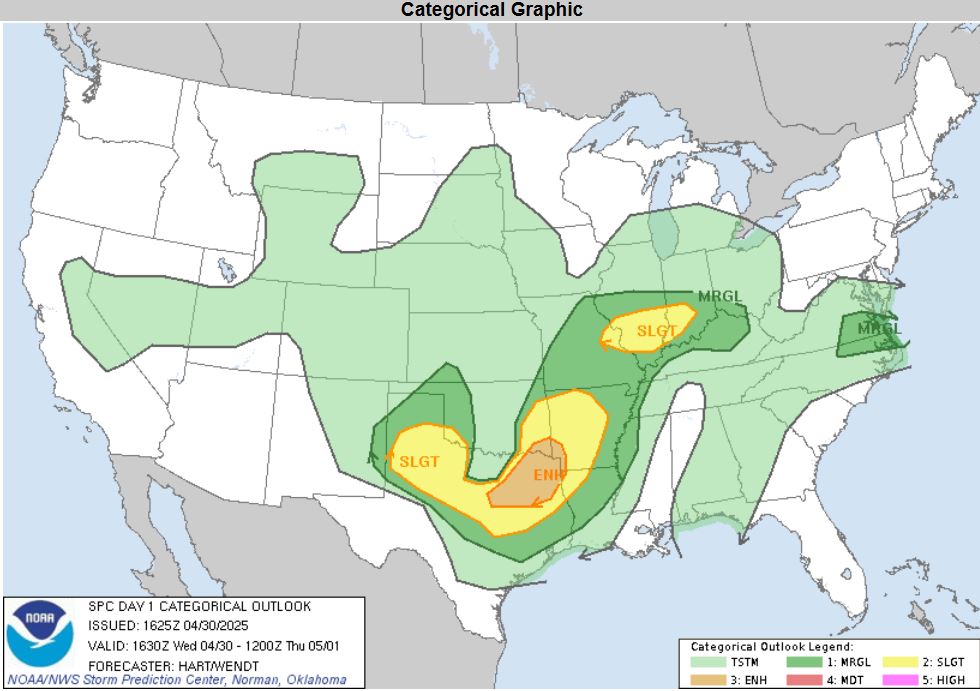
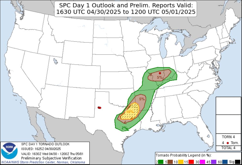
To end the active month of April, my son Ryan and I once again head out on another storm excursion. Luckily, this one is fairly close to home. The Storm Prediction Center put out a Slight Risk of Severe Storms with a 5% possibility for Tornadoes.
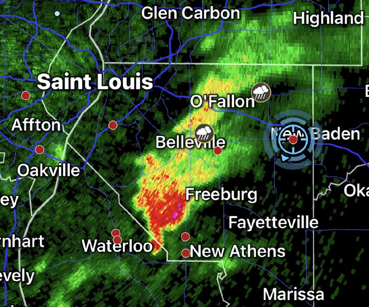
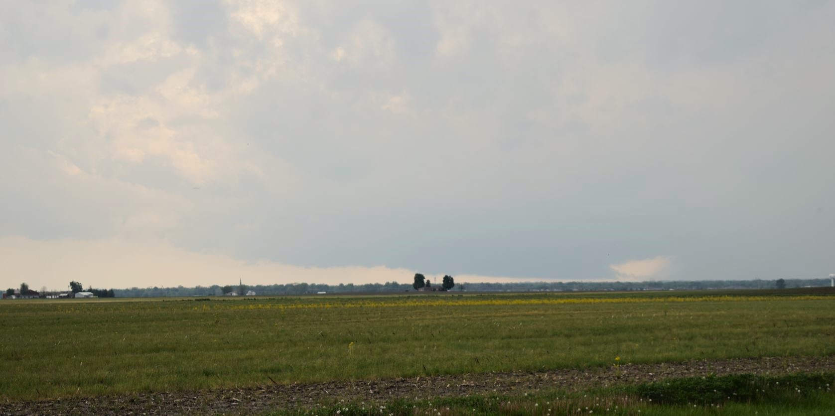
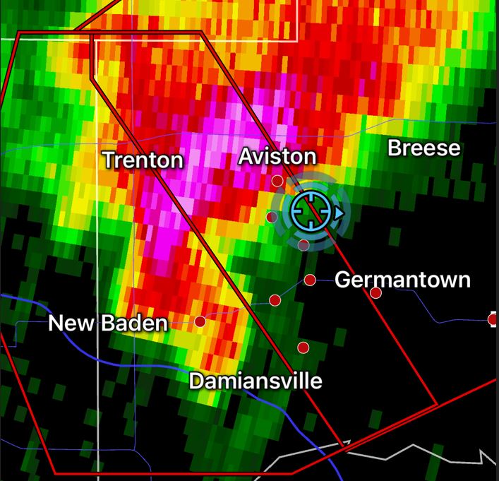
As Ryan finished out his work day, we joined forces and headed out to our target. Once again, our target was a bit flexible depending on storm development, but in general, the plan was to take I-64 about halfway through the state. As we worked our way around the St. Louis metro area, we began watching a storm to our south over the Mississippi River. It continued to grow, so we plotted the path to come right over New Baden, Illinois. We exited the highway there, grabbed a drive-thru lunch, then found a wide open spot to watch the storm coming at us.
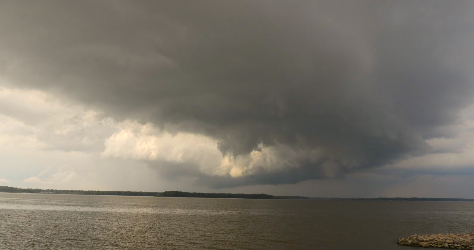
The storm base was wide open giving us an unobstructed view as it moved in closer. The back of the storm developed a hook and the velocity scan showed some rotation. A Tornado Warning was soon issued on the storm.
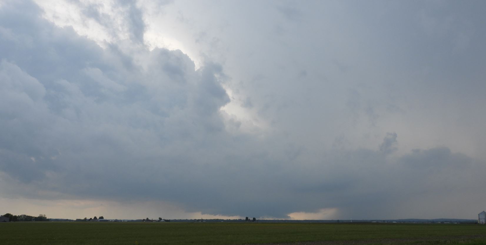
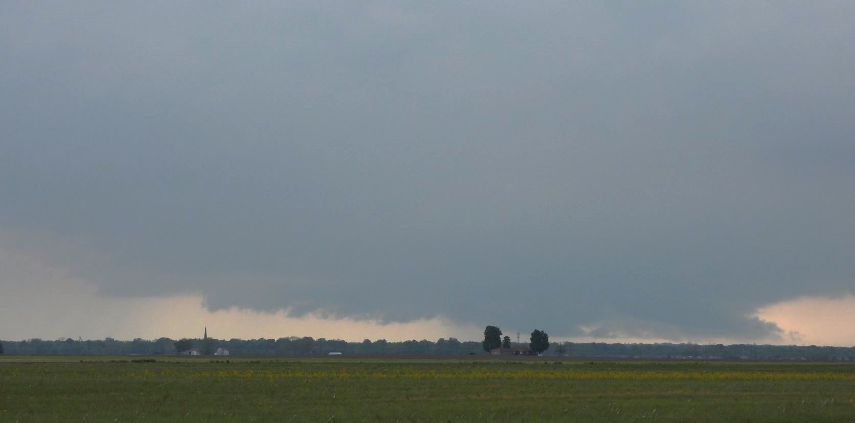
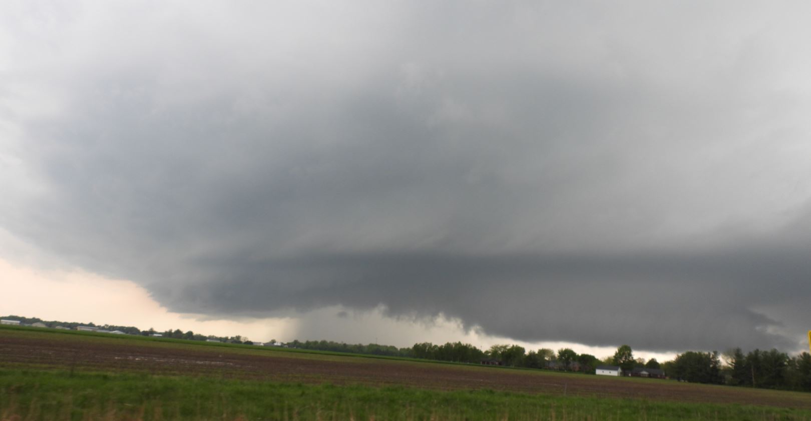
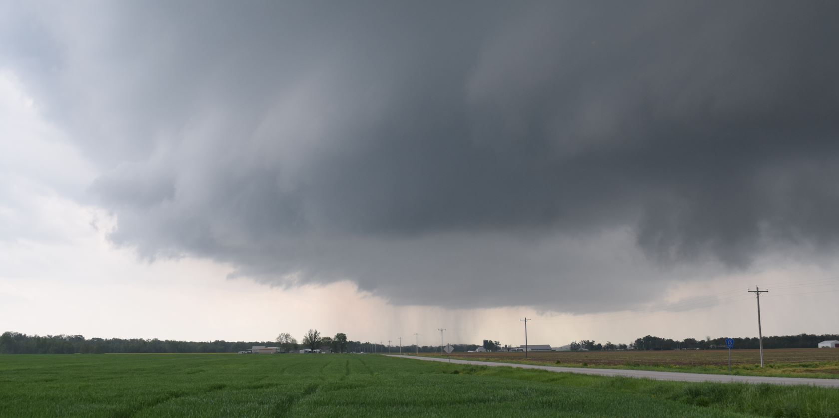
Eventually, the storm reached our location without any Tornado, so we were forced to move out of its way. We moved north out of New Baden on Highway 160 and then turned east onto Highway 161 and once we were out in front of the approaching storm base and wall cloud, we stopped for another look.
 |
 |
 |
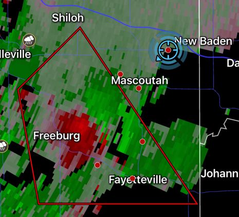
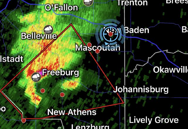
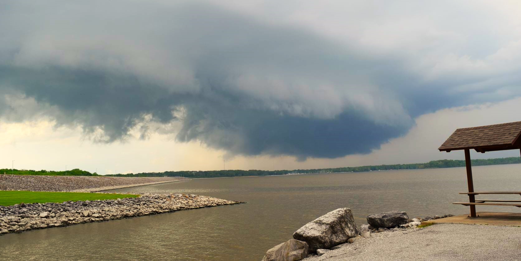
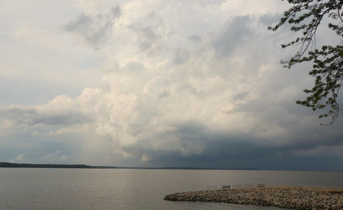
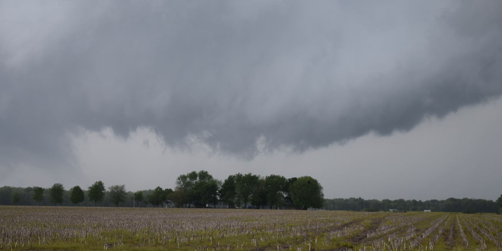
The storm at this point was transitioning into a monster supercell. The storm forced us to move once again. We continued east and north as we tried to decide how to stay with the storm, but navigate around Carlyle Lake. Our decision was to drive around the south side of the lake on Highway 50 and take Highway 51 north on the east side of the lake. As we were passing the Carlyle Lake Dam Entrance to the park, we made a snap decision to go in and find a spot to watch the storm come over the lake. We found a spot and watched, but to our dismay, the storm weakened, the wall cloud was gone, no more rotation was evident, and the Tornado Warning was dropped.
We sat back and watched the storm go over the lake. As the storm moved away, we figured that was the end of the chase. Ryan wanted to look for snakes. I suggested we still drive up the east side of the lake to not only to catch the storm again, but catch Interstate 70 for the return trip home. After a bit of indecision, we chose to drive east, then north as our route home. We got back on Highway 50 and traveled to Highway 51. In the meantime Ryan looked up the route and saw going north would add a lot of extra time getting home and suggested the quickest way home was back west on Highway 50. So we turned around and headed back west to head home.
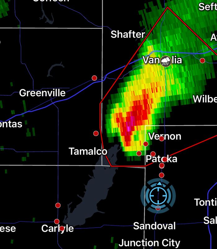
End of story, right? We no sooner turned around and drove less than a mile back west, the storm once again goes Tornado warned. One look at radar and the car was turned back around again and we were heading north on Highway 51 toward the storm.
As we caught up to it again, it now looked stronger than ever.
 |
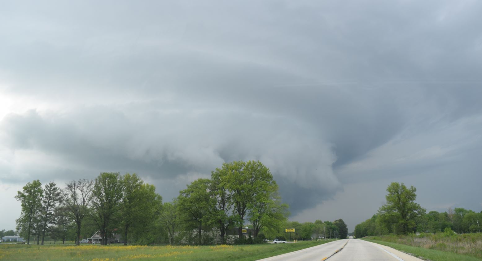 |
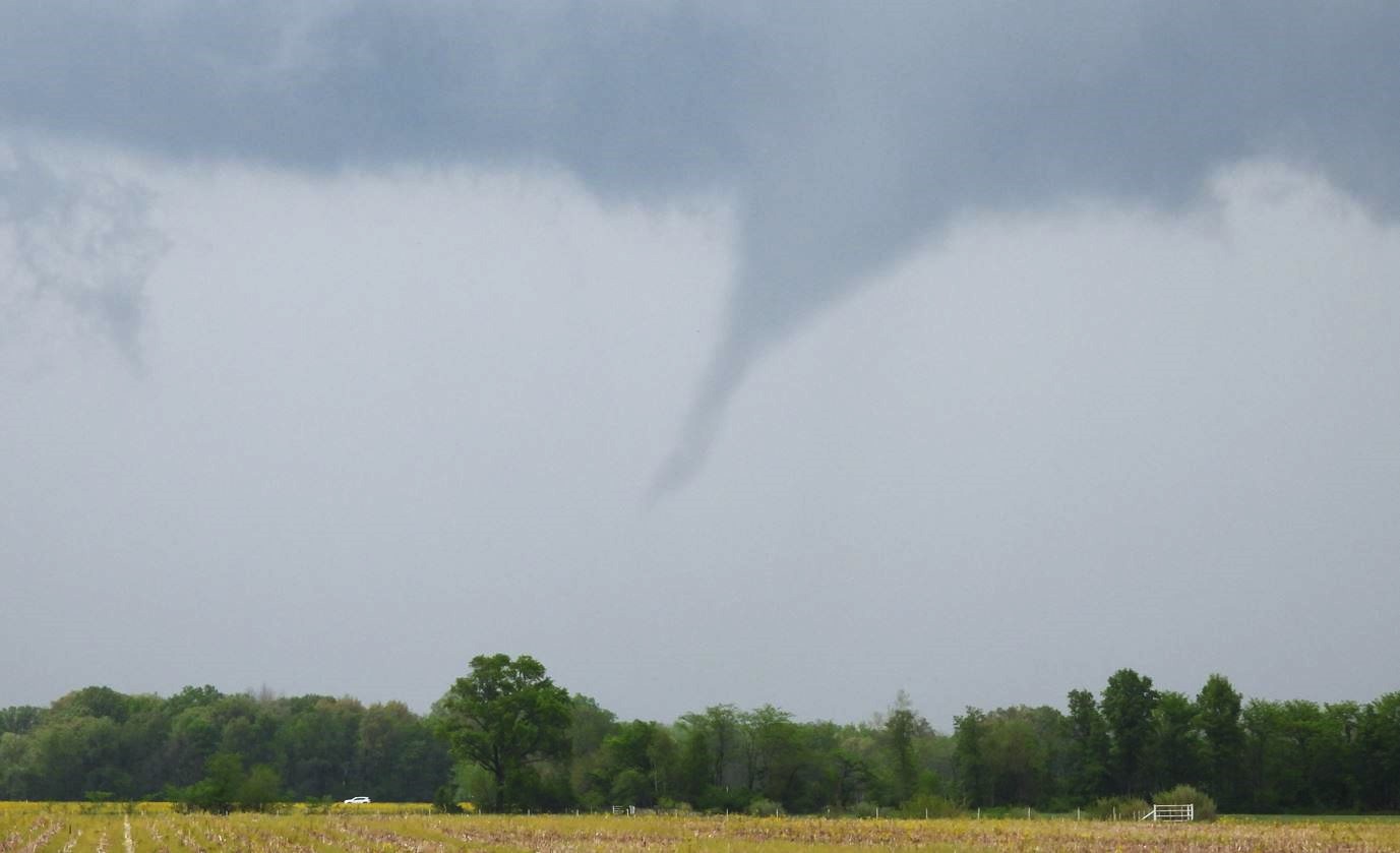
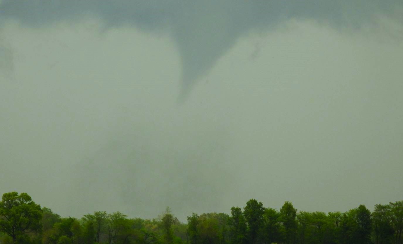
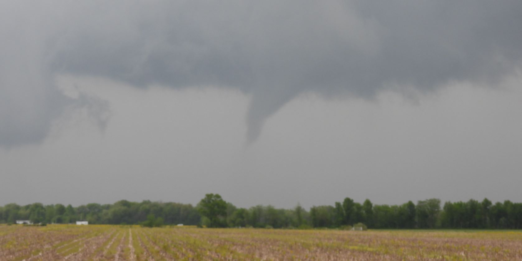
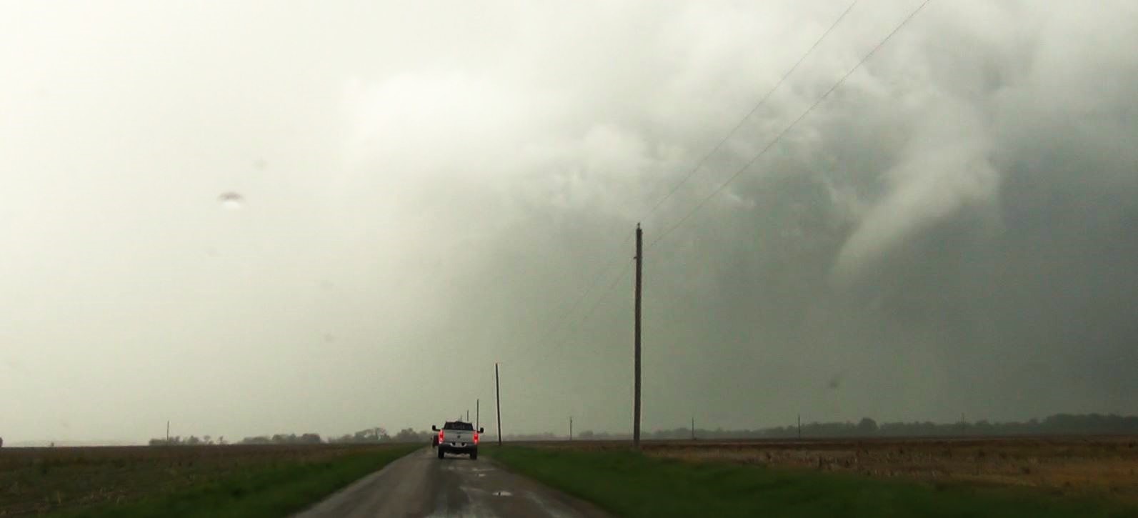
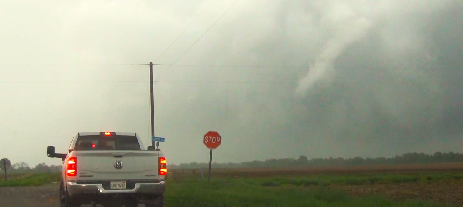
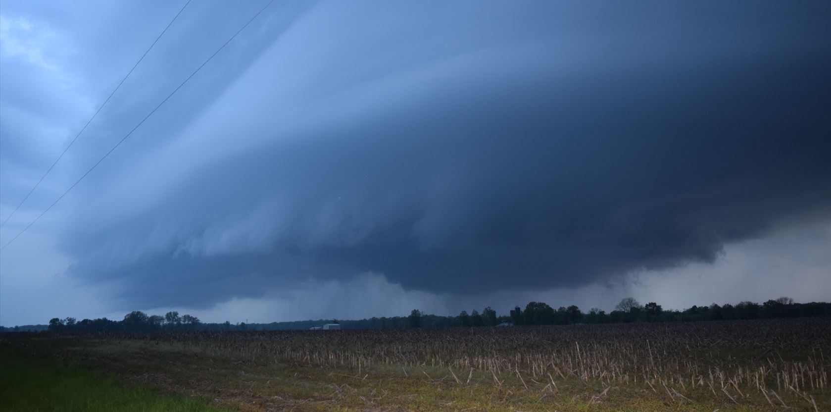
When we reached Vernon, Illinois, we made a right turn on Vermundy Road to head east. At this point the wall cloud was just to our north. Ryan sees the rotation getting stronger and tells me to pull over. We get the Cameras and Camcorders going and the show begins.
 |
 |
 |
 |
 |
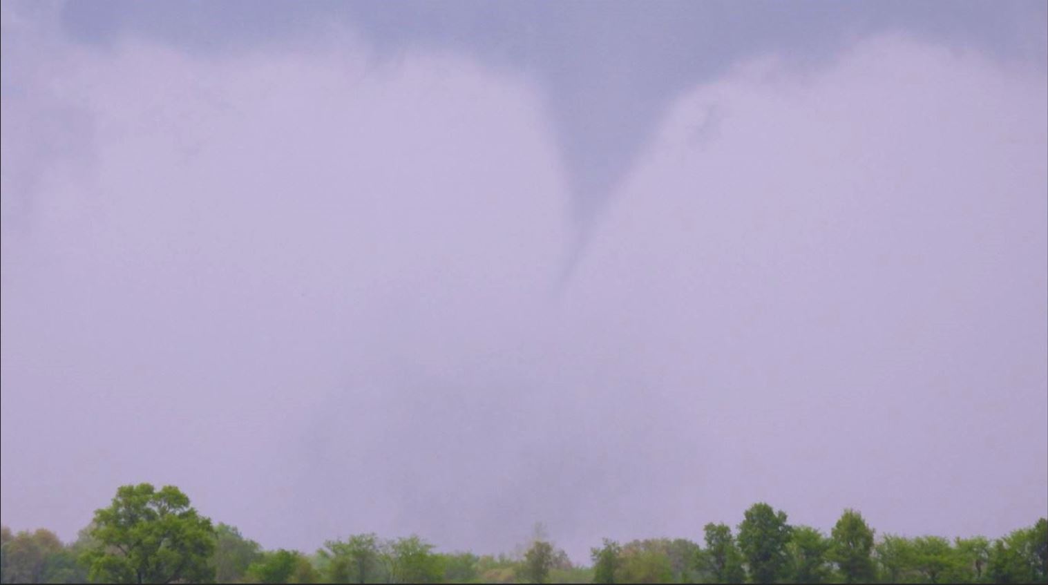 |
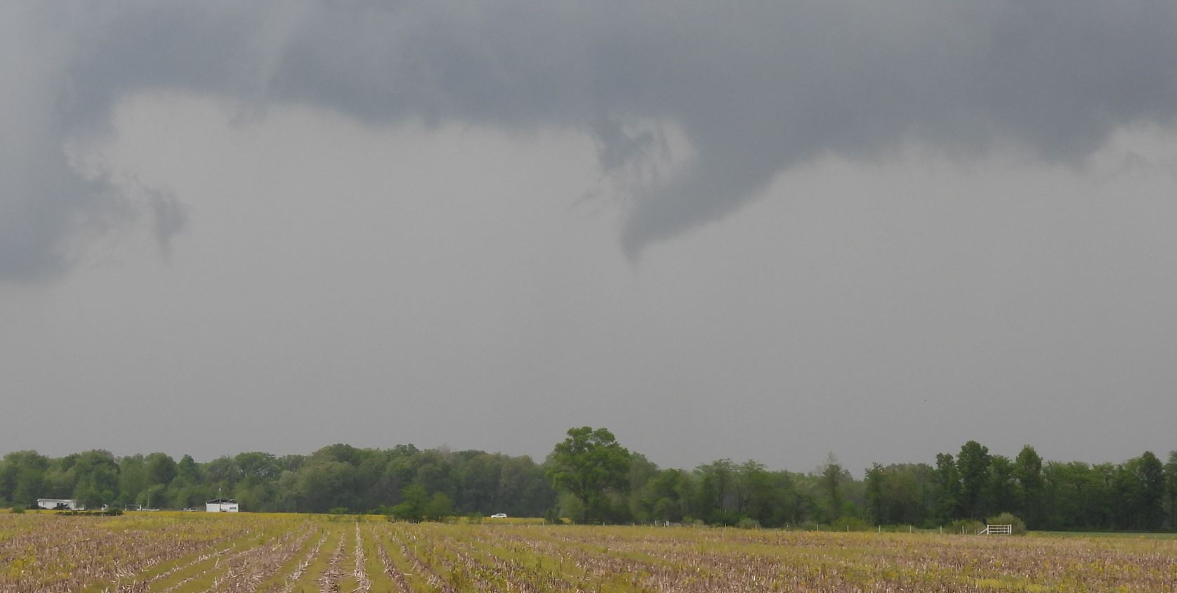
Quite the turn around from thinking the storm was dying to putting down a Tornado. As the Tornado went out of sight in the rain, we zigzagged northward and eastward staying just ahead of the storm. We did get a glimpse of a rope out stage of a Tornado. We are unsure if that was the same Tornado or a Tornado from a different circulation.
W
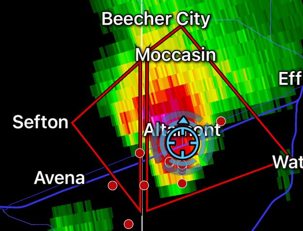
We eventually made it back to Interstate 70 at Altamont, Illinois. We found a spot to let the storm come over us as the day was turning to night. The storm still looked fierce as the rotation came by us, but no tornado was present.
| allowfullscreen="" frameborder="0" height="315" width="560"> |
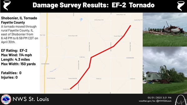
National Weather Service Survey Results
 |
| Our Trip |
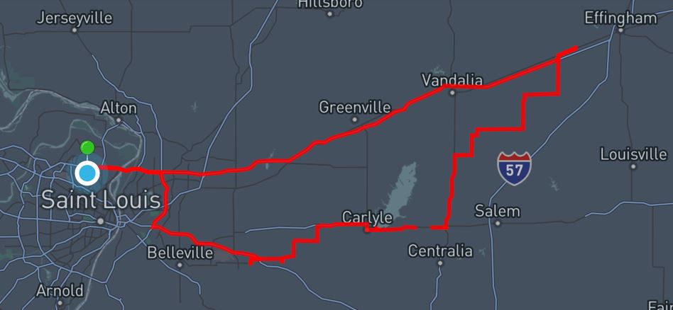 |
7 Hours - 248
Miles
|
Summary 2025 Page |
Storm Index Page |