A
leisurely return trip from a visit to the
Mother-In-Law's place turned into a very unexpected
storm chase. The risk seemed very minimal, so
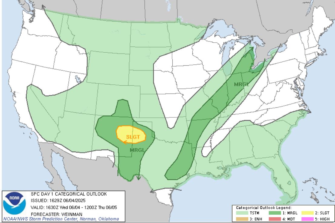
I had not even given a look at the weather outlook
for the day. The Storm Prediction Center had a
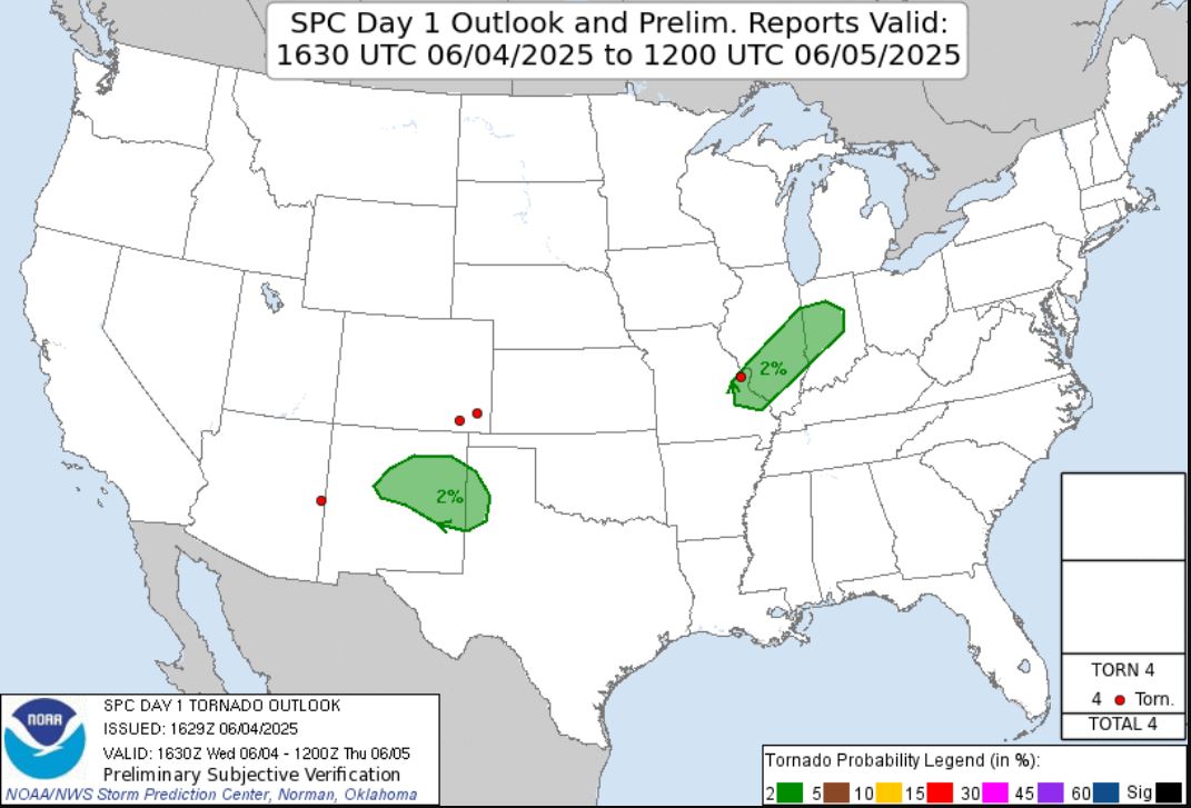
Marginal Risk for our area and only added a 2%
percent Tornado Risk in the afternoon update.
The day started with me agreeing to join my
wife Sally in visiting her mother in Wentzville,
Missouri. We spent lunch and the early
afternoon with her and decided to leave for home
around 2:15. Unfortunately for us, our drive
back home was in moderate to heavy rain.
When we reached Interstate 370, we veered off of our
Interstate 70 route home. The rain finally let
up as we approached the Missouri River as there was
a break between cells. Once we crossed over
the river in Earth City, I began taking notice of a
lowering in the cloud on the storm just to the north
of the Highway. I cracked the joke with
Sally telling her to get the camcorder out of the
camera case to film the Tornado. As we got up
next to it around the old St. Louis Mills Shopping
Mall, it became obvious that lowering was
rotating. It began pulling in scud
clouds. Now very seriously, I told Sally to
get that camcorder out. I had no where
to pull off as I was now driving into the trees, so
we continued on hoping to find a position to view
the lowering once we were on Interstate 270.
Within 30 seconds before we merged from Interstate
370 onto Interstate 270, the phone alerted us to a
Tornado Warning that had just been issued.
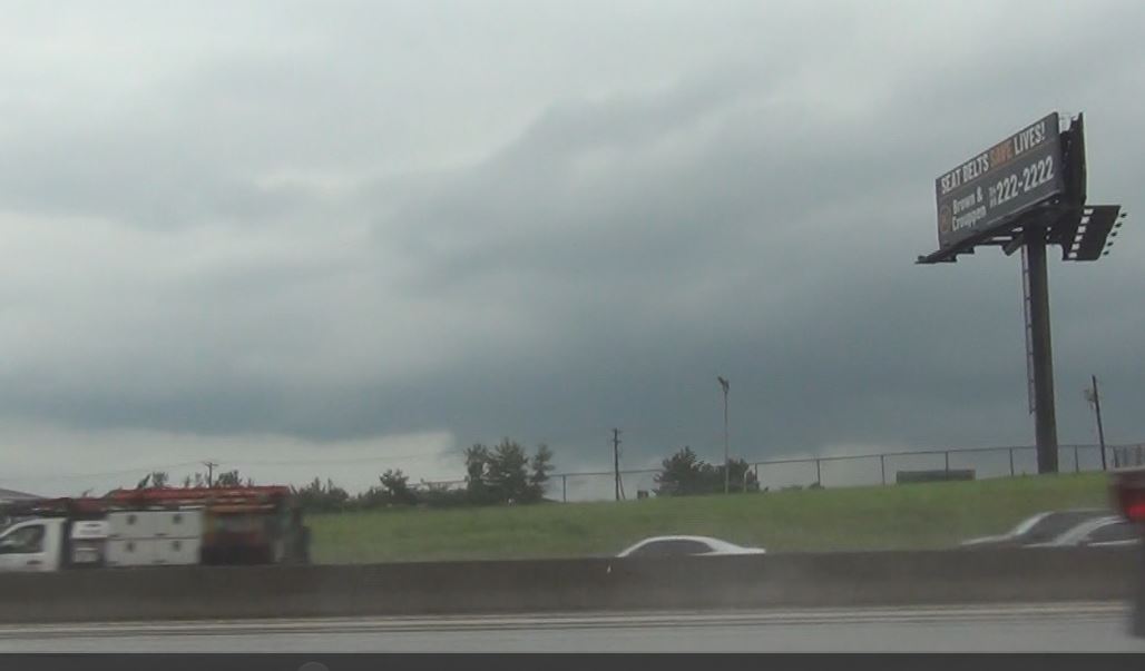
I'd get an occasional glance through the trees and
noticed at one point that the lowering had condensed
enough possibly to reach the ground. I was
able to pull off the Highway on Interstate 270
before Lindbergh, but the view was almost
non-existent at that spot, but there still was some
movement going on under the base of the lowering.
 |
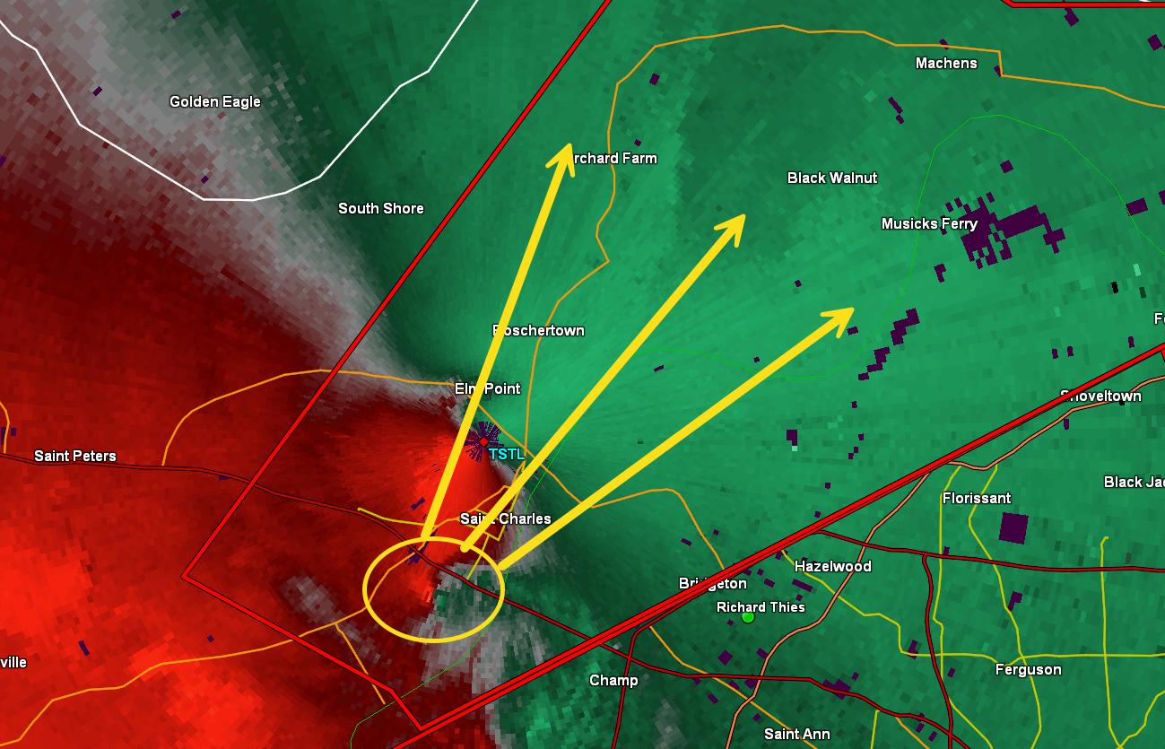
I was finally able to look at the radar and read the
Tornado Warning to discover that the warning wasn't
for what I was looking at, but for a kink in the
line coming at us from the south. The
circulation was coming through Chesterfield,
Missouri and up the Missouri River in Maryland
Heights, Missouri and St. Charles, Missouri. I
needed to plot an intercept point that eliminated
most of the traffic and gave us a reasonable view of
the storm coming in our direction. Even our
chase partner, Brian Stertz, chimed in with a bit of
help over the phone. I chose to take the
Lindbergh exit south and move to the lesser used
Gist Road on the western side of Lambert
International Airport that gave me a view of the
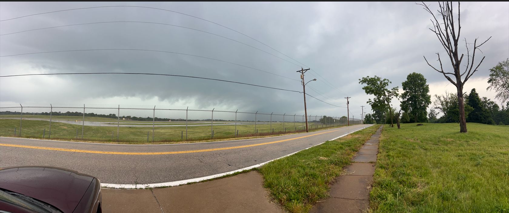
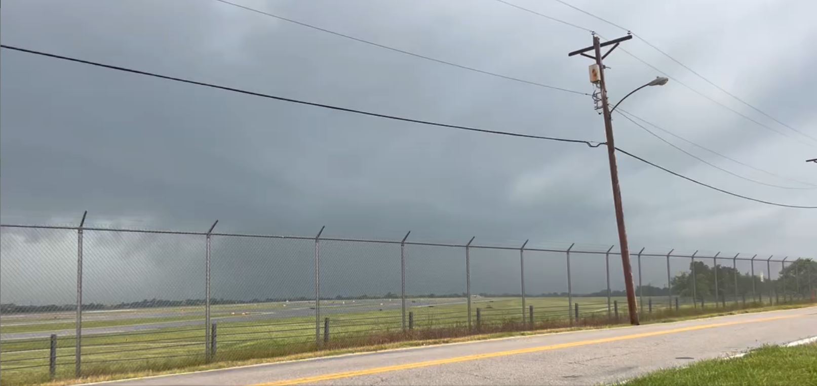
storm coming toward us. We watched as the
storm approached.
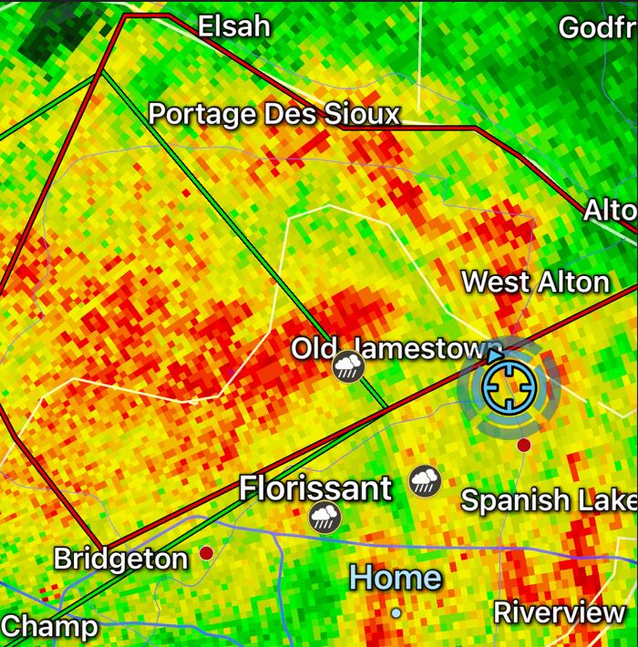
We watched as
this darkened area came closer. It had
that bowing look with the area of interest
wrapped back in on the northern side of the
bow typical of a line embedded storm. It
quickly became wrapped up in rain from our
vantage spot.
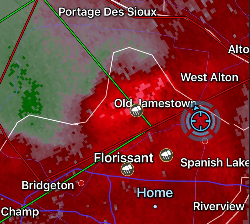
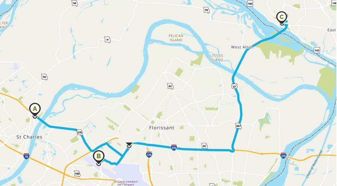
We
retraced our path back to
Interstate 270 and followed the
storm eastward and then up Highway
367, but the storm became weaker
as it lost all of its remaining
rotation and got totally wrapped
up in the rain. We ended our
pursuit in Alton, Illinois.
This was one of
biggest surprise chases of my career as I
stumbled right into rotating storms
without even anticipating and realizing
it. We were disappointed our first
storm was out of our sight very quickly
due to driving and identifying what was
going on too late. That second
Tornado Warned Storm we watched at the
Airport did put down a confirmed Tornado
in the Chesterfield area.
Unfortunately, by the time it reached us
at the Airport, we only had the remnants
of what remained from that Tornado
Circulation. Regardless, it was a
fun, short, and on the way home type chase
and my wife Sally for only the second time
in my 28 years of storm hunting got to
experience what seeking a Tornado is
like. She did an excellent job
handling the camera and camcorder during
the chase as well.
Trip Log
|
|
1.5 Hours
-
31 Miles
|
Click
on the link below to
see video of some of
these storms.
|
 June 04, 2025