June
07, 2025
June
07, 2025
(Click on images to enlarge them)
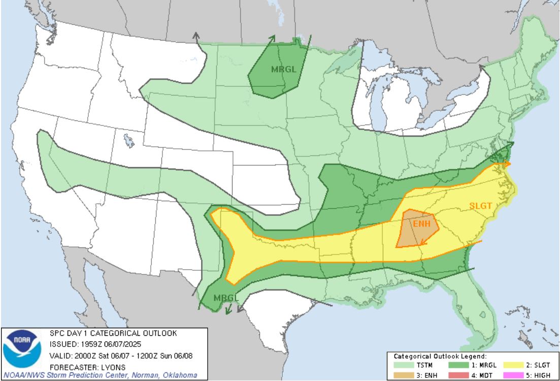
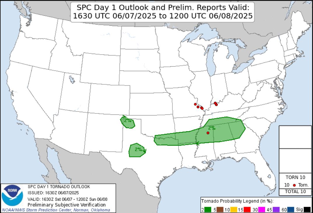
This day started like any other weekend day. I just arrived back from a one week vacation in California late last night and I really was anticipating spending the day following my other hobby of searching and photographing snakes, reptiles, and amphibians. The Storm Prediction Center gave little indication that there could be anything severe. Our area was in a Marginal threat with less than a 2% chance of a Tornado.
 |
 |
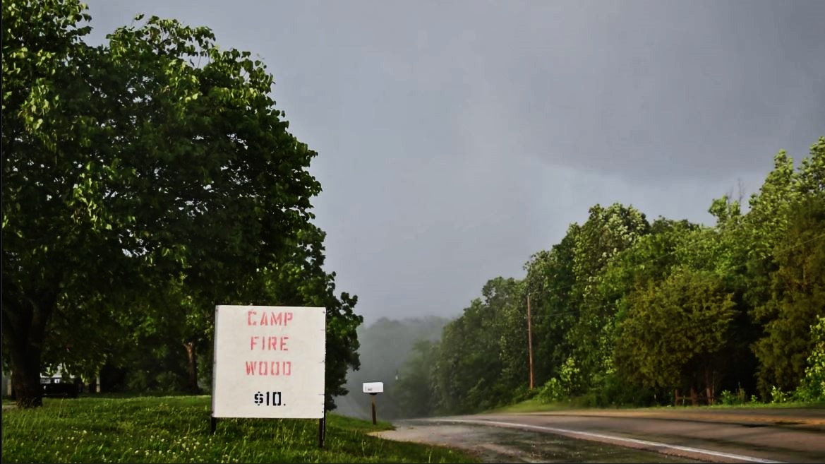
I knew rain would eventually be an issue during the day, so I looked at radar and determined that I would have a few hours in the afternoon to get outdoors in Central Jefferson County, Missouri. My brother Kyle joined me on a snake hunting endeavor. While we were out searching around 2:30pm, I noticed the clouds breaking up and the sun making an appearance. I knew this could further fuel storms, but never gave much thought to severe probabilities. Looking back, this should have been the first clue that the afternoon could be a bit more exciting than we previously thought.
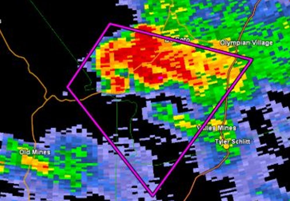
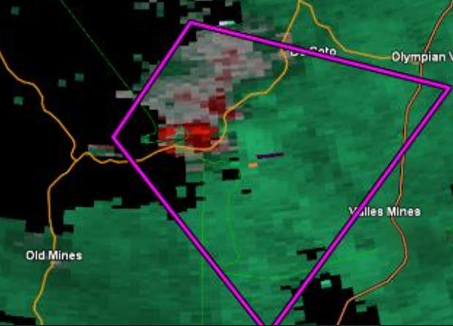
Toward early evening, I noticed three small storms becoming supercells on radar out to our west and southwest. Oddly enough, two of them had hooks and showed mild rotation on the velocity scans. The middle storm looked the strongest and the anvil from it started raining on us. Kyle and I decided to call it quits as we were content with our finds on the day and were ready to head home.
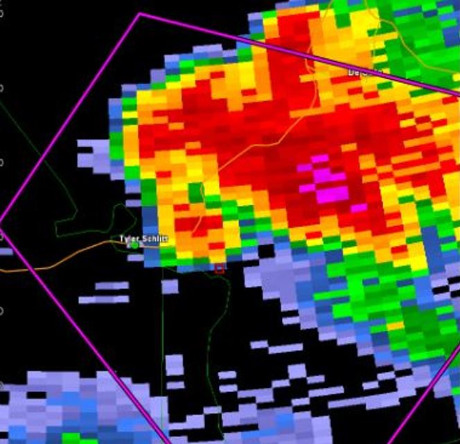
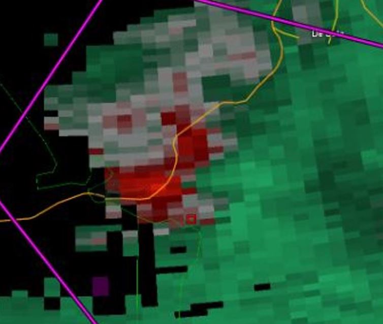
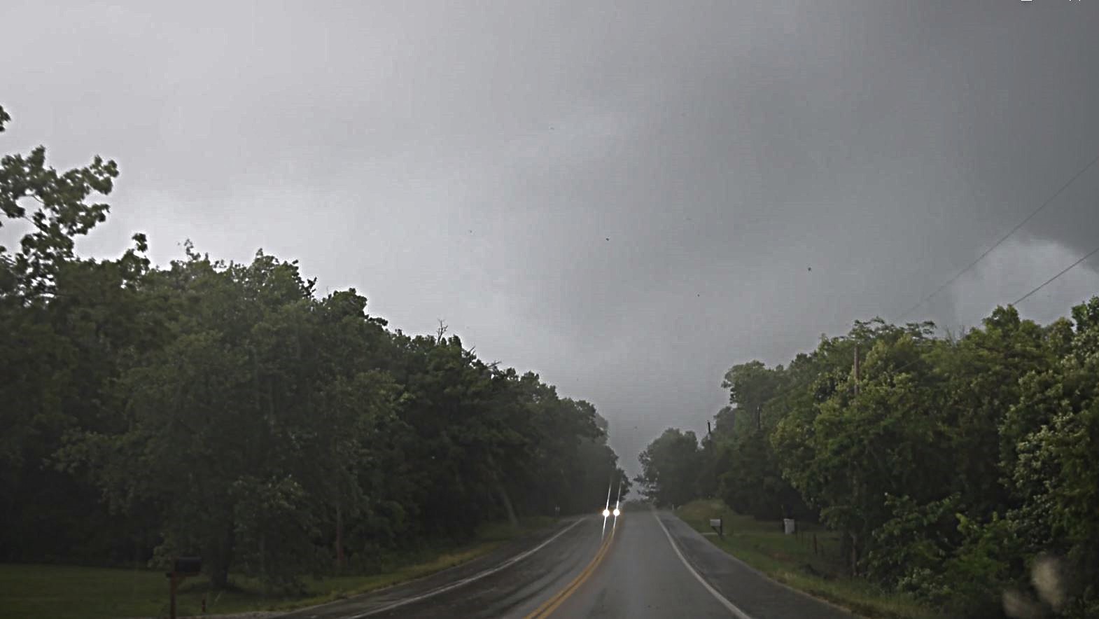
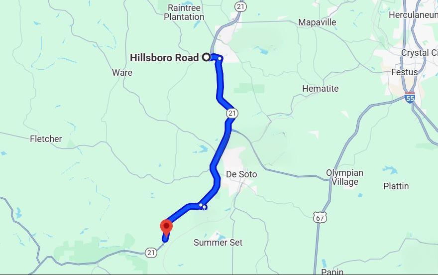
I was still watching the storms closely at this point because they really looked interesting. As we started on our way home, a tornado warning was issued for the middle cell southwest of Hillsboro, Missouri. After some convincing, I was able to talk Kyle into a short drive south for a possible intercept. From Hillsboro, we drove south on Highway 21 knowing that it would be a close call to beat the circulation to the crossing point. We spent some time in heavy rain with no visibility. We soon starting getting out ahead of the rain and evidence of a base started showing up. At this time, the storm had a hook and the velocity on radar had ramped up.
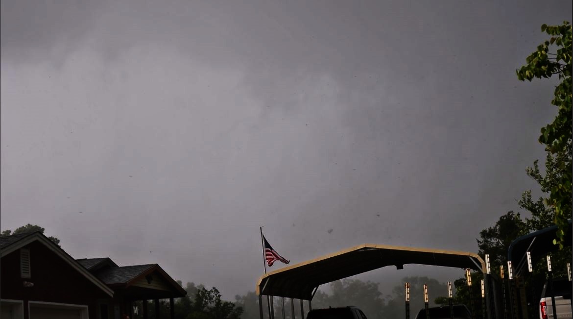
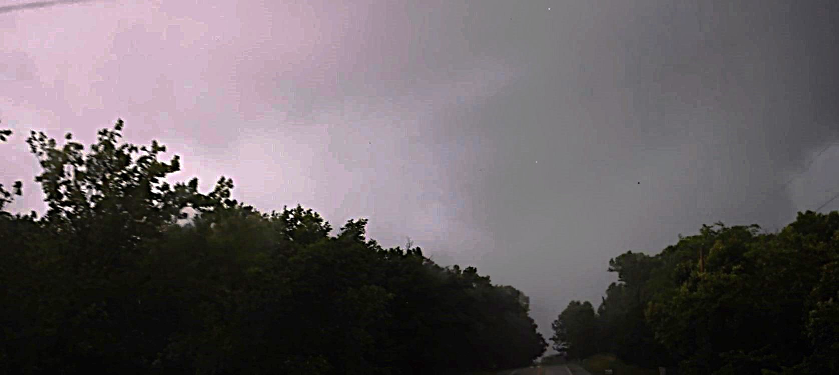
The road turned west briefly and we caught a glimpse of what looked like a cone through the trees. We continued south as the eastern edge of the wall cloud came into view. It wasn’t long before tree debris started raining down on us. Knowing this meant that a tornado was likely just to our west got me a bit nervous. We continued south as we had no visibility due to trees and knew we were likely in the path of a possible tornado.
We continued driving south and found a driveway with a view back to our north. We backed in and watched the show. Rapidly rotating rain curtains spinning from right to left started crossing the road with a bowl shaped wall cloud. The rapid rotation and frequent condensation vortices were lofting large tree debris a quarter mile to our north. It was pelting our car with tree debris. A tornado was in progress!
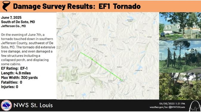
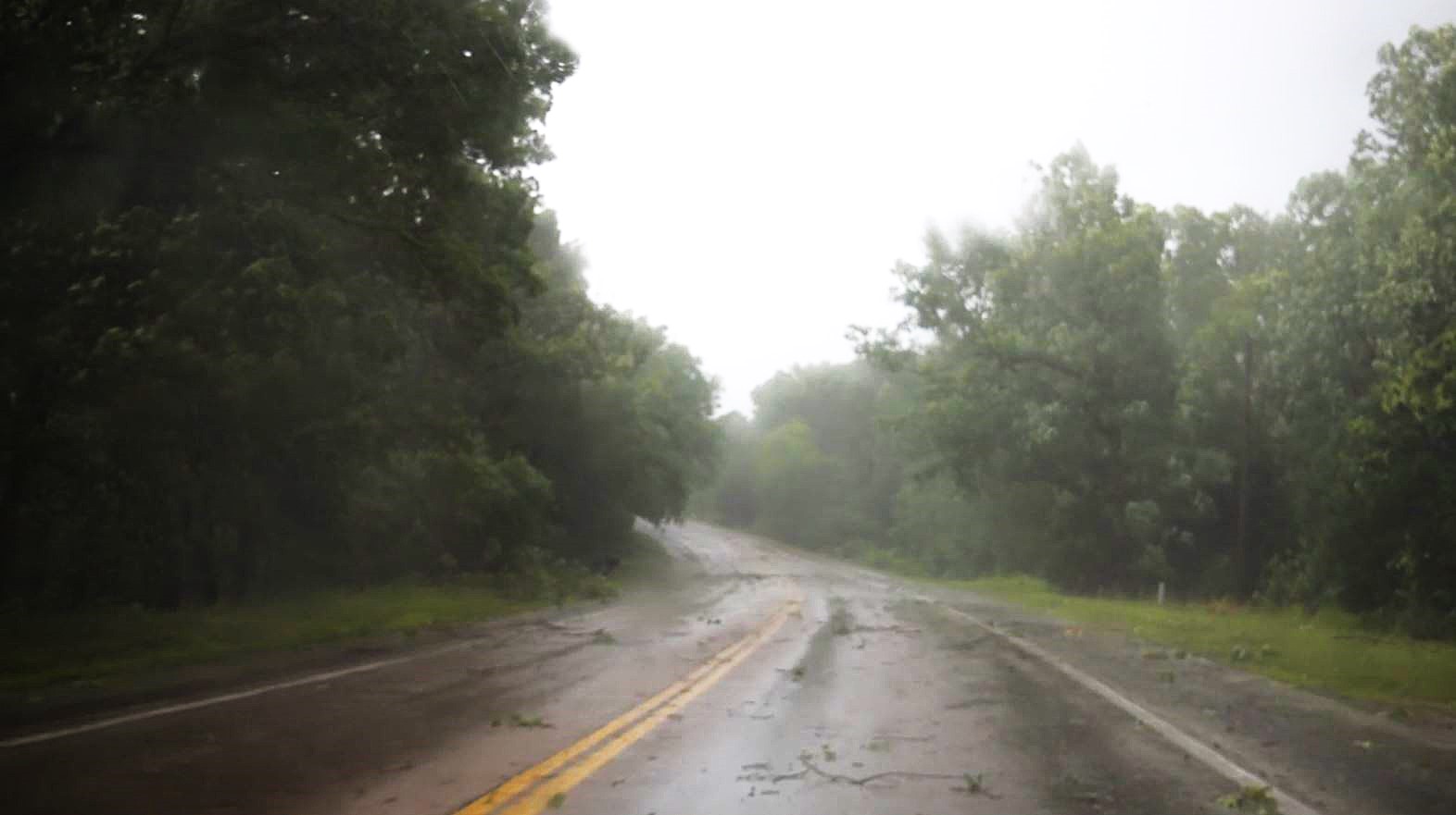
As the Tornado passed, we slowly proceeded back north on the highway. It appeared a rain-wrapped cone had fully condensed to the right of the road. Unfortunately, there was no safe way to follow the storm as it continued into the forests of Jefferson County. As we headed north on Highway 21 and passed the area the tornado had crossed, we saw numerous tree branches and whole trees down along the highway. Tree debris continued to fall on us that had been lofted with the Tornado's crossing as we drove through the path northward. The path width was 100 to 200 yards wide as it crossed the highway.
For a day when seeing a Tornado wasn’t even a thought, this was a heck of a surprise to end the day. We were fortunate enough to be in the right place at the right time to score my brother Kyle’s first tornado!

| Trip Log |
 |
1.5 Hours
-
31 Miles
| allowfullscreen="" frameborder="0" height="315" width="560"> |
NATIONAL WEATHER SERVICE SURVEY