 March 14, 2025
 (Click on images to enlarge them)
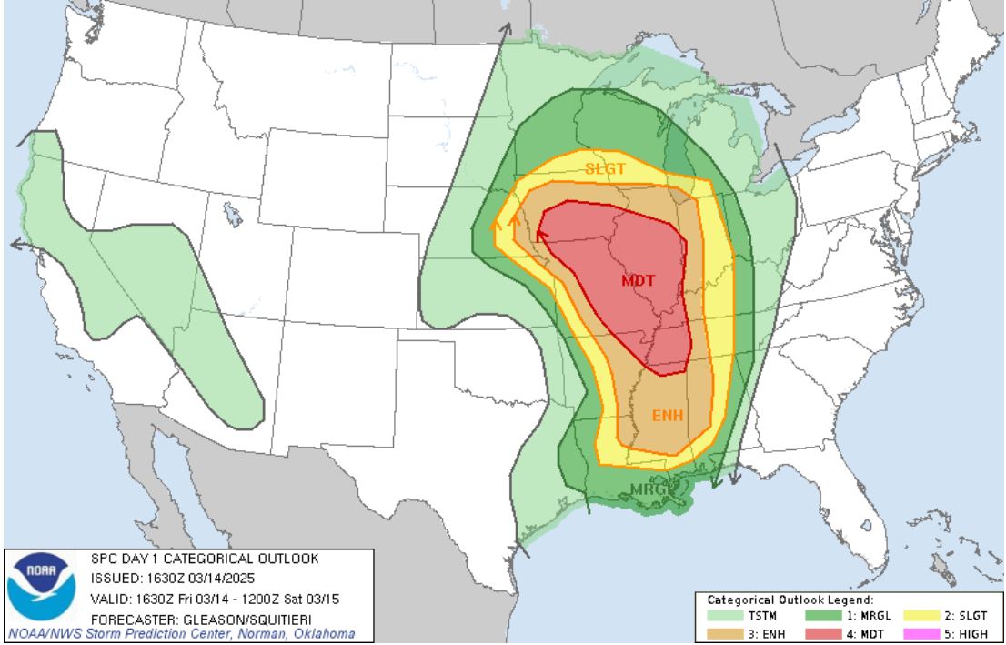
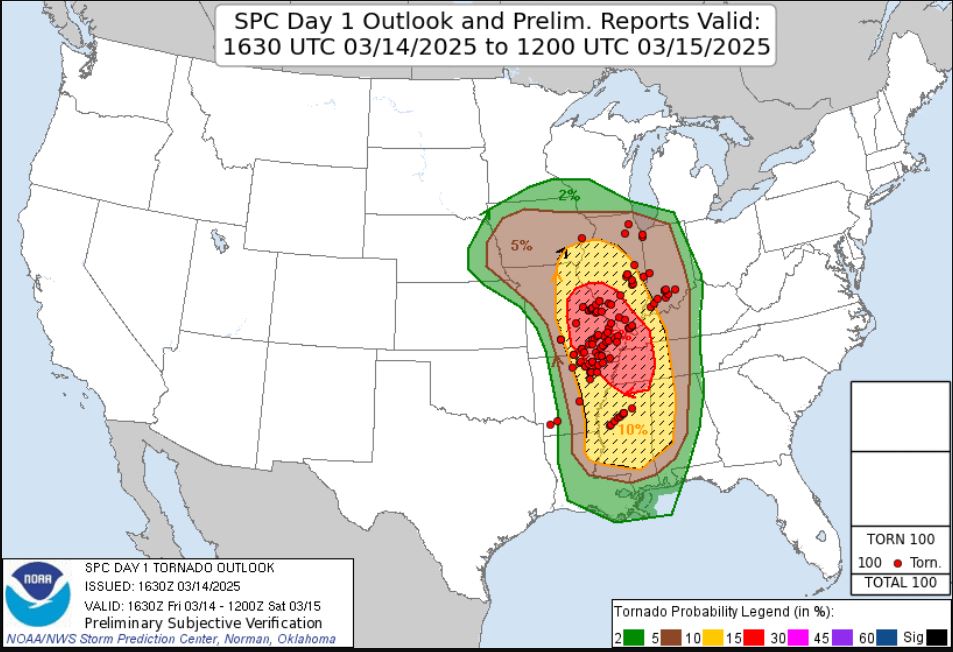
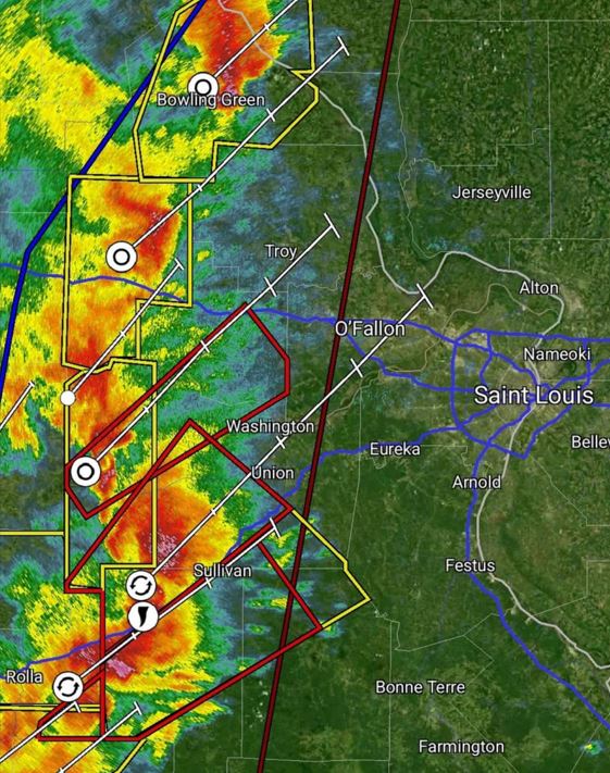
A big tornado day was being hyped and drew a lot of concern by the National Weather Service leading up to this day. The Storm Prediction Center had a broad area highlighted in a Moderate Risk with a 15% hatched area for Tornadoes.
 |
 |
My son Ryan and I decided in the morning to attempt an intercept of a tornado despite the big negatives of this chase with the two biggest concerns being chasing after dark and the storm speeds moving around 70mph. Storms were forecasted to become more severe with the likelihood of tornadoes as the parameters increased when they approached St. Louis from the west. Our plan was to wait on the edge of St. Louis County and watch how things developed as they moved in.
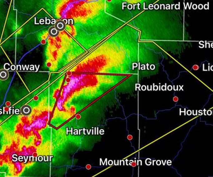
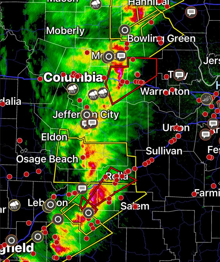
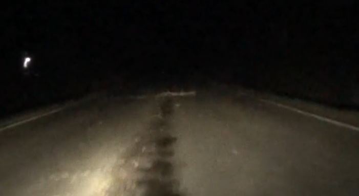
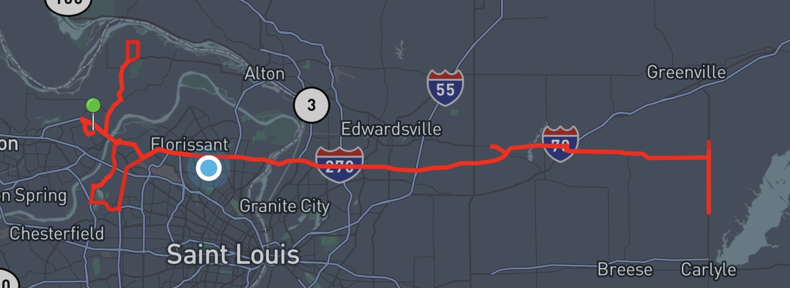
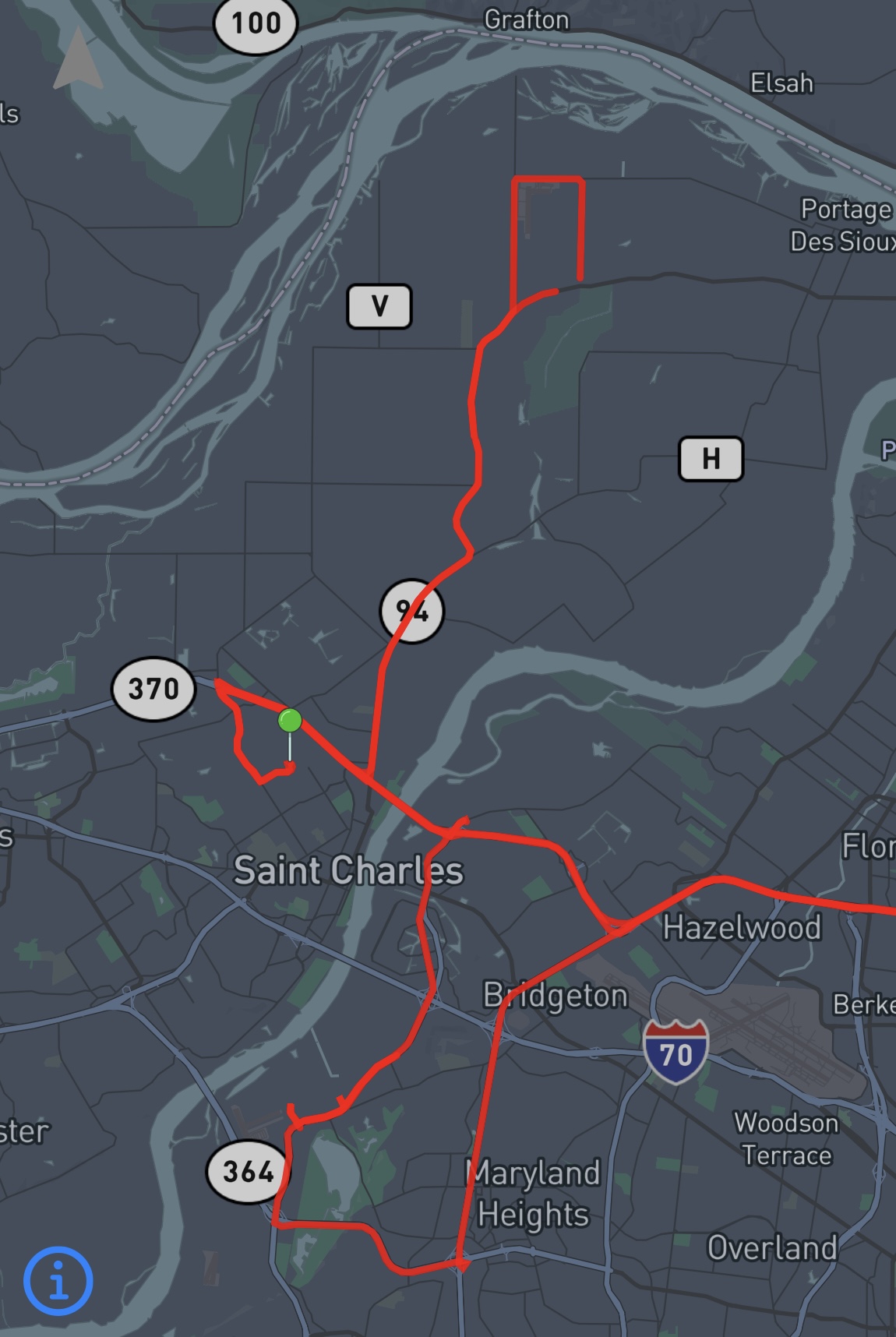
We positioned ourselves right off of Highway 141 south of the Amphitheater and north of Page Avenue with a wide open view to the southwest. We watched on radar as the storms approached. Eventually, we had our first Tornado Warning. Then several as the storms moved closer.
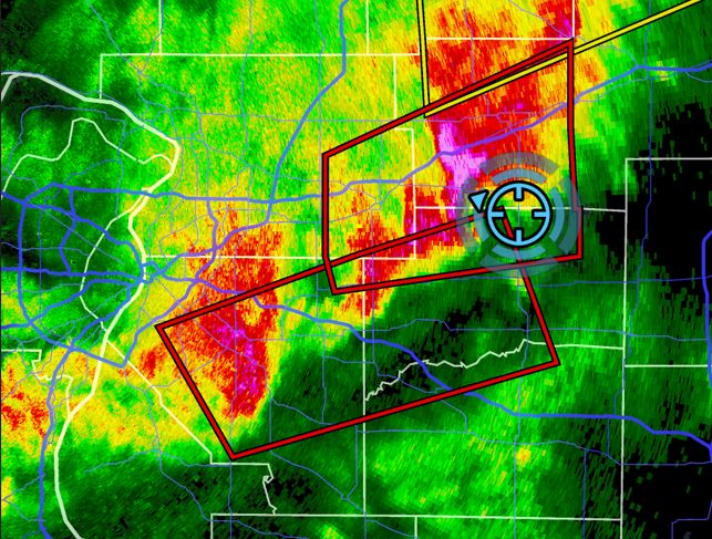
We kept a close eye on the radar as we watched the storms develop. The middle Tornado Warning box seemed to have the most persistent spin ups. As the storms moved closer, they'd spin, then break up and hand off to a new circulation. After several hand offs, we got several confirmations that legitimate Tornadoes had touched down to our southwest based on the debris signature on radar.
We lined ourselves up with this middle Tornado warned cell as it approached. It again spun down and the question became, will it be down on the ground as it passes us or will it be in a cycling with no Tornado on the ground? We realized that if it passed us at our location on 141 with no Tornado, any opportunity for another intercept was over as the storm speed would not allow us to catch up through urban St. Louis.
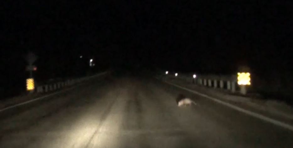
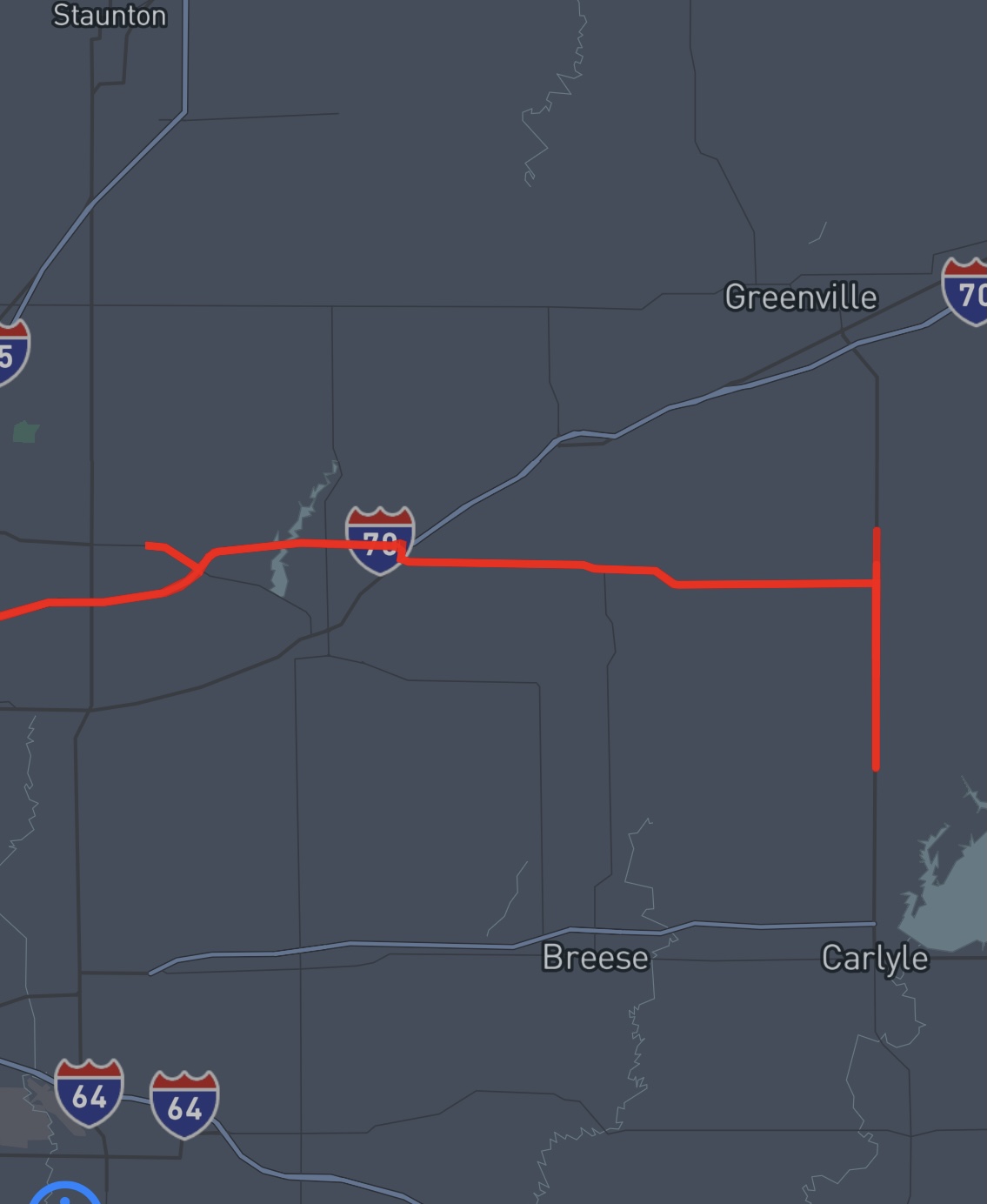
We chose to leave our position and grab Interstate 270 just ahead of the storm and move into Illinois to make a play on the Tornado Warned box just to our south. These storms were showing hooks and had more of an open flow of energy feeding into them. We moved into Illinois, took the Route 143 exit, then over to Route 127. Pretty rough ride as we had to swerve to avoid the animals, avoid the tree debris, and even logs blown onto the road as we were driving through pockets of blinding rain.
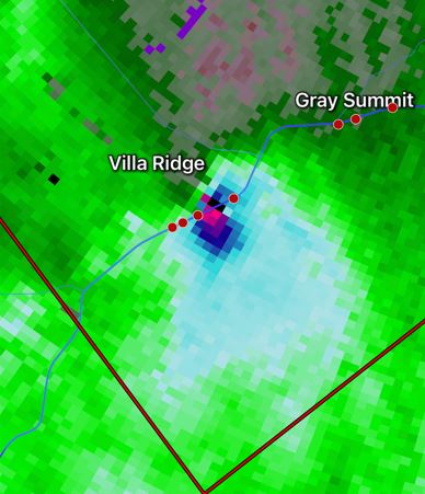
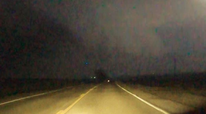
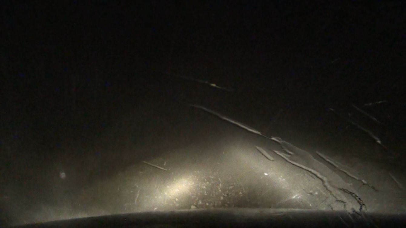
We finally came out of the rain as we moved south on the west side of Lake Carlyle on Route 127. As the promising cell(s) came at us, we flipped the car around and headed back north on 127 and ran into some furious inflow wind. Ryan's view on radar had him yelling "there is a tornado on the ground somewhere just ahead of us to the left of the road".
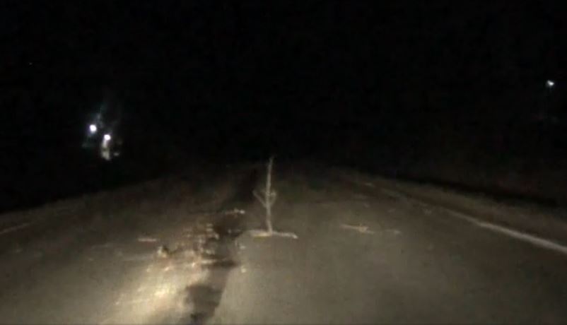
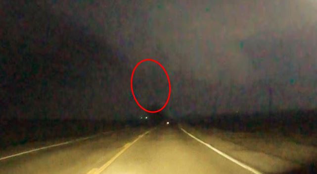
We cautiously moved ahead. Visually, we never saw anything, but one frame of the dash camera lit by lightning clearly showed a lowering, but we are unable to confirm if that is a rope Tornado in the blurriness above the tree.
That is as close as we came to seeing a tornado on this trip. After that encounter, the storm overtook us and we were once again in the blinding rain. We found a spot to pull off as we were no longer able to see far enough ahead to safely drive and we were pounded by the fierce winds, blinding rain, and up to half dollar size hail before it passed and we headed back home.
Looking at our decisions in hindsight, the Tornadic Storm we were originally targeting as it approached us on Highway 141 did produce a tornado near the spot where we were waiting. It continued to sporadically tornado as it moved northwest through North St. Louis County. Our choice to move out before the storm got to us was still probably the correct move as positioning in an urban area at night could have led to no escape routes for many reasons (road network, traffic, debris, etc.) as well as visually not able to see the storm in the dark. Our move to the Illinois side of the river allowed us the ability to more easily avoid any dangerous situations presented by the storm much easier than in the city. Although we missed out on the confirmed Tornado at our original location, we have no regrets.
UPDATE: After the National Weather Service completed their surveys, there was no confirmation of a Tornado in our suspected location along Route 127 in Illinois. Although we got furious inflow wind followed by the glimpse of the suspicious funnel like feature in our video, the survey showed a break in the damage path of the storm between the New Baden, Illinois Tornado and the Vandalia, Illinois Tornado. The means that either the tornado had lifted or if the tornado was still on the ground, the farm fields and farm buildings in that very rural part of Illinois had no reported damage and was not surveyed.

Trip
| Entire Trip |
|
 |
|
| Missouri
Side |
Illinois
Side |
 |
 |
8.5 Hours - 276 Miles