 May 16, 2025
 (Click on images to enlarge them)
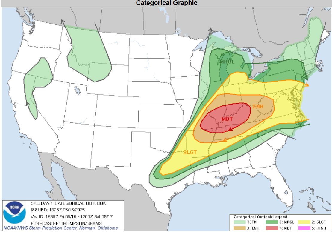
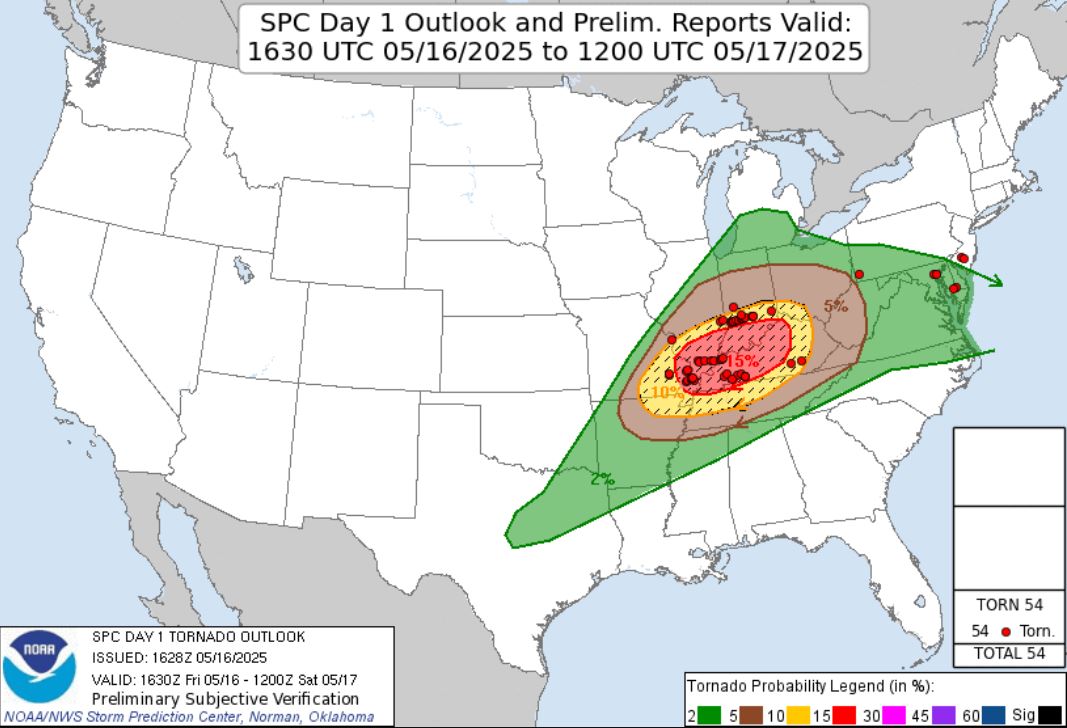
This was a well advertised storm system with the potential for some very strong, long-tracked tornadoes. The Storm Prediction Center put out a Moderate Risk of Storms with a 15% hatched area for Tornadoes.
 |
 |
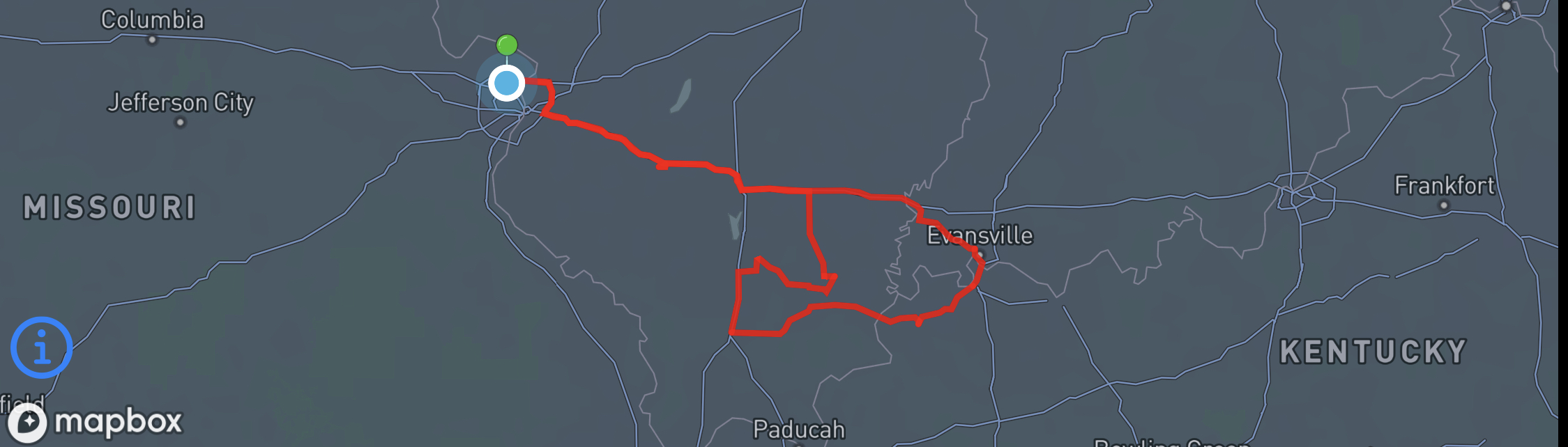
My son Ryan and I decided to put in a half day of work before embarking on this adventure. That still gave us enough time to get to our target in anticipation of the storms initiating. We decided to travel out of St. Louis into Illinois on I-64. We figured we'd go halfway across the state and hold as we watched storms develop.
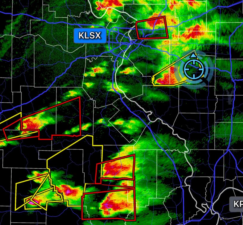
It was a matter of deciding which one in the line had the best chance for a sustained Tornado and in a viewable area. We continued to hold our ground and then we see this. A damaging Tornado going through St. Louis.
So now at this point, we had a Tornado warned storm to our north, a couple to the south and we sat in between them. Our thinking was we were unsure if the northern storm would sustain as it moved northeast and we did not want to battle the forest, rivers, and road network on the storms to our south. We decided to just latch on to the non-Tornado warned storm coming at us hoping it would follow what the other storms were doing. We continued to move east ahead of the storm and unfortunately, we watched our storm fall apart.
 |
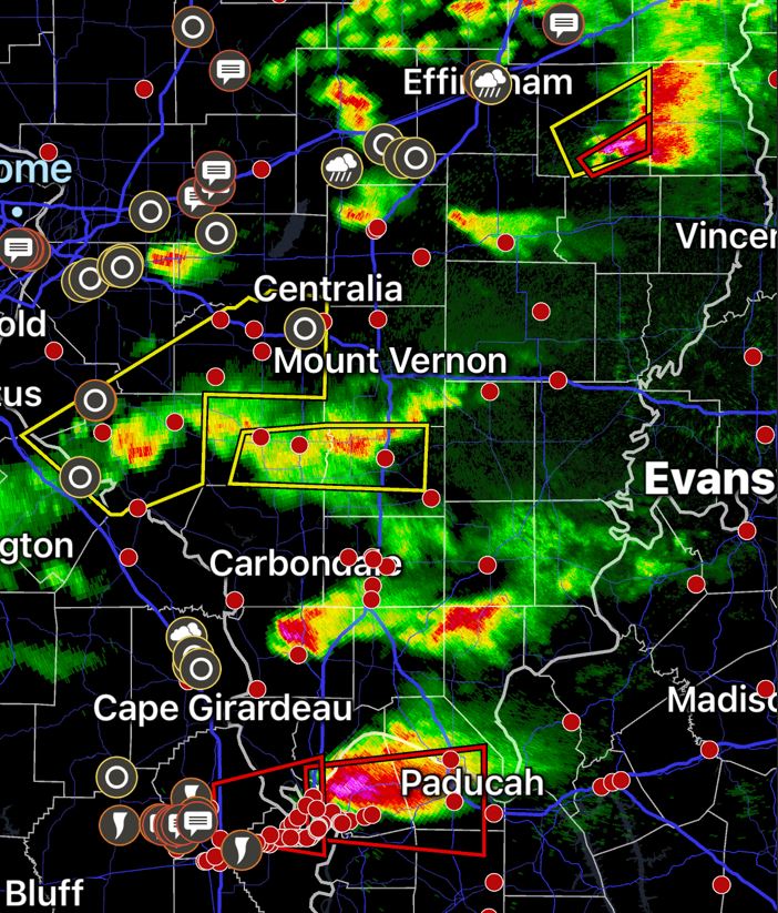 |
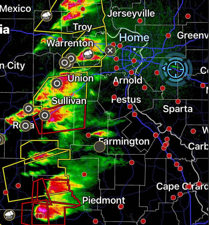
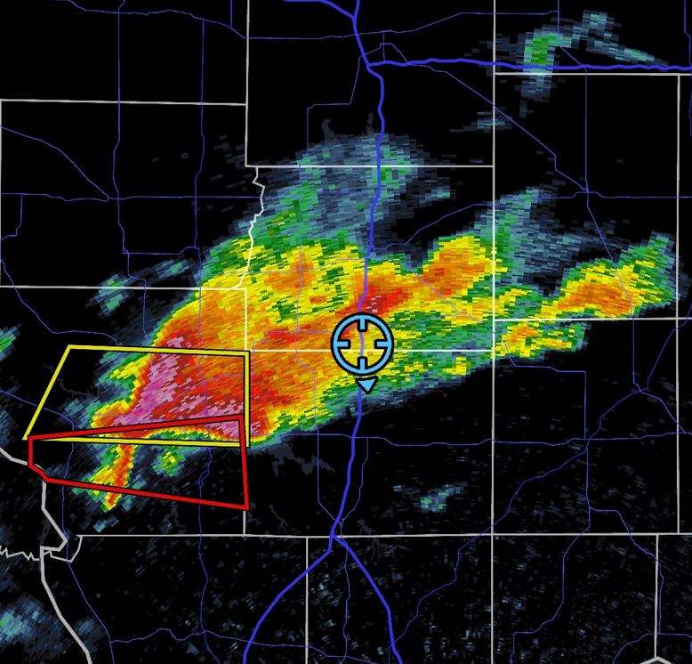
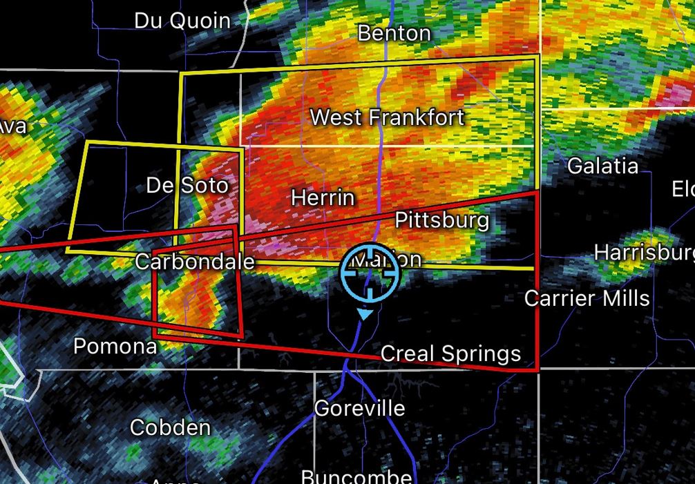
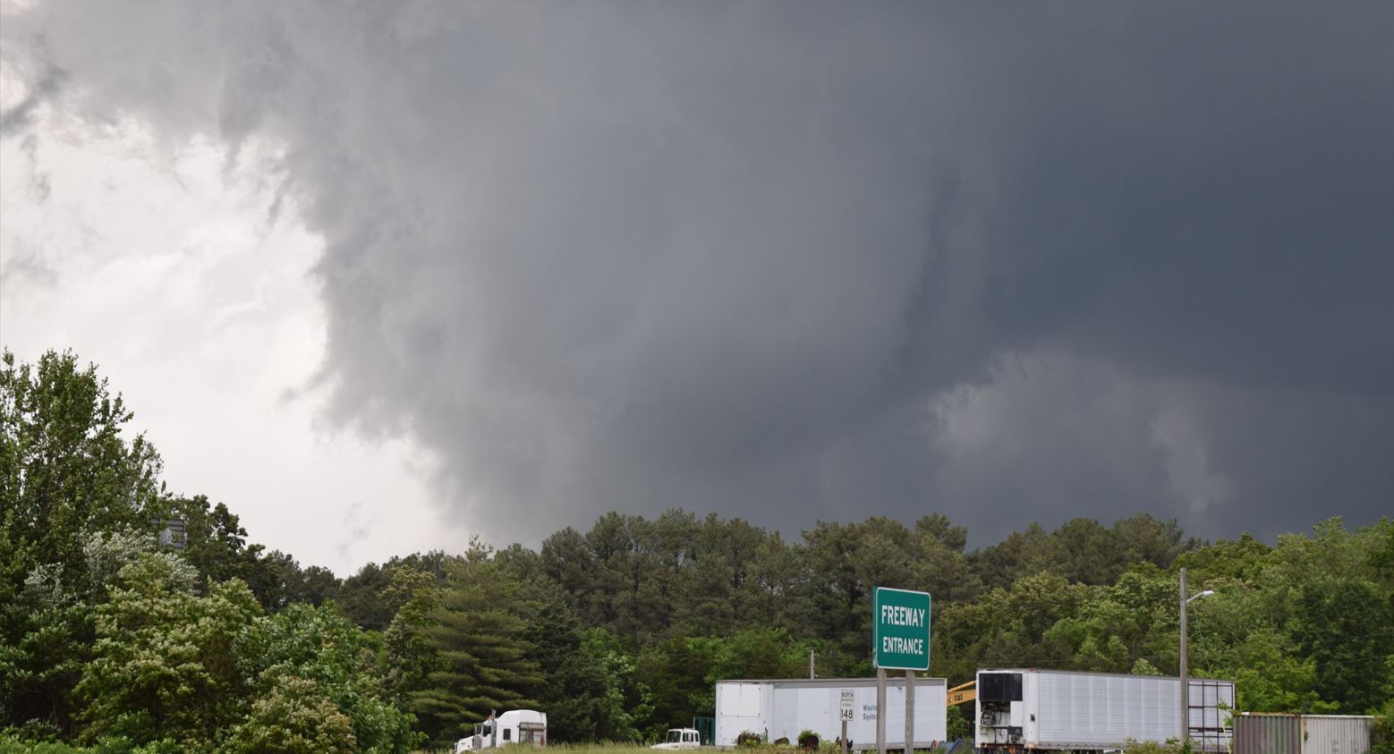
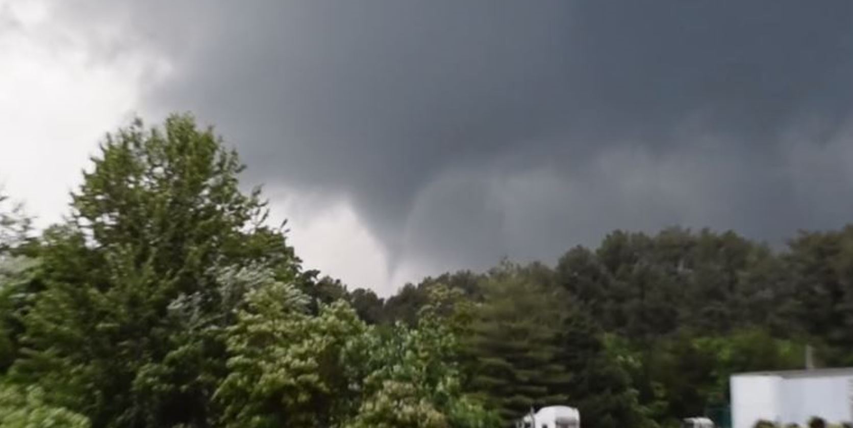
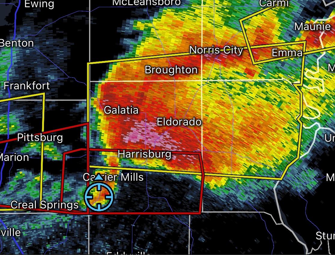
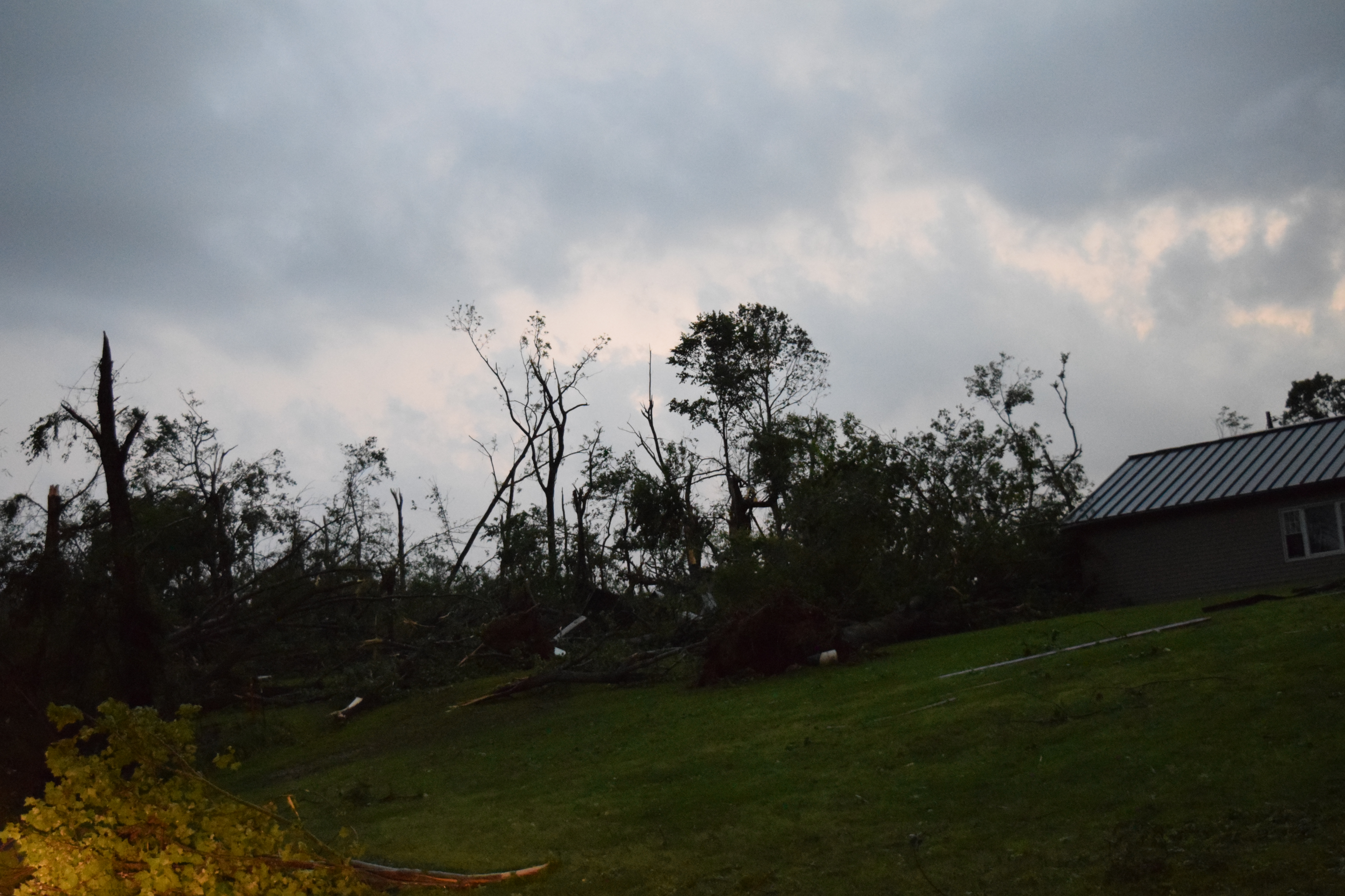
We were beginning to think we were done for the day and missed any opportunity for a Tornado. We took notice of a new cell developing very quickly and becoming Tornado warned coming over the Mississippi River out of Missouri. We planned out an intercept path and did some maneuvering west and south to get in position on the back side of the storm just to the south of Marion, Illinois. We were rewarded with a rapidly rotating wall cloud producing a Wedge Tornado along with a Satellite Tornado spinning around the main Tornado.
 |
 |
 |
 |
 |
 |
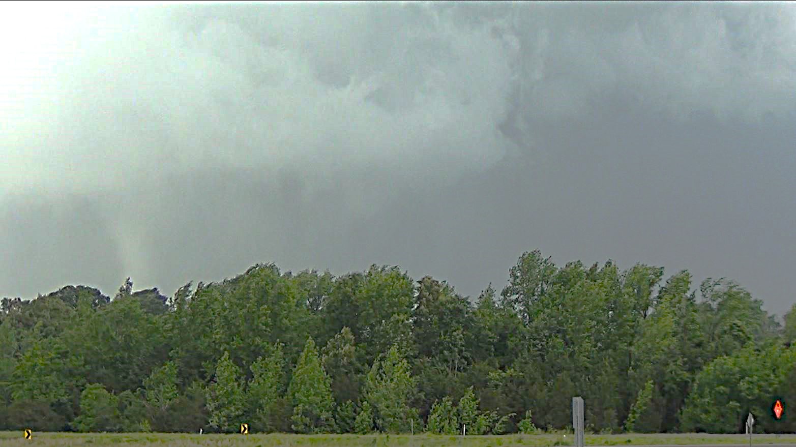
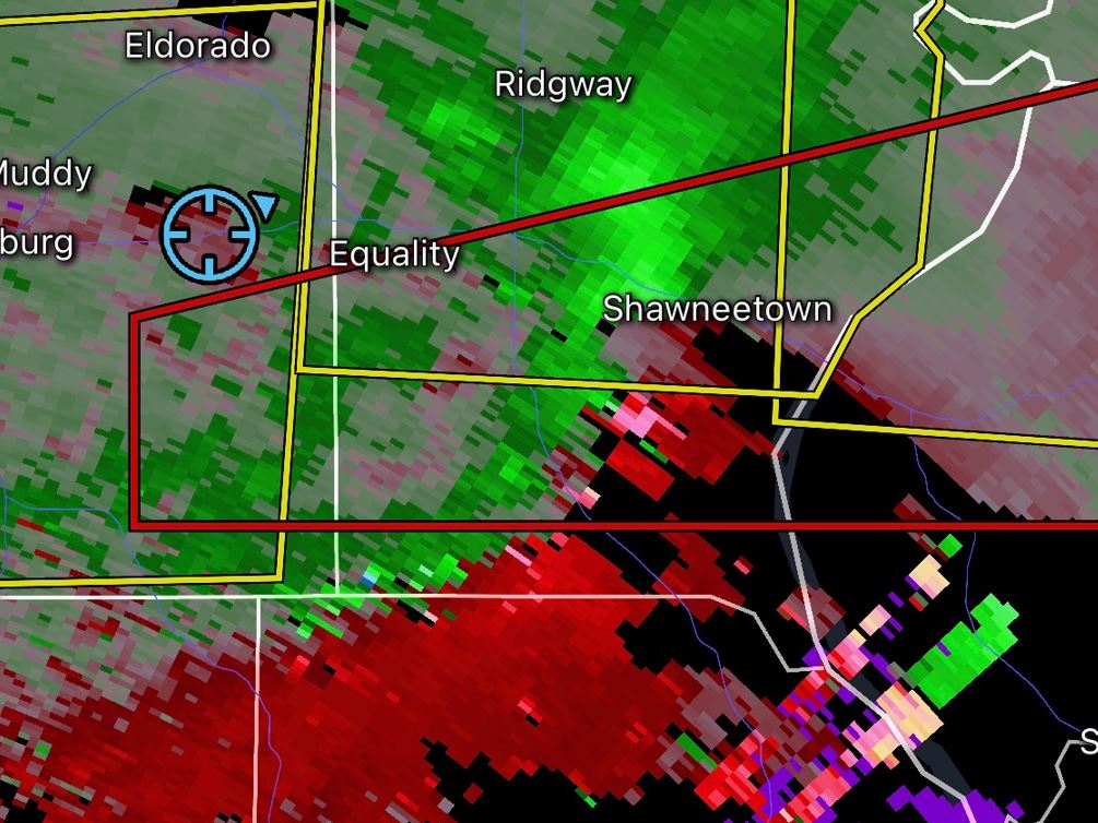
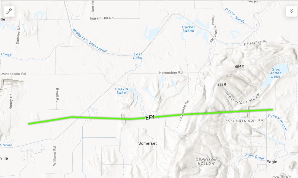
We followed behind the storm as it passed us and moved east paralleling the road. Rain had wrapped around the circulation hiding any Tornado. As we neared the town of Equality, Illinois, the storm gave us another very distant peek to the south at another Tornado that had formed.
 |
 |
 |
|
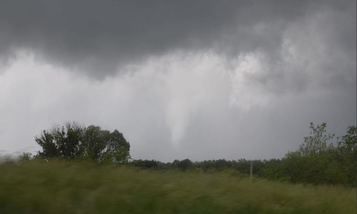
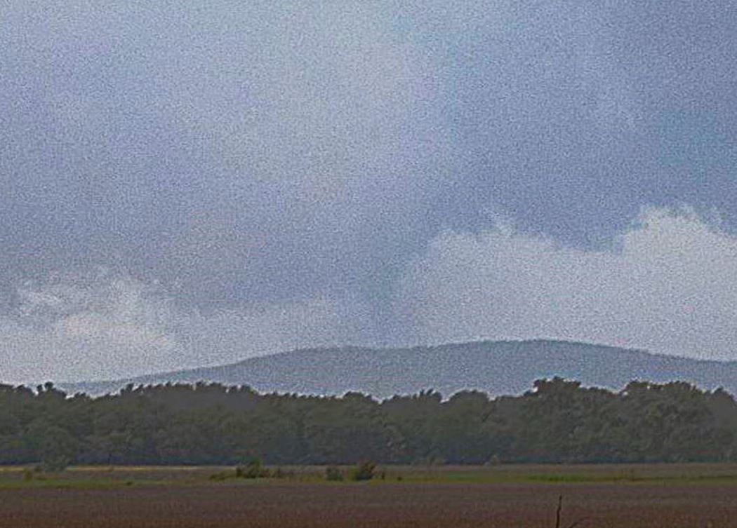
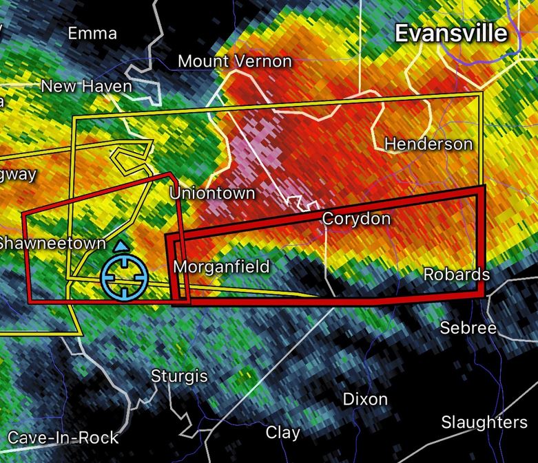
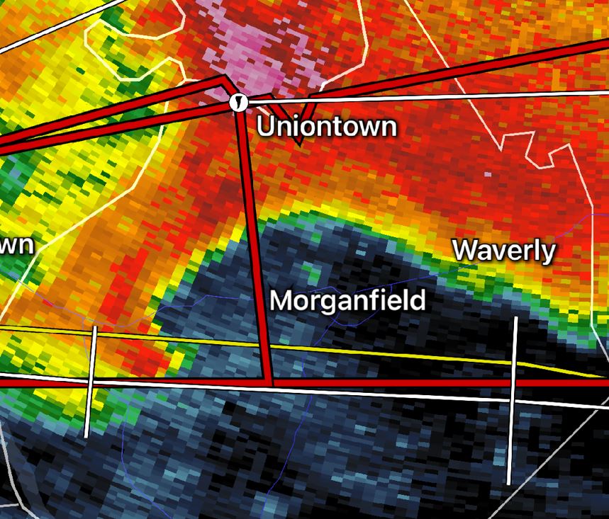
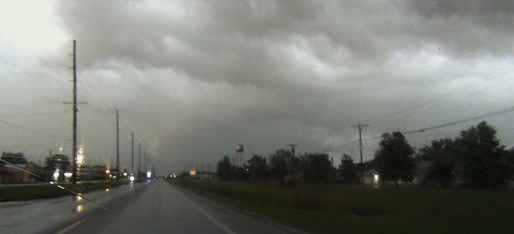
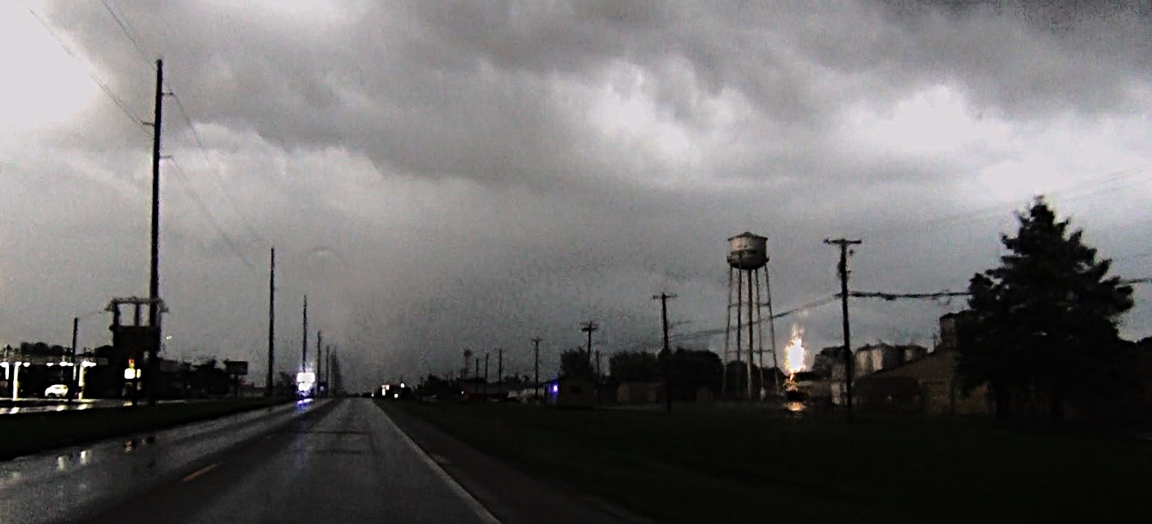
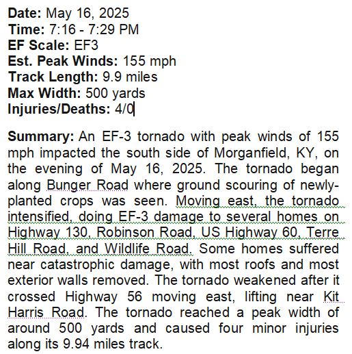
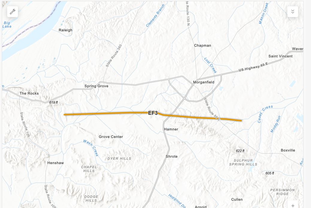
Continuing to follow the storm led us out of Illinois and into Kentucky. Hidden behind the rain and the hazy darkness was lurking a large cone tornado. Our cameras could barely make out the shape of it directly in front of us over the road. It was aimed right at the town of Morganfield, Kentucky.
 |
 |
 |
 |
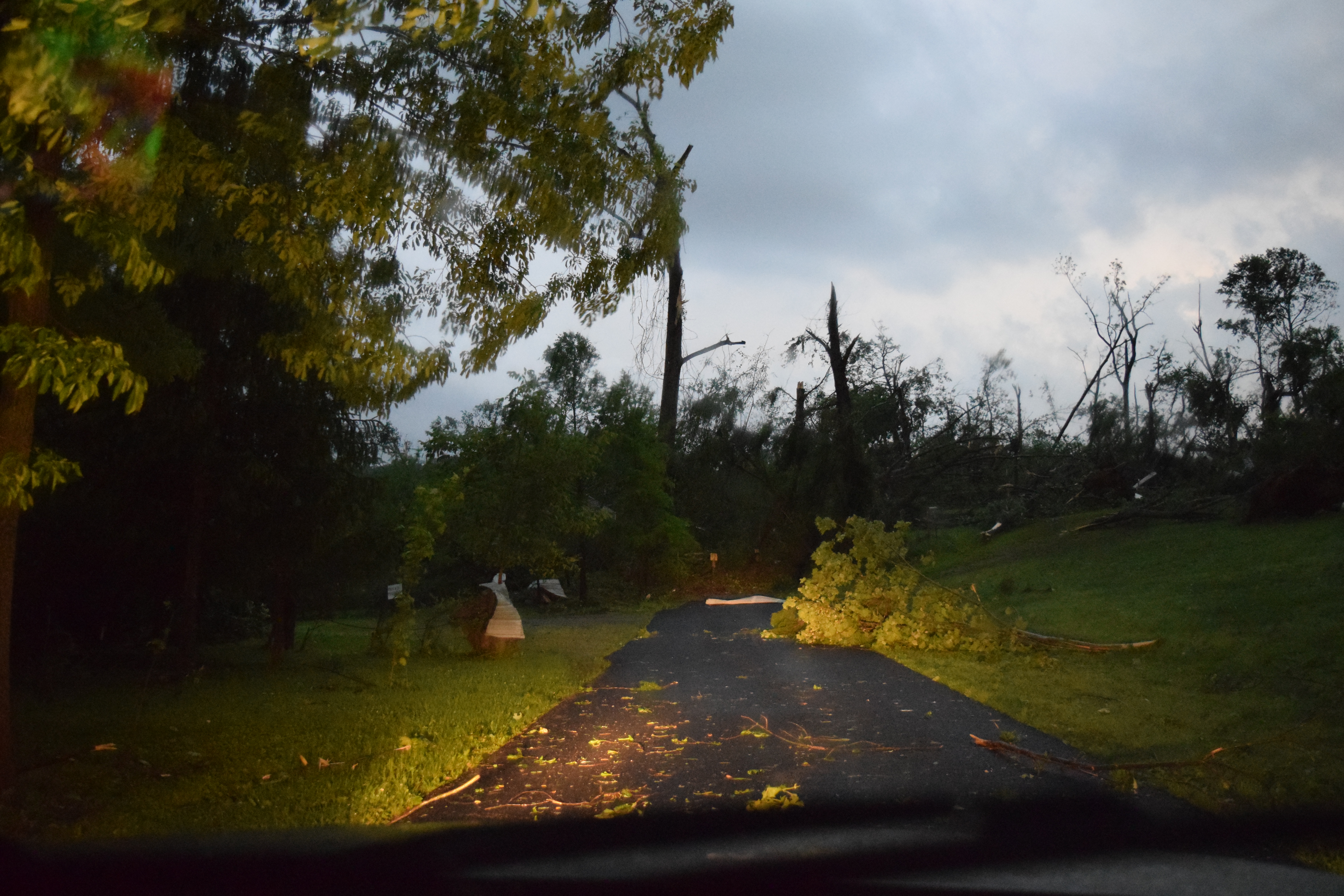
Trailing the storm came to an abrupt end as the Tornado crossed several east / west roads near Morganfield covering the roads with building and tree debris and making those roads impassable.
 |
 |
We maneuvered around the closed roads and debris back to the main highway to the north and attempted to follow the Tornado, but darkness, road network, along with the Tornado gaining distance from us, put an end to our chase.
<
allowfullscreen="" frameborder="0" height="315" width="560">
NATIONAL WEATHER SERVICE SURVEYS
| Entire Trip Log |
Zoomed Chase Area |
 |
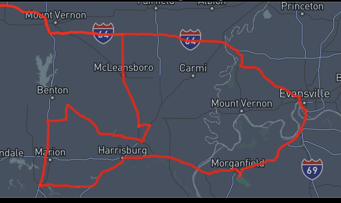 |
11
Hours
-
515 Miles
|
Summary 2025 Page |
Storm Index Page |