May 18, 2025
May 18, 2025
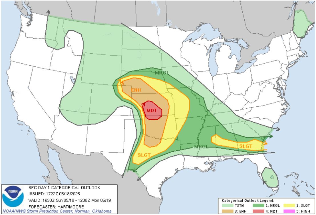
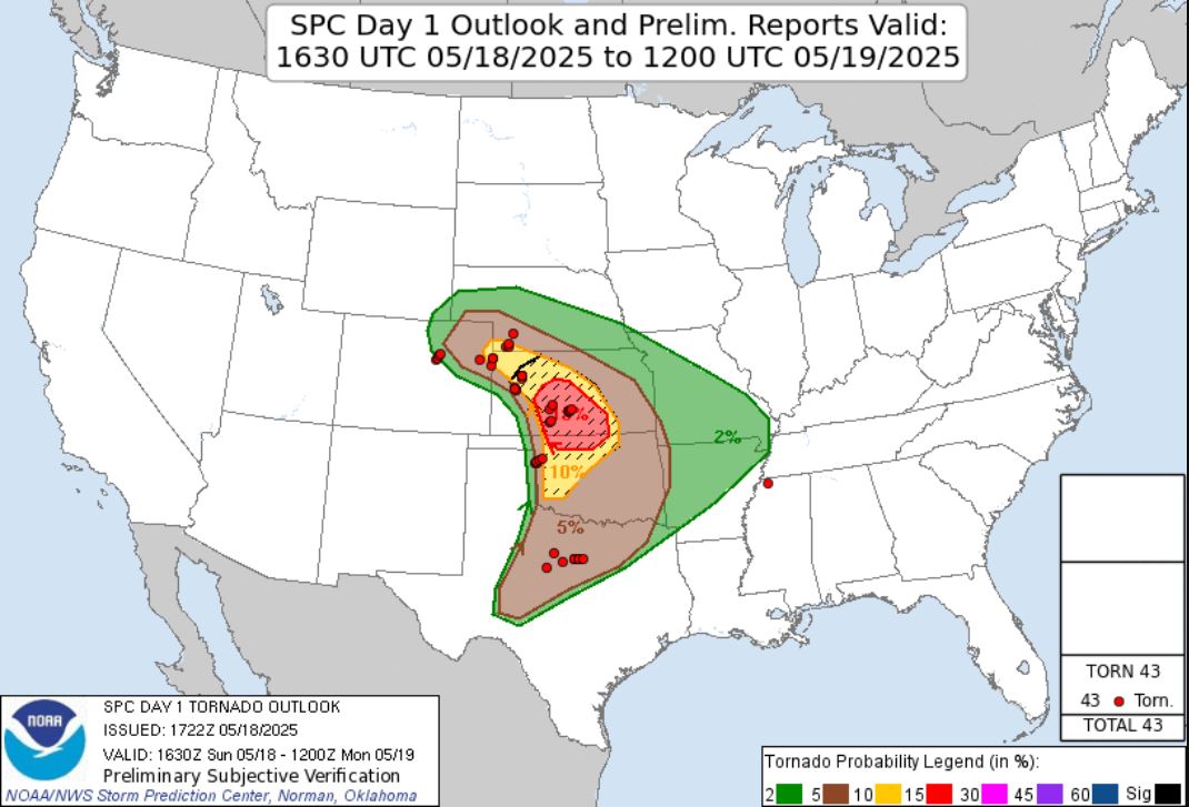
May 18, 2025 As we looked ahead, we could see a much anticipated, multi-day storm chase was in order. On the first day, the Storm Prediction Center put out a Moderate Risk in Kansas with a 15% hatched area for Tornadoes.
 |
 |
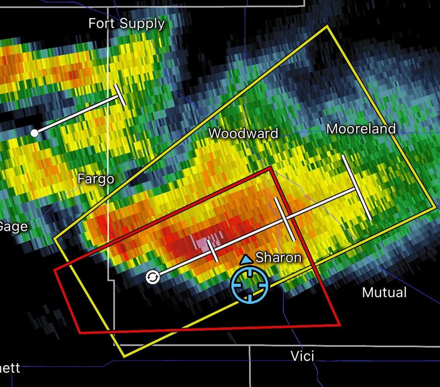
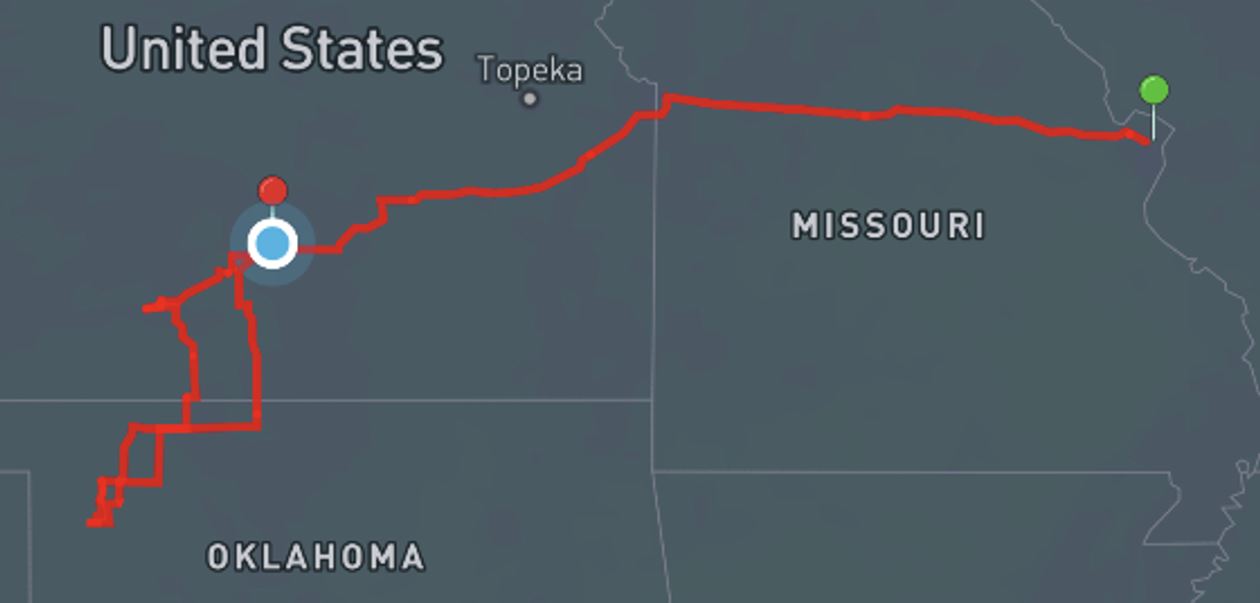
My son Ryan and I left early in the morning with our target of Pratt, Kansas. The drive was long and gave us plenty time to look over the changing model runs. We varied the target slightly on the way down to the area, but would always seem to come back to the area around Pratt. We had our chase partner Brian Stertz chiming in with his thoughts as he recovers and Jeff Piotrowski also was sharing his thoughts with us this day. As we approached our target, Jeff gives us a call telling us that the initiation has started down near Arnett, Oklahoma and we need to get down there pronto. Models still pointed to the are around Pratt as being the favored area, but even though we were still two hours away from Woodward, we made the choice to head down to that area anyway in hopes that these would produce the mega-hyped and anticipated long-tracked Tornadoes.
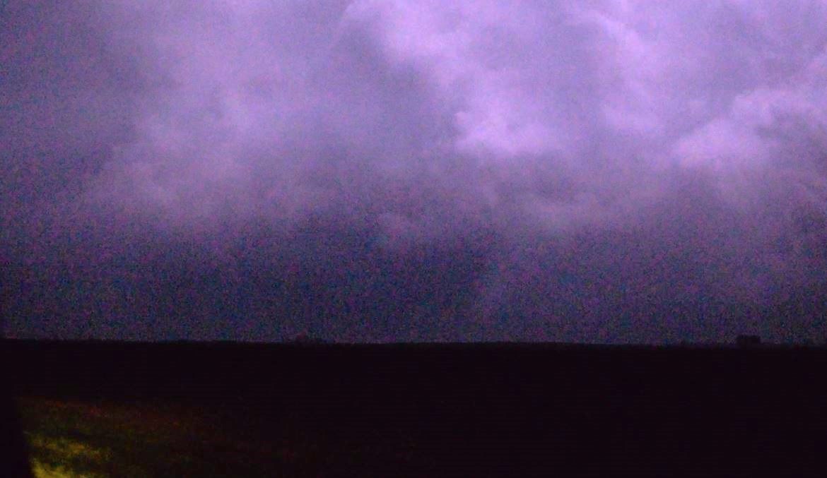
As we continued to drive, we were hearing reports of Tornadoes on the ground near Woodward. Maybe it wasn't such a bad decision after all to take the gamble and head down there. That was until we arrived and found that although the storm was still Tornado warned, the storm was weakening and the Tornado Warnings were soon dropped.
 |
 |
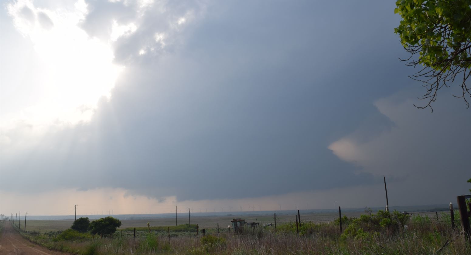 |
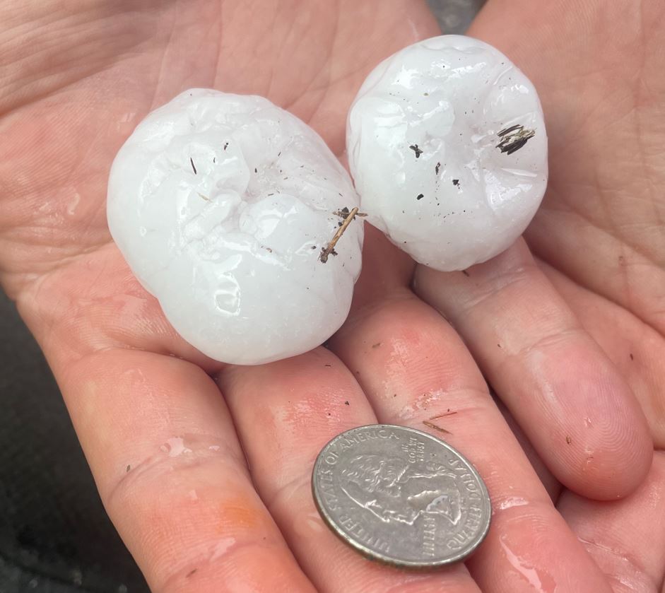
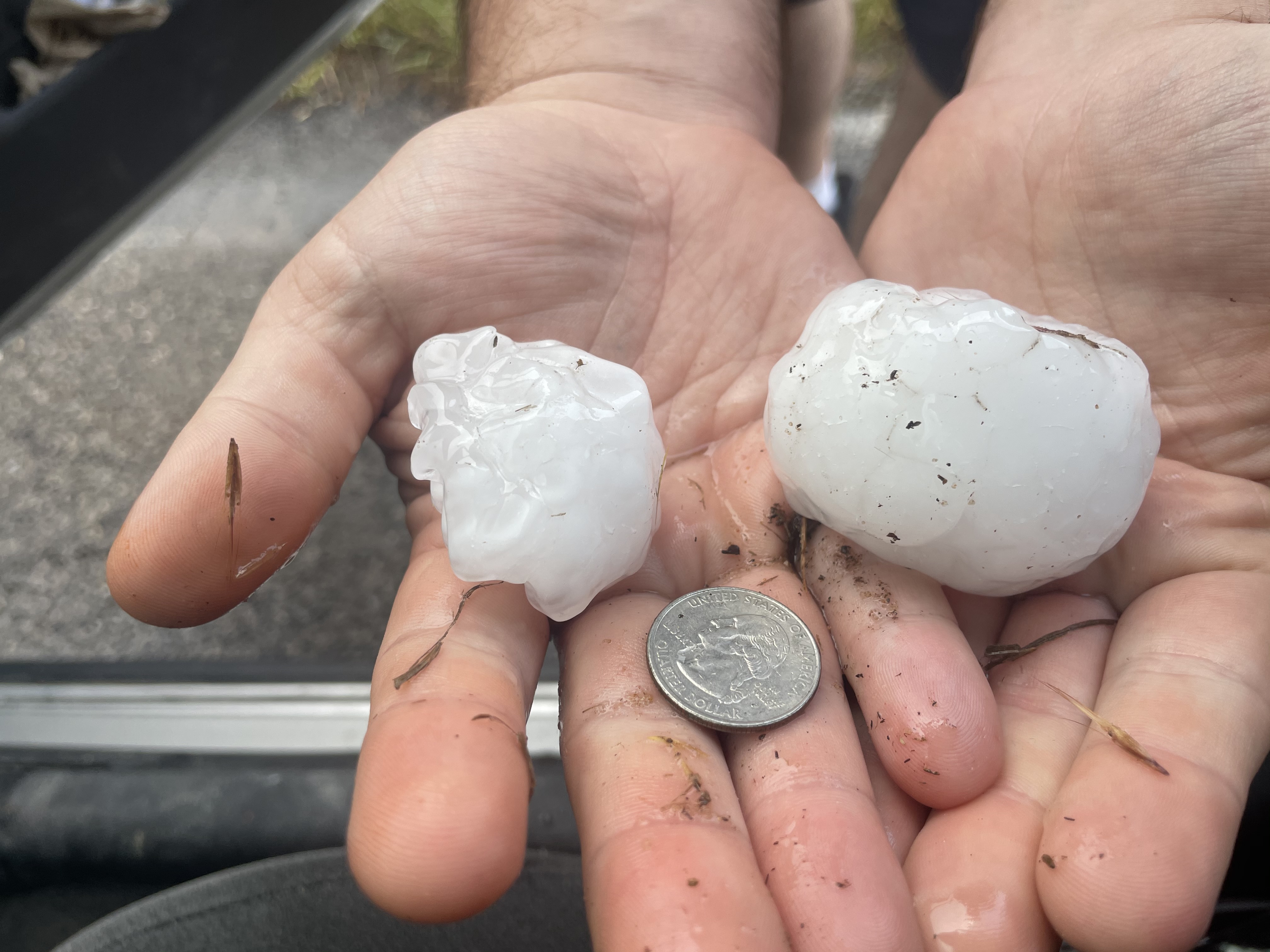
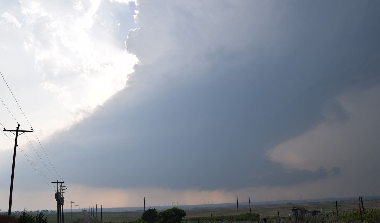
We watch it for a while, then followed the storm in hopes it would revive. In doing so, we crossed the storm's hail path. The hail was measuring between 1.25" up to 2.25".
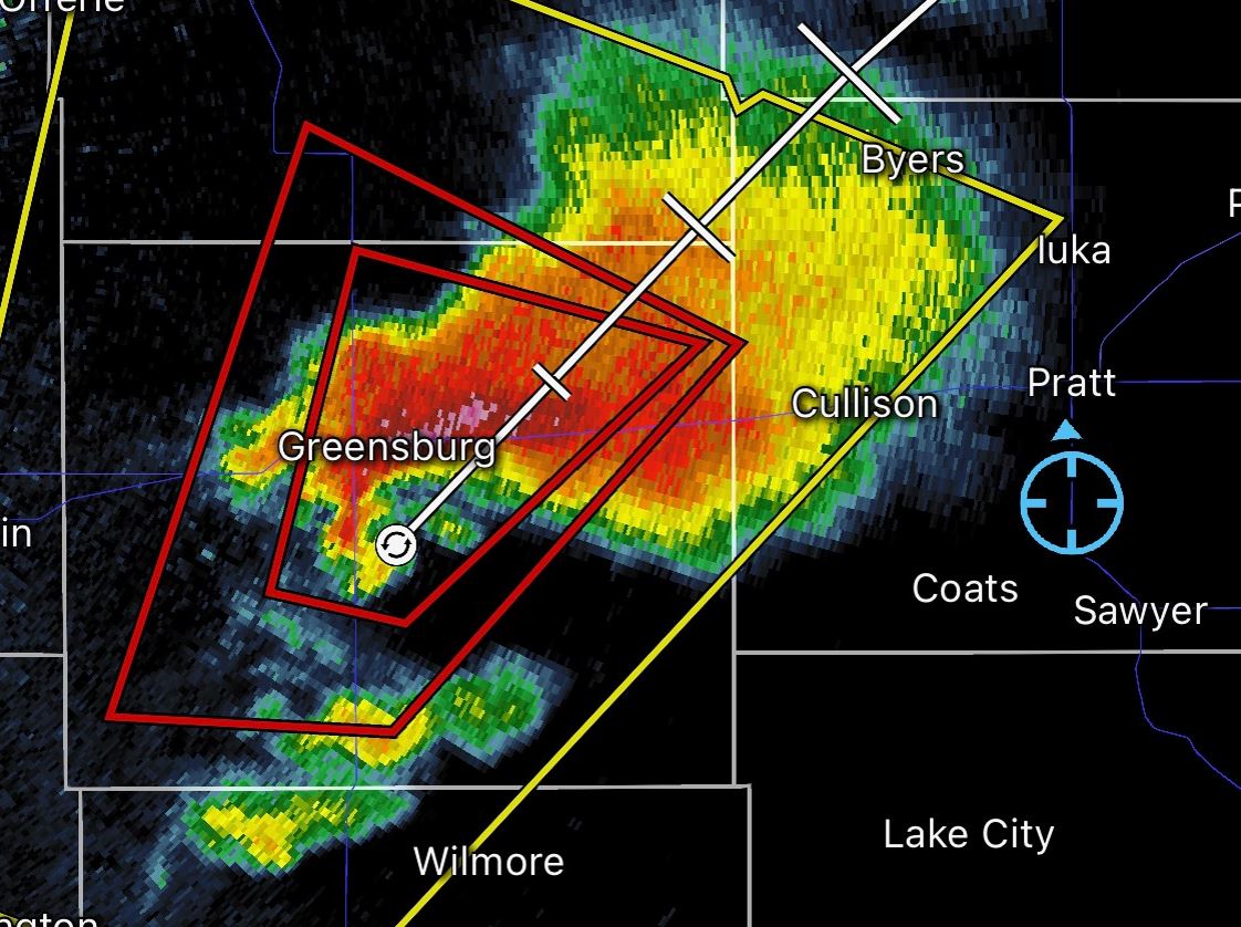
Since the storm had weakened and a repeat of any Tornado was unlikely, we eventually headed back north. Daylight had turned to night as we arrived at Medicine Lodge, Kansas. A cell to the west of us became Tornado Warned. Shortly there after, it became a Tornado Emergency as it neared Greensburg, Kansas.
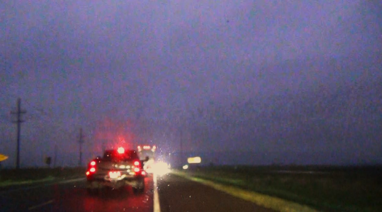
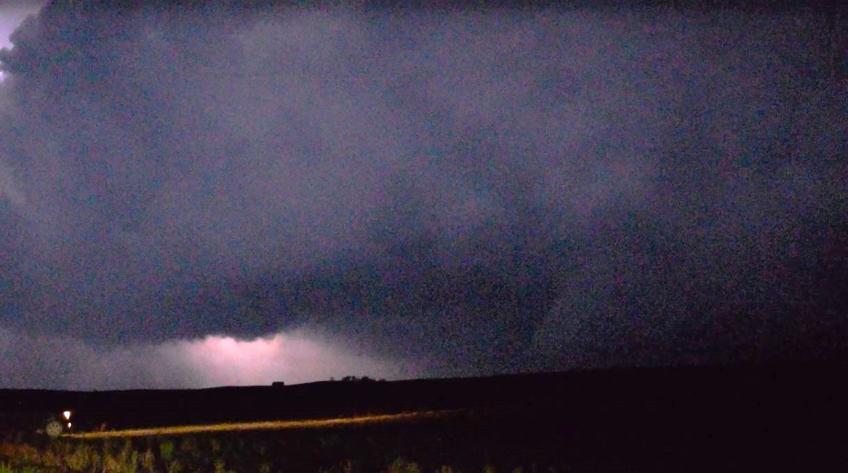
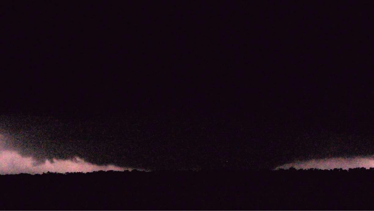
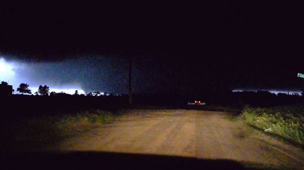
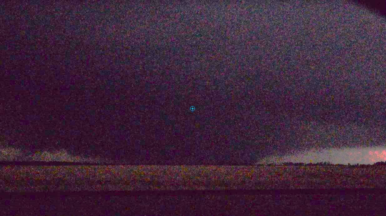
Although it was now dark, we made the decision to get in line with the storm in hopes of seeing a lightning lit Tornado. We worked our way to Pratt, Kansas and went west as the storm approached the area. Police had the main Highway blocked in anticipation of the Tornado crossing the road. Lightning showed the wall cloud passing over the road, so we turned around back east to grab one of the back roads to the north to line up with the approaching storm. We watched as the back side of the storm approached and went by with its features totally hidden. We drove a bit further up the road and found power lines across the road indicating a probable Tornado had passed through. A few lightning flashes now showed what may have been the Tornado moving away from us.
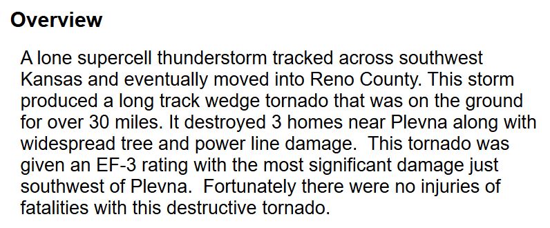
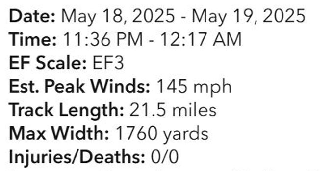
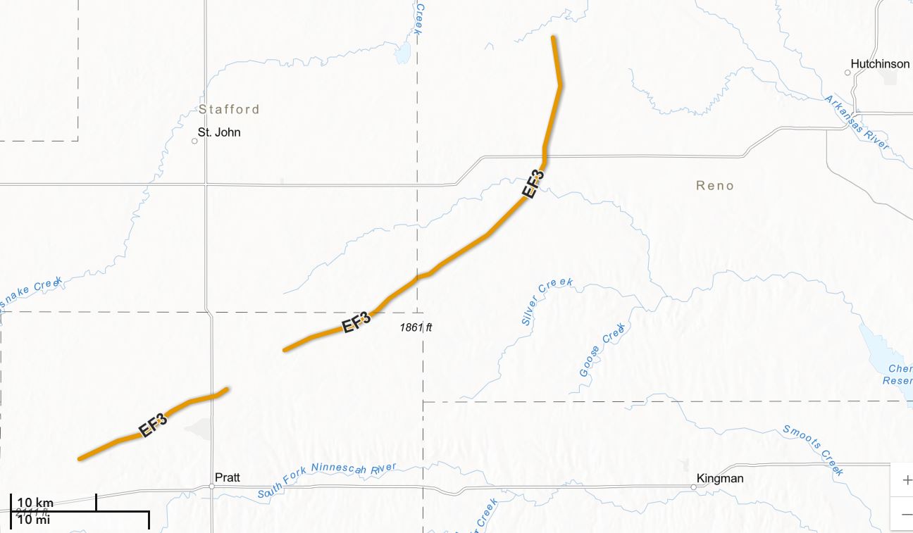
With the north road blocked, we backtracked and found another dirt road east and continued to follow the storm. Luckily, Highway 61 out of Pratt moved northeast and paralleled the storm. We'd use the country back roads off of Highway 61 to work our way closer and to find locations with unobstructed views of the storm off of the main highway. The lightning ramped up as the storm moved northeast and eventually gave us a highly visible, massive wedge that was now on the ground. This Tornado was taking aim at the town of Plevna, Kansas.
A little after midnight, the storm began to weaken and eventually we let the storm go. We headed east to Hutchinson, Kansas for our hotel for the night.
 |
 |
 |
| Trip Log |
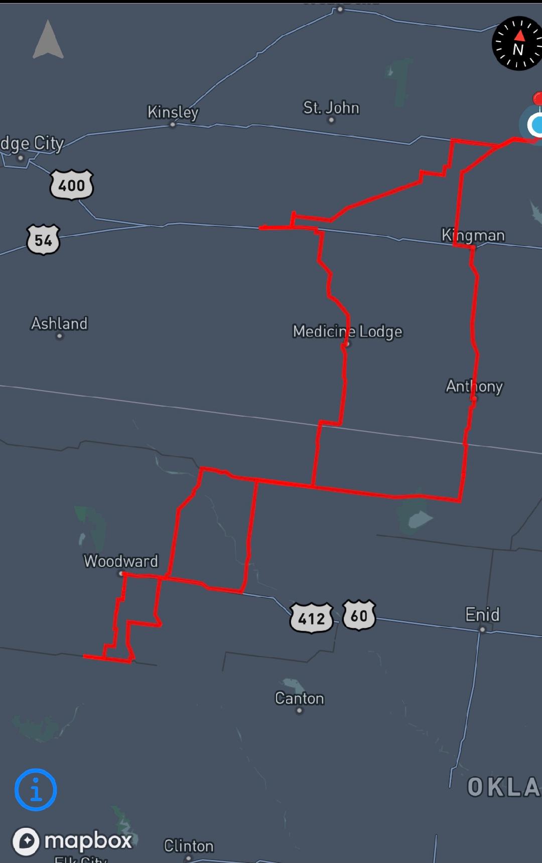
Zoomed Chase Area |
 |
 |
|
Summary 2025 Page |
Storm Index Page |